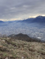
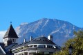
Mont Jalla as seen from the Porte de France

Exploring La Bastille and Mont Jalla. Since 2000, the summit of Mont Jalla has been home to the National Memorial to the Mountain Troops.

Details

1690997
Creation:
Last update:
Last review:
  • Walking
    Activity: Walking
  • ↔
    Distance: 5.47 mi
  • ◔
    Average duration: 3h 45 
  • ▲
    Difficulty: Moderate

  • ⚐
    Back to start: Yes
  • ↗
    Ascent: + 1,460 ft
  • ↘
    Descent: - 1,460 ft

  • ▲
    Highest point: 2,080 ft
  • ▼
    Lowest point: 686 ft
  • ⚐ Country: France
  • ⚐
    Areas: Alps, Dauphiné
  • ⚐ City: Grenoble (38000|38100)
  • ⚑
    Start/End: N 45.194437° / E 5.718662°
  • ❏
    IGN map(s): Ref. 3334OT, 3334OTR, 3335OT, 3335OTR
  • Hour-by-hour weather

Description of the walk

Park in the free car park on the Esplanade Charles de Gaulle.

(S/E) Walk past the Porte de France; this walk begins in the Jardin des Dauphins.

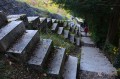
(1) Head north along the paths of this beautiful garden. There are many paths, so it’s easy to get a bit lost, but it’s nothing to worry about. Always follow the paths and steps as you climb. Walk alongside the fortifications of Fort Rabot and continue climbing northwards, passing through the gates and terraces beneath the Bastille.

There are several viewpoints overlooking Grenoble, and plenty of terraces where you can take a break. Take your time – it’s magnificent. There’s a refreshment stand near the ‘Pylône des Bulles’.

(2) Go back down a few steps and cross the drawbridge to head away from the Bastille, still heading north. A leisure park is situated at the foot of the fortifications. Continue along this tarmac road until you reach the car park on the right. Take the path that climbs up before the Père Gras restaurant and continue along it heading north.

(3) At the fork in the road, take the left-hand branch. The climb is gentle and relatively gradual. Stay on this gravel path. After several hairpin bends, Mont Jalla comes into view. You’ll arrive at the Mountain Troops Memorial.

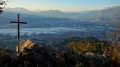
(4) Mountain Troops Memorial, free to visit. Take your time to read all the information boards and admire the view of Grenoble below. This is the highest point of this lovely walk.

Retrace your steps to make your way back down to La Bastille.

(2) Take the path that runs beneath the restaurant and begin the descent along a wide path that passes under the cable car heading south-east. Go 50 metres past a tight hairpin bend to the right.

(5) Turn sharply left onto the path. The path winds down in a series of hairpin bends. Pass through several gates in the defensive walls and also down some steps to reach the Porte Saint-Laurent. Head towards the bridge over the Isère.

(6) Opposite the Isère, take the pavement running alongside it on the right bank, Quai Xavier Jouvin. Continue along Quai Mounier, Quai Perrière and Quai de France. Return to the starting point of the circular route at the Porte de France. Follow the same route back as on the way out to return to the car park at the Esplanade Charles de Gaulle (A/D).

Waypoints

  1. S/E : mi 0 - alt. 692 ft - Esplanade Charles de Gaulle car park
  2. 1 : mi 0.11 - alt. 699 ft - Entrance to the Jardin des Dauphins
  3. 2 : mi 0.81 - alt. 1,565 ft - Pylône des Bulles, cable car top station
  4. 3 : mi 1.02 - alt. 1,611 ft - Before the Père Gras restaurant
  5. 4 : mi 1.92 - alt. 2,073 ft - Mont Jalla, Memorial
  6. 5 : mi 3.44 - alt. 1,378 ft - Sharp left-hand bend
  7. 6 : mi 4.61 - alt. 702 ft - Porte St-Laurent - Isère (rivière)
  8. S/E : mi 5.47 - alt. 692 ft - Esplanade Charles de Gaulle car park

Notes

Food and drink available at La Bastille.
Please note that the gates to the Jardin des Dauphins close at 8.00 pm in summer and 6.00 pm in winter.

You can go up to the roof of the Bastille restaurant to admire the Belledonne massif and, on a clear day, sometimes even Mont Blanc.

Worth a visit

The leisure park, the Mandrin Caves, the Promenade de la Poudrière.

Reviews and comments

4.5 / 5
Based on 3 reviews

Reliability of the description
4.3 / 5
Ease of following the route
4.5 / 5
Route interest
4.7 / 5
lucille augereau
lucille augereau

Overall rating : 4.3 / 5

Date of your route : Oct 27, 2020
Reliability of the description : ★★★★☆ Good
Ease of following the route : ★★★★☆ Good
Route interest : ★★★★★ Very good
Very busy route : Yes

If you take the 380 to get to the Bastille, the climb is incredibly strenuous

Machine-translated

polo381
polo381

Overall rating : 4 / 5

Date of your route : Apr 12, 2019
Reliability of the description : ★★★★☆ Good
Ease of following the route : Not used / Not applicable
Route interest : ★★★★☆ Good

A lovely walk that goes from the town centre up to the mountains; we did it the other way round and carried on as far as Mont Rachais, but the sky was overcast, so we couldn’t see any of the surrounding mountains.

Machine-translated

kili5895
kili5895

Overall rating : 5 / 5

Date of your route : Feb 07, 2019
Reliability of the description : ★★★★★ Very good
Ease of following the route : ★★★★★ Very good
Route interest : ★★★★★ Very good

Easy to get to, especially as we were arriving by train …
a lovely short walk, between the city and the mountains,
magnificent views over Grenoble
markings and signposts making it easy to find your way

Machine-translated

Other walks in the area

For more walks, use our search engine .

The GPS track and description are the property of this route's author. Please do not copy them without permission.