Country:

 City:
City:




Park at Place Médecin Général Blanchard in Briançon’s old town; paid parking applies.
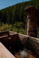
(S/E) Follow the GR®5 trail, marked in white and red, go through the Porte d’Embrun and head down the Chemin Vieux; at the bottom of this path, you’ll come to a fountain.
(1) Turnleft and cross the River Durance. At the roundabout, take Rue Pasteur, then continue straight on along Rue Joseph Sylvestre and Rue Jean Bayle. You’ll reach the boundary between the two towns in the Champ Prouet neighbourhood.
(2) Take Rue du Rencurel and Rue du Mélezin, then turn left into Rue de la Croix; you will then come to a crossroads at a place called Sachas in Villar-Saint-Pancrace.
(3) Carry on, still following the GR®5, andafter Chemin du Serre, turn left onto Rue des Ayes. Take the path which will allow you to cut across the two circular loops. Continue on to reach the old Route des Ayes, which is now closed to cars.
(4) Turn left onto it and follow it as far as the Ayes alpine chalets.
(5) Walk through Les Ayes; at the GR® junction, leave the GR® to your left and continue along the road. Then walk alongside the Torrent de l’Orceyrette, taking the path running parallel to the road. You’ll emerge at Plan Peyron.
(6) Here you have two options:
- cross the car park then follow the right bank of the torrent to reach Lac de l’Orceyrette,
- keep to the right on the track – this is the route shown on the map – to reach Lac de l’Orceyrette.
(7) Follow this route back in the opposite direction to return to the car park at Place Général Blanchard (S/E).
 Visorando Member
 Moderate
 Easy
Easy