Country:
 City:


Small car park at the foot of Mont Kemmel, on Bergstraat.
(S/E) With your back to the car park, set off to the left. Cross the cobbled street leading up to Kemmel and reach a junction (marker 3).
Leave the tarmac and take a grassy path between the two roads (there’s a small sign at the entrance on the right). Follow the path across a vast plain (with numerous facilities) until you reach a flight of steps.
Go down the steps and pass underneath the restaurant (which is beautifully decorated with flowers in the middle of summer).
Continue southwards, letting theGR® head off to the left, until you reach a small road (barrier and marker 72)
(1) Cross the small road. Take the path opposite, towards marker 65. You’ll soon reach a large pasture on the left. There’s no longer a gate, but the track is clearly visible.
(2) Cross the pasture (a lovely farm on the left) diagonally, and you’ll reach a wide track. Follow it to the right. You’ll immediately come to a gate on the left.
Go through it and follow the track across the fields.
Just before another metal gate, turn right and walk alongside a copse for about a hundred metres.
(3) At the end of the copse, turn right to pass two turnstiles (risk of mud). Continue towards a third turnstile, a little further up on the right, and cross a copse. On emerging, continue along the edge on the right. The path turns sharply left and reaches a Fork in the road.
(4) Head straight ahead and follow the path which zigzags through the fields (risk of mud), before reaching a small road. Follow it for about fifty metres, on the left, until you reach marker 97.
(5) Turn right towards the vineyard (Wiingoed Monteberg), a small road that leads to the front of a property. Then turn right onto a long, lovely path (with some improvements but which is sometimes extremely soft), which zigzags through the fields, then runs alongside the Lindebeek (barely visible, but you can make it out) before reaching a road (marker 96)
(6) Follow it to the right. Pass a road on the left and, fifty metres further on, you’ll find a lovely path on the left (with a gate).
This path splits: take the section on the right, which is reserved for walkers.
A gentle climb runs alongside the riding centre and leads to a Fork in the road.
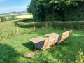
(7) Turn left: picnic table, then deckchairs. At marker 9.
Follow the path straight ahead (wooden duckboards in the wet sections). Join a wide path (marker 61 and a café on the right).
(8) Continue straight ahead (staircase) towards marker 63, following the fence. Ignore a path on the right (hiking marker) and carry on (still heading towards 63) until you reach a small road at marker 63.
(9) Follow the small road to the left, towards marker 74. Just before a large house on the left, you’ll reach a hiking marker (unnumbered). Turn right towards marker 74. A lovely uphill path (steady gradient but difficult in wet weather) leads to the Mont Kemmel Ossuary (marker 74, benches).
(10) At the junction, carry on straight ahead into the woods, towards marker 83. At marker 83 (staircase on the right), carry on straight ahead to reach marker 82: Mont Kemmel.
(11) Before reaching the road, take the path leading down to the left to reach marker 81, near a road.
(12) Just before this road, take the path on the right towards marker 80 (staircase). Follow the arrows carefully (towards the ‘speelzone’) to reach a small road. Cross it and enter the woods. Look for a lovely path (grey bricks) to follow on the right, leading to the totem. The car park is on the right.
(In July 2024, this path is closed due to roadworks. You must therefore follow the road on the right to reach the car park at the foot of Mont Kemmel, on Bergstraat (S/E).

 Visorando Member

 Moderate
 Difficult