The Micardière circular starting from Sartilly

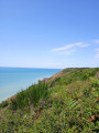
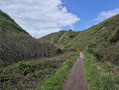
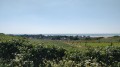
A very pleasant walk around Sartilly-Baie-Bocage. Easily accessible, it takes you around the town, starting through the streets and finishing on well-maintained footpaths. You’ll walk alongside meadows dotted with horses.

Details

n°7754978
Creation:
Last update:
Last review:
  • Walking
    Activity: Walking
  • ↔
    Distance: 2.93 mi
  • ◔
    Average duration: 1h 25 
  • ▲
    Difficulty: Easy

  • ⚐
    Back to start: Yes
  • ↗
    Ascent: + 98 ft
  • ↘
    Descent: - 108 ft

  • ▲
    Highest point: 377 ft
  • ▼
    Lowest point: 299 ft
  • ⚐ Country: France
  • ⚐ City: Sartilly (50530)
  • ⚑
    Start/End: N 48.752496° / W 1.454731°
  • ❏
    IGN map(s): Ref. 1215ET
  • Hour-by-hour weather

Description of the walk

Park in the car park at Sartilly-Baie-Bocage Town Hall.

(S/E) Follow the blue signposts. Take Rue Place de la Mairie and turn right into Grande Rue. Turn right off this street onto Rue de l’Abbaye and you’ll soon reach the junction with Rue de la Micardière.

(1) Turn left onto this street, keep left at the next junction, then continue along a well-maintained footpath. Walk alongside the D973 bypass until you reach a roundabout.

(2) Cross the main road, then follow the D61 along a path that also serves as a cycle path. You’ll reach the junction with Route de Carolles.

(3) Turn left onto it, taking great care as it is a very busy road. You’ll reach the Gilberdière neighbourhood. Cross carefully to head straight ahead and reach the junction with the path leading to the stadiums.

(4) Turn left and walk alongside the stadiums. After the stadiums, continue along the path opposite to reach the Allée des Acacias. Cross the Grande Rue, then continue along the Rue de la Tabarée to reach the junction with the Rue du Petit Pré.

(5) Turn left onto it, passing behind the care home. At the church, turn right then left to return to the car park at Sartilly-Baie-Bocage Town Hall (S/E).

Waypoints

  1. S/E : mi 0 - alt. 344 ft - Town hall car park - Église Saint-Pair (Sartilly)
  2. 1 : mi 0.19 - alt. 338 ft - Rue de la Minaudière
  3. 2 : mi 0.92 - alt. 358 ft - Roundabout
  4. 3 : mi 1.6 - alt. 371 ft - Route de Carolles
  5. 4 : mi 2 - alt. 354 ft - Football stadium
  6. 5 : mi 2.63 - alt. 315 ft - Lower town
  7. S/E : mi 2.93 - alt. 341 ft - Town hall car park - Église Saint-Pair (Sartilly)

Notes

This walk requires no special equipment.

Worth a visit

Take the opportunity to visit Saint-Pair Church, very close to the point (S/E).

Reviews and comments

3.8 / 5
Based on 2 reviews

Reliability of the description
4 / 5
Ease of following the route
4 / 5
Route interest
3.5 / 5
Bronzou
Bronzou

Overall rating : 3.7 / 5

Date of your route : Aug 07, 2023
Reliability of the description : ★★★★☆ Good
Ease of following the route : ★★★★☆ Good
Route interest : ★★★☆☆ Average
Very busy route : No

A section running alongside a busy road that is noisy in summer

Machine-translated

Marcou50
Marcou50

Overall rating : 4 / 5

Date of your route : Mar 23, 2022
Reliability of the description : ★★★★☆ Good
Ease of following the route : ★★★★☆ Good
Route interest : ★★★★☆ Good
Very busy route : No

A brilliant walk along a well-maintained route. The signposting is fine.

Machine-translated

Other walks in the area

For more walks, use our search engine .

The GPS track and description are the property of this route's author. Please do not copy them without permission.