Le Grand Sanguin and La Petite Étoile

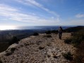
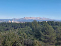
This hike, which runs through the north-western part of the Étoile massif, offers exceptional 360° panoramic views from Aix to Marseille, passing by the Étang de Berre and the Marseille harbour. The route alternates between valleys and paths with spectacular views.

Details

415374
Creation:
Last update:
Last review:
  • Walking
    Activity: Walking
  • ↔
    Distance: 6.41 mi
  • ◔
    Average duration: 3h 55 
  • ▲
    Difficulty: Moderate

  • ⚐
    Back to start: Yes
  • ↗
    Ascent: + 1,093 ft
  • ↘
    Descent: - 1,066 ft

  • ▲
    Highest point: 1,759 ft
  • ▼
    Lowest point: 712 ft

Photos

Description of the walk

Access to the start/finish car park:
Take the D8N (which connects Marseille to Aix). In Septèmes les Vallons, coming from the north (Aix), don't miss the road on the left for the television station towards the Capricorne neighbourhood. At the stadium, take the small road marked "Fréguyères" and park after the rubbish bins, either along the road or a little further on in the dip in the ground.

(S/E) Continue on foot along this small road, which turns into a path. Keep right and take the DFCI path that goes uphill, marked ET207. Stay on this path. At elevation 292 (there is an open cistern), do not take the path that branches off to the right and go straight ahead until elevation 297.

(1) Take the road on the right that descends, take the hairpin bend on the right and stay on the main road. At the fork at elevation 317, stay on the road, do not turn right. Go around the Collet Redon, do not take the shortcuts on the right that climb up to the Collet.

(2) When you reach the cistern, continue on the path on the left that passes under the high-voltage power lines and ends at another fork (elevation 414).

(3) Take the path that climbs to the left, do not continue straight ahead. From there, the path climbs quite steeply to the summit of Grand Sanguin. After a fairly steep climb, you will reach the pylon and the Grand Sanguin lookout. The view of the Côte Bleue and the Étang de Berre is exceptional.

(4) Continue along the path that runs along the summit of the Petite Étoile. Then stay on this path, ignoring the one that branches off to the right, and arrive at the crossroads at elevation 525.

(5) Take the path that descends to the left. Enjoy the view of Marseille and its harbour. At elevation 449, stay on the main path straight ahead. Pass under the three high-voltage power lines again. At elevation 375, stay on the main path and continue straight ahead until you reach a three-way junction.

(6) There is an open-air cistern. Take the path on the left. At elevation 351, stay on the main path and continue straight ahead.

(1) Continue straight ahead. At elevation 292, stay on the main road that branches off to the right and descends to the car park (S/E).


Waypoints

  1. S/E : mi 0 - alt. 712 ft - Parking
  2. 1 : mi 0.91 - alt. 974 ft - Cote 297, path on the right
  3. 2 : mi 1.82 - alt. 1,230 ft - At the cistern, continue to the left
  4. 3 : mi 2.12 - alt. 1,358 ft - Cote 414, path climbing to the left
  5. 4 : mi 2.63 - alt. 1,759 ft - Summit of the Grand Sanguin
  6. 5 : mi 3.34 - alt. 1,726 ft - Cote 525, path descending to the left
  7. 6 : mi 4.62 - alt. 1,184 ft - Turn left at the three-way junction
  8. S/E : mi 6.41 - alt. 712 ft - Parking

Notes

Bring water and energy bars.
The paths are wide but stony, so wear shoes that protect your ankles.

Worth a visit

This hike passes close to the Grand Sanguin lookout tower and the Petite Étoile pylons.
A return trip to the Grande Étoile is possible from the (4).
The first part of the hike offers views of the Pilon du Roi, Aix, Sainte-Victoire Mountain, Gardanne, Plan de Campagne, the Etang de Berre and the Côte Bleue.
The second part overlooks Marseille to the south.

Reviews and comments

4.6 / 5
Based on 47 reviews

Reliability of the description
4.6 / 5
Ease of following the route
4.7 / 5
Route interest
4.5 / 5
piat colette
piat colette

Overall rating : 4.3 / 5

Date of your route : Feb 10, 2025
Reliability of the description : ★★★★☆ Good
Ease of following the route : ★★★★☆ Good
Route interest : ★★★★★ Very good
Very busy route : No

A very pleasant walk, easy to follow and with beautiful views of the town and the Dol valley

Machine-translated

TEMPIER
TEMPIER

Overall rating : 4.7 / 5

Date of your route : Jan 05, 2024
Reliability of the description : ★★★★★ Very good
Ease of following the route : ★★★★★ Very good
Route interest : ★★★★☆ Good
Very busy route : Yes

Very clear explanations
Beautiful hike

Machine-translated

JC010548
JC010548

Overall rating : 3.7 / 5

Date of your route : Dec 03, 2022
Reliability of the description : ★★★★☆ Good
Ease of following the route : ★★★★☆ Good
Route interest : ★★★☆☆ Average
Very busy route : No

This route is worth it for the 360° view from the top of Petite Étoile, but it's a steep climb to get there
The return trip is unremarkable
Best done on a clear day

Machine-translated

jc13500
jc13500

Overall rating : 4 / 5

Date of your route : Nov 26, 2022
Reliability of the description : ★★★★☆ Good
Ease of following the route : ★★★★☆ Good
Route interest : ★★★★☆ Good
Very busy route : No

this route is worth doing for the breathtaking 360° view from the top of the small star
to be done on a clear day
return trip unremarkable

Machine-translated

GIROLAMO
GIROLAMO

Overall rating : 4 / 5

Date of your route : Jan 10, 2022
Reliability of the description : ★★★★☆ Good
Ease of following the route : ★★★★☆ Good
Route interest : ★★★★☆ Good
Very busy route : No

A very beautiful hike with beautiful weather. My only comment is that the trail is not marked. Also, the small slope that you mentioned as being quite steep is very steep and may not be accessible to everyone. In this case, do the hike in reverse, which does not detract from the beautiful landscapes and views of Marseille and the region

Machine-translated

phildaix
phildaix

Overall rating : 4.7 / 5

Date of your route : Mar 09, 2022
Reliability of the description : ★★★★★ Very good
Ease of following the route : ★★★★★ Very good
Route interest : ★★★★☆ Good
Very busy route : No

Easy hike with beautiful views. A bit foggy today, which is a shame.

Machine-translated

1950bba
1950bba

Overall rating : 4.7 / 5

Date of your route : Feb 19, 2022
Reliability of the description : ★★★★★ Very good
Ease of following the route : ★★★★★ Very good
Route interest : ★★★★☆ Good
Very busy route : No

The path itself is not very picturesque, but it does offer exceptional views at points 4 and 5.

A pleasant walk for a winter's day (3 hours' walking, without pushing yourself).

Note that there is a fairly large, shaded car park (listed on Google as "parking chemin des Fryguières") about 100 metres before the start.

Machine-translated

GIROLAMO
GIROLAMO

Overall rating : 5 / 5

Date of your route : Sep 28, 2021
Reliability of the description : ★★★★★ Very good
Ease of following the route : ★★★★★ Very good
Route interest : ★★★★★ Very good
Very busy route : No

We did this route on 28 September. The weather was perfect. We were a group of 16 adults who are used to hiking but are senior citizens. We found this hike very enjoyable. However, the short steep climb mentioned in the description was very difficult for us. I would therefore suggest doing the hike in reverse. The
ivellè remains the same, but the slope is longer and therefore gentler. Another thing to note is that the hike is not signposted. Follow the map and GPS information carefully. Enjoy your walk.

Machine-translated

Jeanluc70
Jeanluc70

Overall rating : 5 / 5

Date of your route : Mar 21, 2021
Reliability of the description : Not used / Not applicable
Ease of following the route : Not used / Not applicable
Route interest : ★★★★★ Very good
Very busy route : No

An easy, very pleasant hike. Allow plenty of time, even if you're not an experienced hiker.

Machine-translated

PL21
PL21

Overall rating : 4.7 / 5

Date of your route : Mar 09, 2021
Reliability of the description : ★★★★☆ Good
Ease of following the route : ★★★★★ Very good
Route interest : ★★★★★ Very good
Very busy route : No

A pleasant route on forest tracks only. Gradual climbs that are not too steep (or over fairly short distances).
Superb views: at landmark 3, take the time to go to the lookout point to enjoy the panorama.
It took us 3 hours.
The elevation markers are not ideal, but it is still easy to find your way around.

Machine-translated

bougnat83
bougnat83

Overall rating : 5 / 5

Date of your route : Feb 14, 2021
Reliability of the description : ★★★★★ Very good
Ease of following the route : ★★★★★ Very good
Route interest : ★★★★★ Very good
Very busy route : Yes

A beautiful hike starting in a bucolic valley. There are many options for extending or shortening the route
A very popular route at weekends

Machine-translated

Celphililo
Celphililo
• Edited:

Overall rating : 5 / 5

Date of your route : Nov 29, 2020
Reliability of the description : ★★★★★ Very good
Ease of following the route : ★★★★★ Very good
Route interest : ★★★★★ Very good
Very busy route : No

Apart from one short steep section, this is an easy and very pleasant walk. The paths are wide, which means you come across more people, mountain bikes, motorbikes, etc., but it is still much less busy than other areas in the department.
For information, I'm a good walker but not a high-level athlete, and I completed this route in 2 hours. We don't all walk at the same pace, but this may reassure some people given the estimated 4 hours.

Machine-translated

henri57
henri57 ★

Hello,

We are amateurs, no longer used to following colleagues who know where they are going.

Everyone started "small"

I'm glad I printed the map beforehand, I didn't let go of it until we got down. There are no signposts.

Excellent reflex!

We started by taking the small path on the sea side but had some doubts...

In this case, to avoid any doubts during your hikes, in addition to the map and description, I recommend downloading the free Visorando app.

Visorando app

See you soon!

Machine-translated

Daria🌱
Daria🌱

Overall rating : 4.7 / 5

Date of your route : Oct 24, 2020
Reliability of the description : ★★★★☆ Good
Ease of following the route : ★★★★★ Very good
Route interest : ★★★★★ Very good
Very busy route : No

Hike done with two colleagues.
We are amateurs, more used to following colleagues who know where they are going.

I was glad I printed the map beforehand, as I didn't let go of it until we reached the descent. There are no signposts.
The path is very pleasant and wide, and I was pleasantly surprised by the surroundings. I was mainly expecting heathland.
The section marked as quite steep may seem endless to some. Just when you think it's over, there's more. 🤣
The view is amazing! 👌🏼
We tried to get to the viewpoint. We started by taking the small path on the sea side, but as we weren't sure how to get up there, we took the main path that goes around the large star, but this didn't lead to the viewpoint we were hoping for. Either we missed it...
It took us exactly four hours, including breaks, snacks and the viewpoint...
Thanks for the itinerary

Machine-translated

Roblec
Roblec

Overall rating : 4.7 / 5

Date of your route : Jun 14, 2020
Reliability of the description : ★★★★★ Very good
Ease of following the route : ★★★★★ Very good
Route interest : ★★★★☆ Good
Very busy route : No

A pleasant, well-signposted short route.
Completed in 2 hours and 15 minutes.

Machine-translated

Other walks in the area

For more walks, use our search engine .

The GPS track and description are the property of this route's author. Please do not copy them without permission.