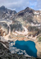
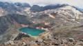
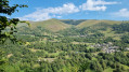
The Grand Quayrat as seen from Les Granges d’Astau

A very demanding and technical day-long high-mountain hike requiring excellent physical fitness to reach the Grand Quayrat pyramid, which rises to an altitude of 3,060 metres and offers a magnificent panorama of the Luchon region. The route includes high-altitude sections, some of which are vertiginous and dangerous, requiring some climbing.

It can be completed over two days by spending the night at the Refuge d’Espingo, in which case the hike is classified as ‘Very Difficult’.

Details

n°38472351
Creation:
Last update:
Last review:
  • Walking
    Activity: Walking
  • ↔
    Distance: 10.09 mi
  • ◔
    Duration according to the author: 10 hrs 
  • ▲
    Difficulty: Extremely difficult

  • ⚐
    Back to start: Yes
  • ↗
    Ascent: + 6,381 ft
  • ↘
    Descent: - 6,352 ft

  • ▲
    Highest point: 9,938 ft
  • ▼
    Lowest point: 3,757 ft

Photos

Description of the walk

Park in the large car park at Les Granges d’Astau, which gets very busy in peak season.

(S/E) Take the GR®10 straight ahead, towards Lac d’Oô. The climb to this lake, which is very popular with walkers and families, is a gentle one through the forest. Reach the lake.

(1) Continue along the GR® which climbs to the left above the lake, towards the Col d’Espingo. The climb becomes steeper towards the end, where you leave the GR® – which veers off to the left – and continue straight on to the pass. You will then discover the Cirque d’Espingo, surrounded by numerous 3,000-metre peaks, including the Pyramide du Grand Quayrat on the left.

(2) On reaching the Col d’Espingo, leave the main path, which continues straight on, and take a small, inconspicuous track rising through the grass on the left. From this point, the ascent is only suitable for hikers with good mountaineering experience, who will need to follow the cairns to the summit to find the path. The path continues to climb up the mountainside, then veers left to lead onto a scree slope.

(3) Climb up this scree slope, following the cairns as best you can (the going is quite tough on this slope). Join the path on the right, which runs along the mountainside once more before reaching a rocky outcrop.

(4) Climb this outcrop – it’s fairly easy to scale, but take care if the rock is wet. Continue along the path, which is at times vertiginous on the right. You’ll reach a large area of large scree.

(5) Use the cairns to help you make your way over these large boulders, the sheer size of which makes progress slow and difficult. You’ll reach the foot of a small cliff.

(6) Climb up the scree slope, continuing to follow the cairns. A few climbing sections take you round a small rocky outcrop to the right before the path veers left, heading due north. A small chimney leads you, after the path has turned right towards the south, to the foot of a large couloir.

(7) Climb this long couloir until you reach the ridge at a small pass between the Petit Quayrat (north) and the Grand Quayrat (south)

(8) Follow the ridge due south until, just before the Grand Quayrat, you come to a step that could be mistaken for the summit. Go round it on the left along a small, vertiginous ledge where there is no room for error.

(9) You will then reach the summit of the Grand Quayrat, offering a magnificent high-mountain panorama across the whole of the Luchon region, notably the Cirque d’Espingo to the right and the Cirque des Crabioules to the left.

Head back down to the Granges d’Astau (S/E) via the same route you took on the ascent, taking extreme care on each descent, which is often more dangerous than the ascent.

Waypoints

  1. S/E : mi 0 - alt. 3,757 ft - Les Granges d’Astau
  2. 1 : mi 1.8 - alt. 4,931 ft - Lac d'Oo
  3. 2 : mi 3.18 - alt. 6,453 ft - Col d'Espingo (1967m)
  4. 3 : mi 3.47 - alt. 6,719 ft - Scree couloir
  5. 4 : mi 3.68 - alt. 7,149 ft - Rocky outcrop
  6. 5 : mi 3.81 - alt. 7,241 ft - Area of large scree
  7. 6 : mi 4.28 - alt. 8,127 ft - Small cliff
  8. 7 : mi 4.45 - alt. 8,478 ft - Base of the couloir leading to the ridge
  9. 8 : mi 4.64 - alt. 9,075 ft - Ridge between the two Quayrats
  10. 9 : mi 4.98 - alt. 9,928 ft - Summit of the - Grand Quayrat (3060m)
  11. S/E : mi 10.09 - alt. 3,760 ft - Les Granges d’Astau. Near the - Neste d'Oô (rivière) - Affluent de l'One

Notes

A demanding, very long and physically strenuous hike. It requires a very good level of fitness and should only be undertaken in summer (wait until the end of June) to avoid snow. Taking a minimum of 9 to 10 hours to complete, this hike crosses numerous scree slopes and steep inclines and involves easy scrambling on several high-altitude sections, some of which are quite vertiginous.

Take plenty of water with you, and avoid the hike if rain is forecast for the day.

The route is signposted, but the path is often difficult to follow, particularly between (2) and (5), where you will need to use cairns and the GPS track if necessary.

Always be cautious and plan ahead when you're outdoors. Visorando and the author of this route cannot be held responsible for any accidents occurring on this route.

The GR® and PR® markings are the intellectual property of the Fédération Française de Randonnée Pédestre.

Reviews and comments

4.7 / 5
Based on 1 review

Reliability of the description
5 / 5
Ease of following the route
4 / 5
Route interest
5 / 5
Mickaelmf47
Mickaelmf47

Overall rating : 4.7 / 5

Date of your route : Aug 18, 2026
Reliability of the description : ★★★★★ Very good
Ease of following the route : ★★★★☆ Good
Route interest : ★★★★★ Very good
Very busy route : Yes

Starting from Les Granges d’Astau, it’s 2,000 metres of elevation gain – so a good hike.
A lovely view of Espingo.
A few sections where you need to use your hands, but nothing out of the ordinary.
About fifty metres from the summit, I couldn’t find the path leading to the top.

Machine-translated

Other walks in the area

For more walks, use our search engine .

The GPS track and description are the property of this route's author. Please do not copy them without permission.