Le Grand Parcher and the Bois de Parapin

A short walk above Les Vigneaux. Splendid views over the Argentière La Bessée valley towards Vallouise.

Details

586053
Creation:
Last update:
Last review:
  • Walking
    Activity: Walking
  • ↔
    Distance: 3.11 mi
  • ◔
    Average duration: 2h 30 
  • ▲
    Difficulty: Moderate

  • ⚐
    Back to start: Yes
  • ↗
    Ascent: + 1,194 ft
  • ↘
    Descent: - 1,194 ft

  • ▲
    Highest point: 4,948 ft
  • ▼
    Lowest point: 3,842 ft

Description of the walk

From the D994E, which links L’Argentière-la-Bessée to Vallouise, turn right onto the D704, which leads to Le Grand Parcher
Park in the Place du Pied de la Poix.

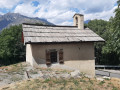
(S/E) Head up towards the Chapelle Saint-André, passing the communal oven. Follow the wide stony path.
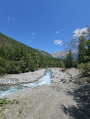
Leave the path leading to Les Vigneaux (return route) on your right and continue straight on towards La Tête d’Amont, following the Grand Parcher stream.
Leave the paths leading to the Combe de la Tête d’Amont and the Roche Pointue on your left, go through the green gate (Vallouise communal forest) and carry on straight along the steep path. Cross the Grand Parcher stream.

(1) Continue along the path (viewpoint over Puy-Saint-Vincent and its resorts). Stay on the main path which continues to the left (ignore the forest track that goes straight on).

(2) Leave the forest track on the left and take the one that continues straight ahead. At the signpost for ‘Bois de Parapin’ (altitude 1,507 metres), turn right towards Les Vigneaux. There is an alternative route by continuing straight on towards the Fontaine des Marcellins (45 minutes’ walk).
The track becomes a path and descends towards a forest road, which you follow for 20–25 metres. Then, when you reach a felled tree, continue along the path to the right.

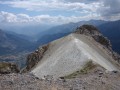
(3) Beautiful views of Les Vigneaux and the Vallouise valley. A few charred tree trunks dot the downhill route. You’ll reach a crossroads of paths at a place called Les Vignasses.

(4) Turn right and follow a virtually level path to reach the junction with the path leading down towards Les Vigneaux.

(5) Leave this path on your left and continue straight ahead to easily reach the car park where you started (S/E).

Waypoints

  1. S/E : mi 0 - alt. 3,842 ft - Place du Pied de la Poix. Near the - Gyronde (rivière)
  2. 1 : mi 0.54 - alt. 4,350 ft - Viewpoint over Puy-Saint-Vincent
  3. 2 : mi 0.95 - alt. 4,892 ft - Path straight ahead
  4. 3 : mi 1.2 - alt. 4,787 ft - Viewpoint over the Vallouise Valley / Les Vigneaux
  5. 4 : mi 1.77 - alt. 4,114 ft - Les Vignasses
  6. 5 : mi 2.45 - alt. 4,062 ft - Descent to Les Vigneaux
  7. S/E : mi 3.11 - alt. 3,842 ft - Place du Pied de la Poix

Notes

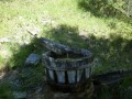
(S/E) Fountain at the car park.

Worth a visit

At the signpost for ‘Bois de Parapin’ (altitude 1,507 metres), turn right towards Les Vigneaux. Alternatively, you can continue straight on towards the Marcellins fountain (45 minutes’ walk).

Reviews and comments

3.8 / 5
Based on 3 reviews

Reliability of the description
4 / 5
Ease of following the route
3.3 / 5
Route interest
4 / 5
Laurent M.
Laurent M.

Overall rating : 4.3 / 5

Date of your route : Aug 23, 2025
Reliability of the description : ★★★★★ Very good
Ease of following the route : ★★★★☆ Good
Route interest : ★★★★☆ Good
Very busy route : No

A pleasant walk with a reasonable profile, ideal for resting after an intense day of climbing
The hike is easy for experienced walkers, but I can understand that for children the initial climb might be a little steep (see other reviews).
Shady route (appreciable in summer) with lovely views.

Machine-translated

Helene102
Helene102

Overall rating : 5 / 5

Date of your route : Jan 01, 2025
Reliability of the description : ★★★★★ Very good
Ease of following the route : ★★★★★ Very good
Route interest : ★★★★★ Very good
Very busy route : No

An easy route provided you’re wearing suitable footwear and perhaps have a pair of walking poles; there’s no trouble following the track, with no obstacles along the way.
We did this walk on 1 January; there were a few icy patches, so the crampons we attached to our boots came in handy.
The route is on the south-facing slope, which is very welcome at this time of year when the sun is low.

Machine-translated

Chris3084
Chris3084

Good evening,
I’m sorry to hear that you found this walk disappointing.
The level of difficulty is always relative, depending on the participants, their physical abilities and, of course, their age.
As for the difficulties encountered on the descent, it’s worth bearing in mind that the route was mapped out almost four years ago and that, since then, bad weather has caused trees to fall – trees which, inevitably, were not identified in 2017.

Machine-translated

Mère de famille
Mère de famille

Overall rating : 2 / 5

Date of your route : Mar 04, 2021
Reliability of the description : ★★☆☆☆ Disappointing
Ease of following the route : ★☆☆☆☆ Very disappointing
Route interest : ★★★☆☆ Average
Very busy route : Yes

This route should be classed as difficult, not moderate. The initial climb and the first half of the walk were steep and unmarked, reducing my three children – aged between 6 and 10 – to tears. Furthermore, the path down through the Parapin woods was difficult to find, blocked by fallen trees and unmarked.

Machine-translated

Other walks in the area

For more walks, use our search engine .

The GPS track and description are the property of this route's author. Please do not copy them without permission.