Circular route along the Onde in Vallouise

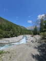
If you have children and are on holiday in one of the villages at the foot of Pelvoux, here’s a short, shaded circular route that will delight young and old alike with its ease and the surprising artworks dotted along the Onde.

Details

37674828
Creation:
Last update:
Last review:
  • Walking
    Activity: Walking
  • ↔
    Distance: 4.73 mi
  • ◔
    Average duration: 2h 45 
  • ▲
    Difficulty: Easy

  • ⚐
    Back to start: Yes
  • ↗
    Ascent: + 696 ft
  • ↘
    Descent: - 673 ft

  • ▲
    Highest point: 4,347 ft
  • ▼
    Lowest point: 3,763 ft

Photos

Description of the walk

Park in the large car park at the Maison des Écrins at the entrance to Vallouise when coming from L’Argentière-la-Bessée.

(S/E) Take the path opposite, passing under a wooden arch. Follow this particularly well-maintained path, then leave it to take a wider track on the left, leading to the Pont de Gérendoine junction.

(1) Cross the road, continue straight ahead along a good path and, after a very gentle climb, reach a bridge over the Ruisseau de Narreyroux.

(2) Cross this bridge and, a few metres further on, turn left onto the path leading to the Cascade de la Pissette. Continue uphill until, a few hundred metres further on, you reach another junction.

(3) Carry on straight ahead, continuing the climb, until you reach the junction at the Ravin de la Fouillette, where there is a signpost.

(4) Turn right downhill and you’ll soon come to a wider track. Take it to the left and follow it, passing the Ravin des Iscles, and you’ll come to a junction of paths immediately afterwards.

(5) Turn right onto this track and continue down an easy descent to reach the Pont des Places campsite.

(6) Turn right onto the wide track, which also forms part of theGR®54, and walk at a leisurely pace to reach the Pont des Fontaines rest area.

(7) Continue along the River Onde to the Ruisseau de Narreyroux bridge.

(2) Keep to the left on the track, then cross the Onde via a wooden bridge. Turn right onto theGR® and continue through the streets of Vallouise to reach the church square.

(8) Head down to the right, reach the right bank of the Gyr, follow it and pass between the Gyr and the Huttopia campsite. Then cross the Onde and, via the path you took on the way there, you’ll easily find the car park at the Maison des Écrins (S/E).


Waypoints

  1. S/E : mi 0 - alt. 3,763 ft - Maison des Écrins car park
  2. 1 : mi 0.37 - alt. 3,802 ft - Gérendoine Bridge - Onde (cours d'eau) - Affluent de la Gyronde
  3. 2 : mi 0.78 - alt. 3,875 ft - Narreyroux Stream
  4. 3 : mi 0.98 - alt. 4,072 ft - Crossroads
  5. 4 : mi 1.39 - alt. 4,278 ft - Fouillette Ravine
  6. 5 : mi 1.67 - alt. 4,249 ft - Trail junction
  7. 6 : mi 2.17 - alt. 4,055 ft - Pont des Places
  8. 7 : mi 3.2 - alt. 3,894 ft - Pont des Fontaines
  9. 8 : mi 4.15 - alt. 3,802 ft - Vallouise Church. Towards the banks of the - Gyr (cours d'eau) - Affluent de la Gyronde
  10. S/E : mi 4.73 - alt. 3,763 ft - Maison des Écrins car park

Notes

An interesting point about this route is that you’ll follow the Onde and then the Gyr in turn. The Onde flows into the Gyr near the Maison des Écrins. So, to keep things simple, the new river has been named the Gyronde – rather original, isn’t it?

Worth a visit

After (7), be sure to enjoy all the original artworks dotted along the route.

Always be cautious and plan ahead when you're outdoors. Visorando and the author of this route cannot be held responsible for any accidents occurring on this route.

The GR® and PR® markings are the intellectual property of the Fédération Française de Randonnée Pédestre.

Reviews and comments

3.8 / 5
Based on 5 reviews

Reliability of the description
3.8 / 5
Ease of following the route
3.6 / 5
Route interest
4 / 5
PANORAMIX05
PANORAMIX05

Overall rating : 3.7 / 5

Date of your route : May 25, 2025
Reliability of the description : ★★★★☆ Good
Ease of following the route : ★★★★☆ Good
Route interest : ★★★☆☆ Average
Very busy route : No

At present, following the floods of September 2024, the only way to reach the PISSETTE waterfall is to go via the right bank, cross the first (unnamed) bridge and follow the path described. From the PLACES bridge, the return journey must be made along the right bank, as the left bank is impassable. It is possible to take a track on the right which runs alongside the ONDE and rejoins the route at the first bridge.

Machine-translated

Danic
Danic

Overall rating : 2.7 / 5

Date of your route : Aug 28, 2024
Reliability of the description : ★★★☆☆ Average
Ease of following the route : ★★☆☆☆ Disappointing
Route interest : ★★★☆☆ Average
Very busy route : Yes

It’s difficult to give an opinion. Following severe flooding, a large section of the paths is closed to the public. We therefore tried to follow the route as closely as possible and ended up going on an impromptu but nonetheless enjoyable walk.

Machine-translated

Doc Arverne
Doc Arverne

Overall rating : 5 / 5

Date of your route : Jul 30, 2024
Reliability of the description : ★★★★★ Very good
Ease of following the route : ★★★★★ Very good
Route interest : ★★★★★ Very good
Very busy route : No

A short, easy and refreshing walk that I did a year ago.
This year, due to the flooding, there have been numerous landslides and footbridges have been washed away.
The route is no longer passable. Work is currently underway.

Machine-translated

pascalou81
pascalou81
• Edited:

Overall rating : 4.3 / 5

Date of your route : Aug 01, 2024
Reliability of the description : ★★★★☆ Good
Ease of following the route : ★★★★☆ Good
Route interest : ★★★★★ Very good
Very busy route : No

A lovely walk, with much of it in the shade (up to bridge 6). Please note: many paths are closed by prefectural order due to rockfalls, particularly at point 6 on the return journey
There are plenty of signposts, but it’s best to follow the trail.
I suggest that the author of the route add the waterfall to the description

Machine-translated

jp11
jp11

Overall rating : 3.3 / 5

Date of your route : Aug 14, 2023
Reliability of the description : ★★★☆☆ Average
Ease of following the route : ★★★☆☆ Average
Route interest : ★★★★☆ Good
Very busy route : Yes

A pleasant walk in the shade.
Given the number of paths that criss-cross the area, it’s best to follow the signposts by name. First, head towards the waterfall, then towards the bridge at Les Places.
Some of the straw and jute sculptures have disappeared.

Machine-translated

Other walks in the area

For more walks, use our search engine .

The GPS track and description are the property of this route's author. Please do not copy them without permission.