The Puy-Saint-Vincent Chapel Route

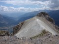
A particularly pleasant circular route allowing you to explore the chapels and the church at Puy-Saint-Vincent. Along the route, at the Saint-Romain Chapel, there is a remarkable view over Vallouise and its surrounding villages, from which you can also see the confluence of the Gyr and the Onde, where they join to form the Gyronde des Alpes.

Details

61530326
Creation:
Last update:
Last review:
  • Walking
    Activity: Walking
  • ↔
    Distance: 4.19 mi
  • ◔
    Average duration: 2h 30 
  • ▲
    Difficulty: Easy

  • ⚐
    Back to start: Yes
  • ↗
    Ascent: + 656 ft
  • ↘
    Descent: - 656 ft

  • ▲
    Highest point: 4,990 ft
  • ▼
    Lowest point: 4,432 ft

Photos

Description of the walk

Park at Puy-Saint-Vincent in the Moulin car park.

(S/E) Leave the car park, then turn right onto theGR®50(marked in white and red) and head towards the Béal des Prés crossroads.

(1) Leave theGR® and turn right onto the canal embankment. Follow it, taking great care at the junctions with the downhill mountain bike trails; these junctions are marked by signs. Continue to the campsite junction.

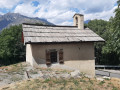
(2) Turn right onto this descending path and you’ll soon reach thefirst chapel, Saint-Vincent, after carefully crossing the D804.

(3) Continue along the road, which is still descending; cross the D804 with care once more and head towards the Serre district to reach Sainte-Marthe Church.

(4) Then turn left for a few metres, before heading down to the right and, once past the road, taking the path which leads up a short climb to the Chapel of Saint-Romain.

(5) Return along the same route in the opposite direction until you find the ‘Sentier des Lutins’ on your left. Take this path and follow it until you reach the ‘Carrefour des Alberts’.

(6) Turn 90° to the right onto theGR®50; at the road, turn right and go up the steps leading to the car parks to reach the Saint-Roch Chapel.

(7) Continue straight ahead along Rue des Prés; you’ll then find the sign for Église Sainte-Marie-Madeleine next to the Sherpa. Follow the signs to reach the church and its cemetery.

(8) Return along Rue des Prés, then turn right to reach the Moulin car park (S/E).

Waypoints

  1. S/E : mi 0 - alt. 4,656 ft - Moulin car park
  2. 1 : mi 0.2 - alt. 4,760 ft - Béal des Prés
  3. 2 : mi 1.12 - alt. 4,977 ft - Campsite junction
  4. 3 : mi 1.53 - alt. 4,872 ft - Saint-Vincent Chapel
  5. 4 : mi 2.04 - alt. 4,580 ft - Église Sainte-Marthe (Puy-Saint-Vincent)
  6. 5 : mi 2.34 - alt. 4,557 ft - Saint-Romain Chapel
  7. 6 : mi 3.33 - alt. 4,432 ft - GR junction
  8. 7 : mi 3.68 - alt. 4,577 ft - Saint-Roch Chapel
  9. 8 : mi 4.02 - alt. 4,613 ft - Church of Sainte-Marie-Madeleine
  10. S/E : mi 4.19 - alt. 4,656 ft - Moulin car park

Notes

There are a few fountains in the village.

Worth a visit

All the chapels are, of course, well worth a visit. As they are all closed for safety reasons, visits can only be arranged through the Tourist Office.
(5) Saint-Romain Chapel: as well as the remarkable view, take in the superb orientation board detailing all the surrounding peaks.

Always be cautious and plan ahead when you're outdoors. Visorando and the author of this route cannot be held responsible for any accidents occurring on this route.

The GR® and PR® markings are the intellectual property of the Fédération Française de Randonnée Pédestre.

Reviews and comments

4.7 / 5
Based on 3 reviews

Reliability of the description
4.7 / 5
Ease of following the route
4.3 / 5
Route interest
5 / 5
fredcom
fredcom

Overall rating : 5 / 5

Date of your route : Jul 01, 2026
Reliability of the description : ★★★★★ Very good
Ease of following the route : ★★★★★ Very good
Route interest : ★★★★★ Very good
Very busy route : No

A relaxing stroll through the woods

Machine-translated

Catherine Cyrot
Catherine Cyrot

Overall rating : 4.3 / 5

Date of your route : Aug 25, 2025
Reliability of the description : ★★★★☆ Good
Ease of following the route : ★★★★☆ Good
Route interest : ★★★★★ Very good
Very busy route : No

A lovely, easy walk

Machine-translated

jp11
jp11

Overall rating : 4.7 / 5

Date of your route : Jun 30, 2025
Reliability of the description : ★★★★★ Very good
Ease of following the route : ★★★★☆ Good
Route interest : ★★★★★ Very good
Very busy route : No

In hot weather, this is a refreshing walk, partly under trees, and interesting for lovers of religious and village architecture. The Saint Vincent chapel is open on Thursdays during the summer so you can admire the frescoes.

Machine-translated

Other walks in the area

For more walks, use our search engine .

The GPS track and description are the property of this route's author. Please do not copy them without permission.