The Walser hamlets of the Val d’Otro

A hike suitable for everyone in the heart of the Otro Valley, offering the chance to visit several of its villages and mountain pastures (Follu, Feglierecc, Ciucche, Dorf, Scarpia, Weng and Gender) situated in one of the most beautiful and distinctive areas of Alagna.
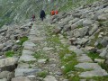
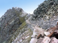
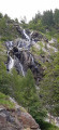
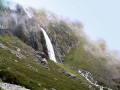
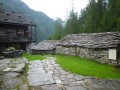
These small hamlets, surrounded by greenery, are accessible only on foot, via paths through a forest of beech and conifer trees. Don’t forget to visit the old manganese mines and the beautiful waterfalls, the best known of which is the Caldaia di Otro.

Details

n°36770949
Creation:
Last update:
Last review:
  • Walking
    Activity: Walking
  • ↔
    Distance: 5.00 mi
  • ◔
    Average duration: 4h 10 
  • ▲
    Difficulty: Moderate

  • ⚐
    Back to start: Yes
  • ↗
    Ascent: + 2,165 ft
  • ↘
    Descent: - 2,162 ft

  • ▲
    Highest point: 5,686 ft
  • ▼
    Lowest point: 3,737 ft

Photos

Description of the walk

The route starts not far from the centre of the village of Alagna Valsesia, the last village in the valley. You can easily park in one of its many car parks, but the route begins at the first free car park on the SP 299 provincial road.

The CAI path to follow is number 203 (formerly 3 on some signs).

(S/E) From the large car park, head towards the village of Alagna by taking the road on the right (Via dei Walser), then turn left onto Via Indeccu. Cross over the Torrente Otro, then turn left to cross over the Rio Fuar. Walk through the small cluster of typical local houses in the hamlet of Resiga.

(1) Walk past the small church of Sant’Antonio da Padova. Follow the signs for “Cascata d’Otro” on small wooden signposts to walk alongside the stream and reach the waterfall after about 200 m.

(2) Turn back towards the church and the cluster of houses.

(1) Go round the house, taking the path on the left towards Val d’Otro. Follow this path, which climbs through the woods and soon joins the “main” path.

(3) Continue straight on uphill (to the left of the oratory) up a flight of large steps, passing another chapel. You’ll soon reach the “Allo Specchio” viewpoint, from where you can admire Alagna from above. Go round the top of the small house and join a path at a fork.

(4) Continue the climb, which features stone steps. You’ll reach another fork in the path.

(5) A path on the left leads to the “Caldaia di Otro”. This beautiful waterfall is well worth the short detour of about 10 minutes there and back.

(6) Turn back to the previous fork.

(5) Turn left onto the main path, which widens and zigzags through the woods, with some fairly steep sections. You’ll come to a junction with a stone fountain.

(7) Continue the climb to the right on path 203 (signposted ‘Otro – Zar Senni’). The path on the left (203a: Gender, Tailly) will be the one we take on the way back.
The route continues up a fairly steep and monotonous winding path, passing a few crosses and a small chapel. Note the “Sasso della Mano della Madonna” with a plaque bearing the following inscription: “Sopra questo sasso la Madonna si è appoggiata. Quando questa via tu salirai posa sopra la mano, per tutto il giorno la Madonna ti aiuterà.” On the right, a sign points to former manganese mines. This detour also leads to the path to Otro (as an alternative route).
After about thirty minutes, you finally reach the alpine plateau and its first hamlet, Follu (1,664 m).

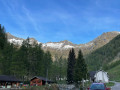
(8) Follu, the “capital” of the Val d’Otro, is the valley’s largest village. Its chapel, dedicated to the Madonna della Neve, stands out amongst the houses and pastures. To the west, the rocky massif is dominated by the peak of Corno Bianco (3,320 m). To the north, the meadows used for grazing rise gently up the slopes of Mount Torru (2,508 m). Continue on to the next hamlet, called Dorf.

(9) Before entering the hamlet of Dorf, head up to the picnic tables, which offer a sunny spot for a break. Continue along the path to the hamlet of Scarpia (1,730 m). Go round it on the left to descend towards the hamlet of Weng di Otro. Follow the CAI 201 path as it winds downhill past the hamlet.

(10) Take the path that descends to the left towards the Otro stream and Alpe Gender.

(11) Cross the small bridge and continue to the left towards ‘bas Gender’.

(12) Do not head up to the right but continue to the left towards Alagna. You’ll reach woodland dotted with rocks. Pass by the “Mulini Puttero” then cross to the left bank of the Otro via a large wooden bridge.

(13) Follow the path, which becomes a track overlooking the stream, until you reach a junction you passed on the way there.

(7) Descend along the same route as on the way there until you reach another fork, which you also passed on the way there.

(4) Turn right onto the steeper descent. The wide stone steps require a degree of care, especially in wet weather. You’ll reach another junction, which you also passed on the way up.

(3) Turn right and head down to the hamlet of Resiga, following the route in the opposite direction to the outward journey.

(1) Continue to the right, then turn right again onto Via Indeccu. Go round the roundabout on the right and return to the car park (S/E).

Waypoints

  1. S/E : mi 0 - alt. 3,737 ft - South car park, Alagna - Cascata d'Otro
  2. 1 : mi 0.32 - alt. 3,802 ft - Resiga hamlet. Return junction at the - Cascata d'Otro
  3. 2 : mi 0.46 - alt. 3,914 ft - Cascata d'Otro
  4. 3 : mi 0.72 - alt. 4,049 ft - Junction with the communal wayside shrine (return route)
  5. 4 : mi 0.88 - alt. 4,324 ft - Cascinetti di Otro. Common junction (out and back)
  6. 5 : mi 0.93 - alt. 4,370 ft - T-junction (return route) at the - Caldaia di Otro
  7. 6 : mi 1 - alt. 4,426 ft - Caldaia di Otro
  8. 7 : mi 1.19 - alt. 4,626 ft - Crossroads with a stone fountain. Circular route for villages
  9. 8 : mi 1.73 - alt. 5,482 ft - Follu. Madona della Neve
  10. 9 : mi 1.9 - alt. 5,568 ft - Dorf. Picnic area
  11. 10 : mi 2.63 - alt. 5,486 ft - Weng di Otro junction
  12. 11 : mi 2.8 - alt. 5,299 ft - Gender Bridge. Otro stream
  13. 12 : mi 2.94 - alt. 5,308 ft - Alpe Gender
  14. 13 : mi 3.4 - alt. 5,089 ft - Wooden bridge
  15. S/E : mi 5 - alt. 3,737 ft - South car park, Alagna

Notes

The route largely follows the CAI 203 trail (formerly 3).

Fountain and mountain hut (catering: Rifugio Zar Senni) at Follu (8).

Worth a visit

  • Church of Sant’Antonio.
  • Otro Waterfall.
  • Caldaia di Otro.
  • Manganese mine: the mine reached its peak of activity during the Second World War, when the extracted materials were used to produce steel for the aeronautical industry. A large cableway was built there to transport the extracted material down into the valley. Mining operations ceased in 1949, as they soon did at all the other mines in the valley.
  • Madonna della Neve (Follu). This hamlet once had a school, which was destroyed by an avalanche in 1919. Today, it is home to the Rifugio Zar Senni (where meals are available).
  • Alagna: the Via dei Walser is the main street, which is entirely pedestrianised. Balconies brimming with colourful flowers offer glimpses of modern houses interspersed with old wooden buildings in the Walser style (baita).

The Walser were a Germanic people who, towards the end of the 12th century, settled in several uninhabited Alpine regions of Piedmont and the Aosta Valley. The small villages they established often remained very isolated from the local populations, which enabled them to preserve their culture, customs and language virtually unchanged. The Walser lived mainly from agriculture and pastoralism; their villages (often self-governing) were generally equipped with a bread oven and a chapel known as an ‘oratorio’.
What still bears unmistakable witness to their presence are the characteristic Walser houses, built mainly of stone and wood and featuring typical wooden lofts running throughout the house, which were used to dry hay or other produce.

Reviews and comments

4.7 / 5
Based on 1 review

Reliability of the description
4 / 5
Ease of following the route
5 / 5
Route interest
5 / 5
Keeshond
Keeshond

Overall rating : 4.7 / 5

Date of your route : Jul 04, 2026
Reliability of the description : ★★★★☆ Good
Ease of following the route : ★★★★★ Very good
Route interest : ★★★★★ Very good
Very busy route : Yes

A really lovely place; we went there on a Saturday, which explains why it was so busy.
We just had a bit of trouble finding the signposted car park. We set off from a different one. No problem, though, as it’s very well signposted.

Machine-translated

Other walks in the area

For more walks, use our search engine .

The GPS track and description are the property of this route's author. Please do not copy them without permission.