The Bonneville double circular loop

A simple and flexible nature route: two circular routes that can be done independently of one another, with young children for example:
- the circular route from Combeauvert to Fontmeau takes 40 mins,
- the Trélonge loop takes 25 minutes.
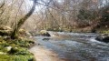
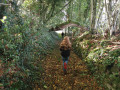
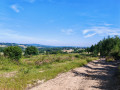
The route follows grassy paths and sunken lanes, offering some lovely views.

Details

n°3206118
Creation:
Last update:
Last review:
  • Walking
    Activity: Walking
  • ↔
    Distance: 2.67 mi
  • ◔
    Average duration: 1h 30 
  • ▲
    Difficulty: Easy

  • ⚐
    Back to start: Yes
  • ↗
    Ascent: + 328 ft
  • ↘
    Descent: - 331 ft

  • ▲
    Highest point: 2,011 ft
  • ▼
    Lowest point: 1,667 ft
  • ⚐ Country: France
  • ⚐ City: Thauron (23250)
  • ⚑
    Start/End: N 46.021897° / E 1.797248°
  • ❏
    IGN map(s): Ref. 2130E
  • Hour-by-hour weather

Description of the walk

Park on the outskirts of the village of Bonneville.

(S/E) Head towards Combeauvert, then take the sunken path that climbs to the right, north-east. You’ll reach a multi-way junction in Combeauvert.

(1) Cross the main road carefully and take the path directly opposite. You’ll reach a Y-junction at the edge of the woods.

(2) Turn left and you’ll soon reach Fontmeau. Keep left on the road, then turn right off it and head into the woods. After a 90° right-hand bend, continue straight on to reach the edge of the woods.

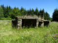
(3) Walk along the clearing, taking the grassy path (on the right) between the meadow and the fir forest. Enter the woods again, then come out and walk along the clearing to reach another T-junction. In good weather, enjoy the view here of the Chaîne des Puys and Mont Sancy.

(4) Continue by turning right down the path that leads back to the Y-junction you passed earlier.

(2) Follow the route back in the opposite direction to return to the original junction.

(1) Just behind the house, turn left onto the path leading to the Sentier de la Trélonge.

(5) Reach this hamlet by turning right, walk through it and take the road back to the Bonneville car park (S/E).

Waypoints

  1. S/E : mi 0 - alt. 1,736 ft - Bonneville car park
  2. 1 : mi 0.26 - alt. 1,824 ft - Combeauvert junction
  3. 2 : mi 0.38 - alt. 1,847 ft - Fourche Fontmeau
  4. 3 : mi 1.03 - alt. 2,001 ft - Clearing
  5. 4 : mi 1.37 - alt. 1,965 ft - Crossroads with a view
  6. 5 : mi 2.3 - alt. 1,670 ft - La Trélonge junction
  7. S/E : mi 2.67 - alt. 1,736 ft - Bonneville car park

Reviews and comments

5 / 5
Based on 1 review

Reliability of the description
5 / 5
Ease of following the route
5 / 5
Route interest
5 / 5
Francoise dherain
Francoise dherain

Overall rating : 5 / 5

Date of your route : Oct 24, 2022
Reliability of the description : ★★★★★ Very good
Ease of following the route : ★★★★★ Very good
Route interest : ★★★★★ Very good
Very busy route : No

A short, very pleasant walk thanks to its varied terrain; you walk in turn along the edge of woods, across meadows, in open country and through woodland consisting of conifers as well as chestnut trees. Superb views over the region. The Auvergne mountains are visible but still quite far away. Do bring your binoculars. The route is not signposted but is described in great detail.

Machine-translated

Other walks in the area

For more walks, use our search engine .

The GPS track and description are the property of this route's author. Please do not copy them without permission.