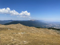
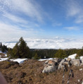
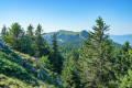
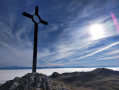
Crêt de la Goutte as seen from the Pays de Gex

Route taking the most direct path to the orientation table at the highest point in the southern Jura, offering a 360-degree view stretching from Lake Geneva to Lake Bourget. The route starts from a small tarmac road leading to the Pré Bouillet refuge.

Details

n°107228225
Creation:
Last update:
Last review:
–
  • Walking
    Activity: Walking
  • ↔
    Distance: 4.31 mi
  • ◔
    Average duration: 3h 00 
  • ▲
    Difficulty: Moderate

  • ⚐
    Back to start: Yes
  • ↗
    Ascent: + 1,211 ft
  • ↘
    Descent: - 1,194 ft

  • ▲
    Highest point: 5,312 ft
  • ▼
    Lowest point: 4,114 ft

Description of the walk

The road to the starting point above Pré Bouillet is tarmac-surfaced almost all the way. There is a car park at the starting point, or alternatively a larger one at the previous hairpin bend on the road before passing above the Pré Bouillet Refuge.

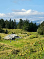
(S/E) Turn left onto the track heading due north, then follow the GR® du Balcon du Léman before turning left off it to climb gently up to the Chalet du Sac.

(1) Continue due south across the mountain pasture until you reach the foot of the Crêt de l’Aiguillon at a crossroads of paths.

(2) Turn right, and further on join the GRP® du Grand Tour de la Valserine, marked in yellow and red. Follow it to the left. Continue uphill to reach the summit of the Crêt de la Goutte.

(3) Begin the descent opposite, and you’ll soon reach another junction of paths.

(4) Leave the GRP® and take the path to the left, heading due north. You’ll reach a rocky section; continue straight ahead and then across the mountain pasture to rejoin the junction you passed on the way out.

(2) Follow the route taken on the way out in the opposite direction. Return to the Chalet du Sac.

(1) Turn right and enter the forest. Continuing downhill, you’ll reach a Y-shaped junction.

(5) Keep left on the path; take care on the descent, as it is slippery due to the accumulation of fallen leaves. You will then reach a forest track.

(6) Follow it straight ahead to reach the car park above Pré Bouillet (S/E).

Waypoints

  1. S/E : mi 0 - alt. 4,117 ft - Car park above Pré Bouillet
  2. 1 : mi 1.12 - alt. 4,534 ft - Chalet du Sac
  3. 2 : mi 1.64 - alt. 4,790 ft - Junction of the circular loop - Crêt de l'Éguillon
  4. 3 : mi 2.22 - alt. 5,299 ft - Crêt de la Goutte
  5. 4 : mi 2.41 - alt. 5,082 ft - Crossroads at the end of the GRP
  6. 5 : mi 3.75 - alt. 4,173 ft - Y-junction
  7. 6 : mi 4.06 - alt. 4,137 ft - Forest track
  8. S/E : mi 4.31 - alt. 4,117 ft - Car park above Pré Bouillet

Notes

No water source.
(1) The Chalet du Sac offers accommodation.

Worth a visit

(3) Crêt de la Goutte: enjoy the 360° view and explore the surrounding areas described on the orientation board.

Always be cautious and plan ahead when you're outdoors. Visorando and the author of this route cannot be held responsible for any accidents occurring on this route.

The GR® and PR® markings are the intellectual property of the Fédération Française de Randonnée Pédestre.

Other walks in the area

For more walks, use our search engine .

The GPS track and description are the property of this route's author. Please do not copy them without permission.