Crêt d’Eau Circular Trail

Circular loop for trail running training, offering beautiful scenery and varied terrain.

Details

27908
Creation:
Last update:
Last review:
  • Walking
    Activity: Walking
  • ↔
    Distance: 10.45 mi
  • ◔
    Average duration: 6h 50 
  • ▲
    Difficulty: Moderate

  • ⚐
    Back to start: Yes
  • ↗
    Ascent: + 2,362 ft
  • ↘
    Descent: - 2,352 ft

  • ▲
    Highest point: 5,315 ft
  • ▼
    Lowest point: 3,770 ft

Description of the walk

From Farges, drive up the tarmac forest road which starts opposite the church.
When you reach the 1149 mark (hairpin bend), leave your car there.

(S/E) Take the dirt track on the right, on the uphill side, towards Le Gralet.

(1) When you reach the ridge, take theGR® (red and white markings) to the left.

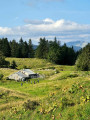
(2) Pass the Chalet la Poutouille.

(3) After the descent, carry on straight ahead; do not take the path leading down to the Col de Menthière. After about 2 km through the forest, you will come to a major forest track.

(4) Turn right to reach the 1330m point, and from there, continue straight on into the valley, initially following the road.

(5) Carry on further along the ski run to the Chalet du Sac.

(6) Join theGR® trail again (signpost) and climb up to the Crêt de la Goutte.

(7) Head back down to the Chalet du Sac and take the forest track that starts behind the chalet.

(8) Pass the Col du Sac and continue along the track.

(9) Take the tarmac road on the left to return to your car.

Waypoints

  1. S/E : mi 0 - alt. 3,770 ft - Forest track, elevation 1149
  2. 1 : mi 1.65 - alt. 4,495 ft - GR to the left
  3. 2 : mi 3.29 - alt. 4,754 ft - Chalet la Poutouille
  4. 3 : mi 3.93 - alt. 4,514 ft - Straight ahead
  5. 4 : mi 4.84 - alt. 4,396 ft - Turn right
  6. 5 : mi 5.28 - alt. 4,219 ft - Continue along the ski run
  7. 6 : mi 5.79 - alt. 4,505 ft - Return to the GR
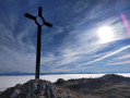
  8. 7 : mi 6.93 - alt. 5,315 ft - Crêt de la Goutte – View of the - Lac Léman
  9. 8 : mi 8.6 - alt. 4,442 ft - Col du Sac
  10. 9 : mi 9.29 - alt. 4,117 ft - Turn left onto the road
  11. S/E : mi 10.45 - alt. 3,770 ft - Forest track, elevation 1149

Notes

This route runs wholly or partly through the Haute Chaîne du Jura National Nature Reserve. Please observe the regulations: https://www.rnn-hautechainedujura.fr/reg...
Part of this route lies within a Wildlife Quiet Zone from 15 December to 30 June (during this period, it is forbidden to stray from the route between points 1 and 3, and between points 8 and 9). Further information here: https://www.rnn-hautechainedujura.fr/car...

Always be cautious and plan ahead when you're outdoors. Visorando and the author of this route cannot be held responsible for any accidents occurring on this route.

The GR® and PR® markings are the intellectual property of the Fédération Française de Randonnée Pédestre.

Reviews and comments

4.6 / 5
Based on 3 reviews

Reliability of the description
4.3 / 5
Ease of following the route
4.7 / 5
Route interest
4.7 / 5
Franzi
Franzi

Overall rating : 4.7 / 5

Date of your route : May 31, 2024
Reliability of the description : ★★★★☆ Good
Ease of following the route : ★★★★★ Very good
Route interest : ★★★★★ Very good
Very busy route : No

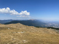
A lovely walk. The most interesting section runs from the Chalet du Sac to the Crêt de la Goutte, with beautiful pastures and spectacular 360-degree views. The rest of the route is through the forest.
One downside: the distances and elevation gain given in the description are underestimated. I measured 19 km in length and 760 m of elevation gain whilst following the route exactly as indicated.
Suggestion: Do the route in the opposite direction to avoid the climb to the summit after what is already a very long walk.

Machine-translated

albéric 74
albéric 74

Overall rating : 5 / 5

Date of your route : May 17, 2020
Reliability of the description : ★★★★★ Very good
Ease of following the route : ★★★★★ Very good
Route interest : ★★★★★ Very good
Very busy route : No

Perfect! A lovely circular route! A perfect GPX track!

A lovely ride! A great reward at the summit

Well worth a go

Machine-translated

gazok54
gazok54 ★

Hello 11crananec
I’d advise you to follow the route description and use the map to find your way. We’re not entirely sure about the signposting, but we do know the route description.

Machine-translated

11crananec
11crananec
• Edited:

The signposting was very poor, so I couldn’t do the walk.
I’ll give it another go.
Thanks anyway

Machine-translated

gillou45
gillou45

Overall rating : 4 / 5

Date of your route : Sep 01, 2014
Reliability of the description : ★★★★☆ Good
Ease of following the route : ★★★★☆ Good
Route interest : ★★★★☆ Good

view of the Alps and Lake Geneva

Machine-translated

Other walks in the area

For more walks, use our search engine .

The GPS track and description are the property of this route's author. Please do not copy them without permission.