Country:

 City:
City:


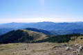
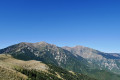
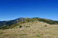
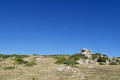
Whether approaching from Vinça or Céret, take the D13 via Coll Palomeres (elevation 1,035). Park on the track or in an area on the left-hand side of the D13 as you head towards La Bastide.
(S/E) From this recommended car park, follow the D13 towards Valmanya for about twenty metres and look out for an electrified fence on the left-hand side of the road, marking the start of theGRP® Ronde du Canigou.
Yellow and red markings for theGRP® Ronde du Canigou
(1) Please note: there are two high steps at the start. Disconnect the top wire, go through the gate and reconnect the wire. Head down the path which leads into the forest (south-east). You will arrive at a private property. Permission to pass has been granted. Please respect the premises. Thank you. Go through a steel gate and close it behind you. Continue along the path which runs alongside a high fence on your left. Horses, donkeys and llamas are present. Further on, you’ll reach a dirt track.
(2) Cross it and continue down the path. Pass through another steel gate (end of private property). You will then arrive at a small open area with a tall, old building on your right: the foreman’s house.
(3) Continue down through the woodland, then pass through an area of scree consisting of non-ferrous rocks. Look out for a signpost (at this point?) and you’ll very quickly reach the former site of the Els Menerots mine. Stay on the marked path. Observe the safety instructions.
(4) Now head uphill, still through the forest. Very soon you will see the ruins of a building below on your left. There are ballast trolleys*. However, stay on the marked path, cross a track (an old railway line), and emerge onto a track suitable for vehicles at elevation 1231, at a junction of paths and a track. Signpost.
(5) Continue for about twenty metres to the left. Look out for the continuation of the signposted GRP on the right. No signposting!Climb very steeply to the right along this lovely forest path. You’ll reach, much higher up, a small gate and a broken fence. Signpost.
(6) Carry on climbing straight ahead through a sort of narrow pass and emerge onto a track suitable for vehicles at a junction of paths and tracks.
You can make a round trip to Torre de Batera on the left to enjoy a stunning 360° view.
Leave theGRP® and continue to the right along the track for 20 m until you reach a padlocked steel gate on the right-hand side of the track.
Very old, scattered yellow markings
(7) Go round it, leaving the grassy track to your left to climb north-west along a good path that is very clearly marked on the ground. Keep following the ridge path (black dots on the IGN map background: municipal boundary). This will take you to a lovely viewpoint at elevation 1603.
(8) Now continue due west, following an old fence along this same municipal boundary. Further on, after a series of ascents and descents, you’ll reach a quarry and an iron ore mining area at an elevation of 1652.
(9) Go round it on the right. Now climb more directly north-west towards the clearly visible summit. Old wooden posts, painted yellow in places. After one final push, reach the Puig de l’Estella (Star Peak) at an altitude of 1,782 metres . A stunning 360° viewpoint. On a windless day, it is a lovely spot to take a break.
(10) Turn back a few metres and climb up the opposite slope, due west, along a path marked on the ground. There is an old wooden post painted yellow. Then descend into a hollow at the Collet de Pei (Little Pine Pass). Please note: there are several paths here.
(11) Leave the ridge and head due south along a sunken track (in the true sense of the word). Old yellow markings. Pass through a wooded area of young pine trees, staying on level ground until the junction at elevation 1657. Keep to the right, descending slightly, and eventually reach a junction and theGR®10(which replaces theGRP® Tour du Canigou and Tour du Vallespir routes).
White and red markings forthe GR®10
(12) Turn left and follow the newGR®10markings throughout. Pass the old Batera mine. Information board. You will then reach the tarmac road and follow it to the Batera refuge.*
Another lovely spot for a break. Stunning views.
(13) Continue along the road, descending to the Coll de la Descarga (at the start of a right-hand bend; there is a car park below on the right).
No signposting
(14) Leave theGR®10and the road, head up to the left, due north along the track – which is tarmac-surfaced at the start – and follow it until you reach the junction with the Estella circular route that you passed on the way out.
Yellow and red markings for theGRP® Tour du Canigou
(7) Continue along the track for a few more metres in the opposite direction to the outward journey, then turn left towards the gate you passed on the outward journey.
(6) Go through the gate and, following the route in the opposite direction to the outward journey, descend to the track suitable for vehicles at the Menerots junction, which you have already passed on the outward journey (elevation 1231).
(5) Turn left onto the track. After passing the third còrrec (depression), look out for the start of a grassy track on the left, marked by a wooden gate. There is an information board explaining the site’s restoration (safety) work at the start of this track
(15) Climb slightly to the left, go round the barrier and continue along this former railway line, which linked the various iron ore extraction and processing sites.
(16) Pass a spring/fountain on your left-hand side.
(17) You’ll soon reach an old iron mine. There are old buildings and ballast-laden mine trolleys.* Continue along this route, passing through three railway tunnels. When the old railway track turns north, look out for a path leading down to the right at the following left-hand bend. There’s a signpost.
(18) Descend steeply to the right along this path, heading due north through the forest, and join a track further down. There is a signpost opposite, on the other side of the track.
(19) Head down to the right along this track. Pass a concrete section and reach Coll Palomères (S/E).



 Visorando Member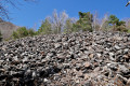


 Moderate