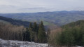
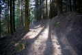
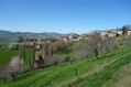
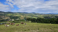
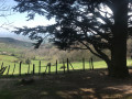
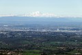
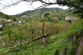
The Col de Malval at the start of the Courzieux Wildlife Park

More of a stroll than a hike, which can then be followed by a visit to the Wolf Park.

Details

32707556
Creation:
Last update:
Last review:
  • Walking
    Activity: Walking
  • ↔
    Distance: 3.27 mi
  • ◔
    Average duration: 2h 10 
  • ▲
    Difficulty: Easy

  • ⚐
    Back to start: Yes
  • ↗
    Ascent: + 778 ft
  • ↘
    Descent: - 771 ft

  • ▲
    Highest point: 2,559 ft
  • ▼
    Lowest point: 1,808 ft

Description of the walk

Park at the entrance to Courzieux Park.

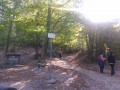
(S/E) Turn right at the entrance to the park car park onto the tarmac road, following the red and white markings ofthe GR®89. Continue along the wide track to reach, via a gentle climb, the junction with the Col de Malval track.

(1) Carry on straight ahead along theGR® and stay on it. You’ll reach the Château de Saint-Bonnet-le-Froid. Please note that before you reach the road, theGR® has been diverted, but the route you’re following is indeed the original GR® path. Stay on the road for about a hundred metres until you reach the track junction.

(2) Leave theGR®89here and turn right onto theGRP® for the Tour des Monts du Lyonnais. Now follow the yellow and red markings. Walk at a leisurely pace along the almost flat path until you reach the Col de Malval.

(3) Cross the car park to the right, then begin the descent along the track to return to the junction you passed on the way out.

(1) Turn left and retrace your steps along the route you took on the way there to return to the car park at the entrance to the Animal Park (S/E).

Waypoints

  1. S/E : mi 0 - alt. 1,818 ft - Car park at the entrance to the Animal Park
  2. 1 : mi 0.64 - alt. 2,260 ft - Crossroads at the end of the circular loop
  3. 2 : mi 1.24 - alt. 2,477 ft - Château de Saint Bonnet le Froid
  4. 3 : mi 2.02 - alt. 2,411 ft - Col de Malval (732m)
  5. S/E : mi 3.27 - alt. 1,808 ft - Car park at the entrance to the Animal Park

Notes

No water points on this route

Worth a visit

Always be cautious and plan ahead when you're outdoors. Visorando and the author of this route cannot be held responsible for any accidents occurring on this route.

The GR® and PR® markings are the intellectual property of the Fédération Française de Randonnée Pédestre.

Reviews and comments

4.6 / 5
Based on 3 reviews

Reliability of the description
4.7 / 5
Ease of following the route
4.7 / 5
Route interest
4.3 / 5
mike01500
mike01500

Overall rating : 5 / 5

Date of your route : Jun 08, 2026
Reliability of the description : ★★★★★ Very good
Ease of following the route : ★★★★★ Very good
Route interest : ★★★★★ Very good
Very busy route : No

A lovely, well-marked route with some beautiful views
Very easy

Machine-translated

User 21778102

Overall rating : 4 / 5

Date of your route : Aug 04, 2025
Reliability of the description : ★★★★☆ Good
Ease of following the route : ★★★★☆ Good
Route interest : ★★★★☆ Good
Very busy route : No

Well shaded, no difficulties. Time of 2.5 hours, well respected.

Machine-translated

Beata
Beata

Overall rating : 4.7 / 5

Date of your route : Jan 12, 2024
Reliability of the description : ★★★★★ Very good
Ease of following the route : ★★★★★ Very good
Route interest : ★★★★☆ Good
Very busy route : No

A lovely walk through the snow-covered, magical woodland. It’s hard to say how good the view was, as the sun was supposed to be shining much higher up in the sky… The signposts are clear, the path is easy, and the estimated duration is generous.

Machine-translated

Other walks in the area

For more walks, use our search engine .

The GPS track and description are the property of this route's author. Please do not copy them without permission.