


 Country:
 City:
City:


The route starts at the information board detailing the four routes offered by Gratentour Town Hall, on the Town Hall Square, opposite the municipal café ‘L’entrepôtes’. A large car park is available (please note there is a market on Saturday mornings).
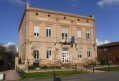
(S/E) To start your walk, head towards the church. Walk past the church entrance and continue towards the town hall building. Opposite the town hall (behind the small car park), you’ll find a narrow path with steps leading down to the right. Take this path down to the footbridge and the Chemin des Enfants de l’An 2000. This first section is identical to the Visorando route entitled: ‘Around Gratentour’.
(1) Follow this path to the left to reach the Parc des Enfants de l’An 2000. Carry on straight ahead, crossing Rue des Pyrénées, and take the road opposite (Rue du Coustela) to climb up the hillside and enjoy an unobstructed view of the Toulouse basin of the Garonne.
(2) Once you reach Rénery, turn right to head down through the fields. Please note that this path can sometimes be a little damp. Once at the bottom, do not cross the Ruisseau de Serre but turn right at a 90° angle to join Rue de la Garenne.
(3) At this junction, you may wish to take a look at the Miyawaki microforest on your right, located at the entrance to the Fontgauzy housing estate (50 m). There you’ll find a spot to rest in the shade and have a picnic.
Continue your walk along Rue de la Garenne. Carefully cross the busy county road at the pedestrian crossing and carry on straight ahead through the old centre of the lower village along Route du Barry. Make sure you keep heading in the same direction, ignoring the side streets. At the end of the street, turn right and walk up the right-hand pavement along the Côte de Mance.
(4) Turn right onto the small Chemin du Vieux Cimetière, which leads uphill, and continue to the village centre, where you will arrive directly at the starting car park (S/E).



 Visorando Member
 Moderate
 Local authority
 Association / Club / Walk leader
