Country:

 City:


Meet in front of the Collegiate Church of Avesnes-sur-Helpe. There is parking around and near the church.
(S/E) Leave the collegiate church and turn left. Walk alongside this building on Place du Général Leclerc. Turn left after the canon’s house (Tourist Office) onto Rue de Berry to reach the presbytery. Continue up the steep sections of Rue de Berry.
(1) Take the steps on your right to reach the Bastion Saint-Jean. Retrace your steps and head back to Rue de Berry.
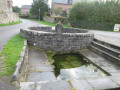
(1) Walk down the steep section of Rue de Berry and make a quick left-right turn onto Rue Jean-Paul Chabloz, then turn right into the narrow Rue du Pont des Dames. Cross the bridge over the Helpe and continue to Rue de Mons. Keep left onto Rue de Mons, cross at the pedestrian crossing and turn right onto Quai de l’hôpital.
Carry on to the left along Rue du Lavoir. Turn right onto Rue des Près and follow it for about 150 metres.
(2) Cross over to reach the Bastion de la Reyne, which is on your left after the steps. Continue along the grassy section, keeping the rampart wall on your left.
Take the ‘Les Petits Pas’ steps on your left. Please take care, especially in wet weather.
You will reach the Jean Mossay forecourt (formerly the Chemerault plateau). You are now at the highest point in Avesnes-sur-Helpe and can enjoy a 360° view.
Head towards the barracks. Keep the Courthouse on your right.
(3) Cross the road and continue straight on along Rue Bultot. Cross Rue Léo Lagrange and take the small steps opposite. Walk down Rue Villien on your left to reach Place Guillemin. Head back up to the right along Rue du46eMobile and return to your starting point (S/E).

 AONB
 Moderate


 Visorando Member