Country:

 City:
City:


From the car park in Villefranche-de-Conflent – on the right as you come from Perpignan – at the entrance with the old drawbridge over the Cady.
(S) Enter the Citadel, turn right then left. A few metres further on, enter the tunnel on the right, then turn left onto the rampart walk. Then cross the bridge over the Têt on the right (watch out for the third live rail of the Train Jaune line), then head right until you reach a sign pointing towards Fort Libéria on the left.
Take the track on the left and leave it a few metres further on by taking the steps on the left. The route then becomes a footpath which, after five hairpin bends, leads to Fort Libéria.
(1) Walk along the right-hand side of the fort and continue northwards. After a hairpin bend to the left, you’ll reach a junction.
(2) Ignore the path on the right towards Belloc and carry on straight ahead. At the fourth hairpin bend, keep left, then further on you’ll come to a series of seven hairpin bends leading to another junction, faintly marked by a yellow sign indicating you should turn left. (It is also possible to carry on straight ahead to make a round trip to the Saint-Étienne Chapel.)
(3) Turn left and cross the track three times (take care, as this section is tricky to navigate). Continue due north, then follow the hairpin bend to the left. The path continues to climb until it enters a wooded area where you can give your legs a bit of a rest. The path emerges from the woods briefly before returning to it, eventually reaching the Roque Fumade refuge.
(4) Carry on straight ahead along the track that climbs to the right. After a few metres, a sign points to the Chemin Vauban.
(5) Stay on the track and follow it. Atthe fourth hairpin bend on the left, ignore the “Sentier de la réserve” opposite and continue along the track until you meet another track at a hairpin bend on the left.
(6) Leave the track and take the faint path opposite (a tricky section) to reach the first junction. Carry on to the right to reach another crossroads.
(7) Carry on to the left to reach the entrance to the village of Jujols.
(8) Do take a moment to wander around the village. There are two options:
_ either stay on the higher ground of the village by turning right,
_ or go through the lower part of the village by turning left (suggested route), where you’ll find the ‘window overlooking the Canigó’.
(9) Turn slightly to the right, passing the church on your left and the car park on your right, before reaching a junction.
(10) Turn left and follow the track. Leave the track at the next bend to take the path opposite. From this point, follow the orange markings (if you come across a Yellow Cross alongside the orange markings, continue along the path marked in orange anyway). You’ll reach a junction.
(11) Take the path on the left, cross a stream (which is dry at this time of year, early September) and climb steeply up to the next junction.
(12) Climb steeply to the left for a short distance until you reach another junction marked by the Chemin Vauban.
(13) If required, the Refuge des Hautes Comelles is 100 metres to the right, due west.
Begin the descent to the left towards Olette, which comprises 22 hairpin bends, the last of which are quite steep. Join a track, then reach the tarmac road at the gendarmerie. Continue straight on to reach the village square and the RD66 (E).
 Visorando Member
 Moderate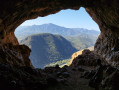

 Extremely difficult
  Easy
Easy