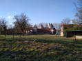
Le château depuis Rebreuve-Ranchicourt

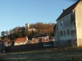
Cette randonnée vous permettra de découvrir de jolis paysages et, sur le retour, le Château de Ranchicourt

Details

66877550
Creation:
Last update:
Last review:
  • Walking
    Activity: Walking
  • ↔
    Distance: 7.69 mi
  • ◔
    Average duration: 3h 55 
  • ▲
    Difficulty: Moderate

  • ⚐
    Back to start: Yes
  • ↗
    Ascent: + 433 ft
  • ↘
    Descent: - 446 ft

  • ▲
    Highest point: 604 ft
  • ▼
    Lowest point: 197 ft

Photos

Description of the walk

Start from the car park at Place de la Place next to the church

(S/E) Leave the car park and head straight ahead onto Rue de l’Église, then cross the cemetery and the A-road at the pedestrian crossing to reach Rue du Moulin.

(1) Continue straight ahead along this road until you reach Chaussée Brunehaut.

(2) Cross the road, head straight ahead with the stream on your left until you reach the small bridge.
(3) Turn left and carry on straight ahead until you reach the D72.

(4) Keep to the right and continue straight on. At the junction, turn right and continue straight on until you reach a Fork in the road at the Plaine du Ransart.

(5) Continue to the right and straight on until you reach a junction on a downhill stretch beneath Mont de la Comté.

(6) Take the path on the left, turn at the first right and carry on straight ahead until you reach a Fork in the road.

(7) Turn right, then take the first left and continue straight on. Pass through a wood to reach a Fork in the road.

(8) Take the path on the left and, at the crossroads, go straight ahead until you reach a building on the left.

(9) Keep to the right; at the end, turn left onto Chaussée Brunehaut until you reach Rue de la Paturelle.

(10) Turn left onto it, then, at the end, turn left again until you reach the entrance to the castle.

(11) Continue along Rue du Château, then take the second right onto Rue de la Fusion and head for the car park at Place de la Place (S/E).


Waypoints

  1. S/E : mi 0 - alt. 253 ft - Car park at Place de la Place
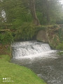
  2. 1 : mi 0.16 - alt. 223 ft - Rue du Moulin - Brette (rivière) - Affluent de la Lys
  3. 2 : mi 0.51 - alt. 233 ft - Chaussée Brunehaut
  4. 3 : mi 1.14 - alt. 299 ft - Small bridge
  5. 4 : mi 2.58 - alt. 587 ft - D72
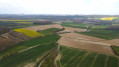
  6. 5 : mi 3.23 - alt. 594 ft - Plaine du Ransart
  7. 6 : mi 3.95 - alt. 574 ft - Junction beneath the Mont de la Comté
  8. 7 : mi 4.93 - alt. 430 ft - Four-way junction
  9. 8 : mi 5.7 - alt. 292 ft - Junction after the woods
  10. 9 : mi 6.43 - alt. 197 ft - Building
  11. 10 : mi 6.93 - alt. 240 ft - Rue de la Paturelle
  12. 11 : mi 7.42 - alt. 200 ft - Château de Ranchicourt
  13. S/E : mi 7.69 - alt. 253 ft - Car park at Place de la Place

Worth a visit

Ranchicourt Castle.
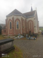
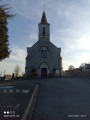
Church.

Reviews and comments

5 / 5
Based on 1 review

Reliability of the description
5 / 5
Ease of following the route
5 / 5
Route interest
5 / 5
souchez rando
souchez rando

Thank you for your feedback and enjoy your future hiking trips.

Machine-translated

User 10624135

Overall rating : 5 / 5

Date of your route : Jun 08, 2025
Reliability of the description : ★★★★★ Very good
Ease of following the route : ★★★★★ Very good
Route interest : ★★★★★ Very good
Very busy route : No

Very nice walk, not very busy today, but a popular route for the famous Trail des hobitts! Lovely views of the beautiful church at Houdain! Little change in altitude and a passable path despite the rain the day before!

Machine-translated

Other walks in the area

For more walks, use our search engine .

The GPS track and description are the property of this route's author. Please do not copy them without permission.