The Castellas de Roquemartine, the Crête du Defens, and the Grottes de Calès caves

A nice hike in the Alpilles to see the ruins of Castellas de Roquemartine (Château de la Reine Jeanne), and end with the caves of Calès, a very interesting cave network.

Details

n°105922
Creation:
Last update:
  • Walking
    Activity: Walking
  • ↔
    Distance: 8.20 mi
  • ◔
    Average duration: 4h 50 
  • ▲
    Difficulty: Average

  • ⚐
    Back to start: Yes
  • ↗
    Ascent: + 1,201 ft
  • ↘
    Descent: - 1,198 ft

  • ▲
    Highest point: 1,017 ft
  • ▼
    Lowest point: 325 ft

Photos

Description of the walk

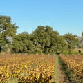
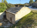
(S) Park in the St. Denis spring car park. Continue west where the small paved road becomes a dirt road, passing by all the trails right and left. It runs through a pine and oak wood and along the vineyards.

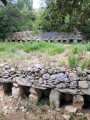
(1) Cross the D72 and then take a trail opposite that passes in areas of mazets (small, rural, single-room buildings). After a wide right turn, the road continues west along a large cypress hedge to arrive at a crossing.

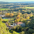
(2) Continue straight through the ruins. On maps it says ‘’Ruines de Notre-Dame'', but it seems they are on private property. From here one can see the beautiful Castellas Roquemartine to continue in its direction. Pass by a path on the left and continue to the right to get around the rocky outcrop, ignoring a path off to the right.

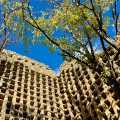
(3) At the place called "Mas Blanc", at the junction with a road coming from the right, follow the tracks that go left towards the castle. On the way to the castle you can see an amazing ruined tower on the left, which is an old pigeon loft that is worth a look. Continue up to Le Castellas.
‘’Warning: the ruins of the Castellas in danger of collapsing, approach it at your own risk, and it is strongly advised not to stay near the walls and avoid entering the older parts, no matter how sturdy they appear''.

(4) From the castle, turn left, southbound, ignoring two trails to the left and one to the right. Then continue on to the ridge, to the south-east. Find and take a marked trail on the right to reach the D72 road.

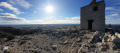
(5) Take the road to the right for about 150 m, to find the GR6 on the left, which leads to caves of Calès. Stay on the main trail ignoring all other paths. After about 1 km, this wide trail turns right and begins the climb to the Plateau du Defens, which offers a nice view of Eyguières, Salon-de-Provence and the Etang de Berre.

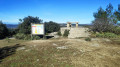
(6) Continue left on the GR6 (whose markings are not always easy to spot...). Before passing under a power line, pass by a track on the left and continue the path that goes down to the caves of Calès.

(7) At the first tank, continue straight passing by the path that leads to the right. The trail branches off to the left, after approximately 300 m. Then there is a second tank before a wide right turn that leads to the third tank.

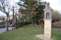
(8) Continue on the GR6 to the left to get around the site of Calès. Several options are available to visit the site of ancient cave dwellings. Go right to the southern entrance where a stone staircase leads to the right on a plaza with a statue of the Virgin which overlooks the site.

(9) Go back down and continue visiting the caves. Cross the vast esplanade, pass next to a small forum and then continue a path towards the north by crossing a wall, leading down a few steps and to the Roman chapel of Saint-Denis.

(10) Continue the path to the north, and pass by the paths on the right and left to find the parking area about 400 m further on.


Waypoints

  1. S/E : mi 0 - alt. 430 ft
  2. 1 : mi 1.6 - alt. 344 ft - Junction with the D72
  3. 2 : mi 2.14 - alt. 341 ft - Straight to the ruins
  4. 3 : mi 3.07 - alt. 505 ft - Crossroads
  5. 4 : mi 3.26 - alt. 466 ft - Crossroads
  6. 5 : mi 3.43 - alt. 600 ft
  7. 6 : mi 4.4 - alt. 466 ft - Arrival on the D72
  8. 7 : mi 5.57 - alt. 1,010 ft - Viewpoint
  9. 8 : mi 6.2 - alt. 807 ft - First tank crossing
  10. 9 : mi 6.88 - alt. 692 ft - Third tank crossing
  11. 10 : mi 7.59 - alt. 676 ft - Statue of the Virgin Mary
  12. 11 : mi 7.98 - alt. 476 ft - Saint-Denis chapel
  13. S/E : mi 8.2 - alt. 430 ft

Notes

Period: mid-season, winter (in summer, the trails are closed because of fires),
Equipment: Good shoes, water,
Water point: Lamanon.
Pick up a map of the caves of Calès site at the tourist office of Lamanon.

Worth a visit

A remarkable plane tree in Lamanon,
Old pigeon loft just before the Castellas de Roquemartine.

Reviews and comments

4.4 / 5
Based on 75 reviews

Reliability of the description
4.3 / 5
Ease of following the route
4.3 / 5
Route interest
4.6 / 5
BCC
BCC
• Edited:

Overall rating : 5 / 5

Date of your route : Jan 26, 2026
Reliability of the description : ★★★★★ Very good
Ease of following the route : ★★★★★ Very good
Route interest : ★★★★★ Very good
Very busy route : No

A lovely hike with varied landscapes. The start is easy, perfect for warming up, then the sections around Roquemartine, along the ridges (with beautiful views) and on to Cales are very interesting. When the mistral wind is blowing, it is best to do the walk in the direction indicated. There are many trails at Cales, but they all allow you to explore the area thoroughly.

Machine-translated

Aymeric
Aymeric
• Edited:

Overall rating : 3.7 / 5

Date of your route : Jan 12, 2026
Reliability of the description : ★★★★☆ Good
Ease of following the route : ★★☆☆☆ Disappointing
Route interest : ★★★★★ Very good
Very busy route : Yes

For lovers of the great outdoors, this hike is more of a stroll. You will make some wonderful discoveries, including an ancient ruined castle and its chapel on the heights. A magnificent landscape with views of the Alpilles, Mont Ventoux (snow-capped, please), the
Luberon and, the icing on the cake, the Alps, which are snow-capped at this time of year. The cherry on top are the Calès caves with their troglodyte dwellings, a unique and unspoilt place. This is a hike that is not to be missed.

Machine-translated

bruken
bruken
• Edited:

Overall rating : 4 / 5

Date of your route : Dec 13, 2025
Reliability of the description : ★★★★☆ Good
Ease of following the route : ★★★★☆ Good
Route interest : ★★★★☆ Good
Very busy route : No

Hike done in very sunny weather. The route started off without any difficulty until we reached Queen Jeanne's Castle.
We went to the Château de la Reine Jeanne, but did not go up to it (private property). We passed by the chapel at the foot of the spur on which the château stands and continued along the ridges above Eyguières to reach the intersection with the D72 and join the Défens d'Eyguières path.
After that, the trail markings are sparse, and you'll need either a GPS or a map and compass to stay on the right track.
The Calès caves are as surprising and magnificent as ever. Don't miss the two chapels (Ste Marie/St Pierre and St Denis) on the way back to the Source St Denis.

Machine-translated

joel13360
joel13360
• Edited:

Overall rating : 4.7 / 5

Date of your route : Nov 09, 2025
Reliability of the description : ★★★★★ Very good
Ease of following the route : ★★★★★ Very good
Route interest : ★★★★☆ Good
Very busy route : No

A beautiful autumn hike with varied landscapes, colourful vineyards, fragrant heath and then cool, damp woodland. Beautiful views all along the route, around the castle, then towards the sea, the Berre lagoon and the Alpilles as you walk along the rocky ridge overlooking Lamanon. There are lots of people when you arrive at the Calès caves, a site that deserves to be developed to bring it back to life.

Machine-translated

MichelBnk
MichelBnk
• Edited:

Overall rating : 4.7 / 5

Date of your route : Aug 25, 2025
Reliability of the description : ★★★★★ Very good
Ease of following the route : ★★★★☆ Good
Route interest : ★★★★★ Very good
Very busy route : Yes

Superb walk, there is some building work going on at the castle but we were able to get through. A hike worth doing

Machine-translated

marquounet
marquounet
• Edited:

Overall rating : 4 / 5

Date of your route : Jun 08, 2025
Reliability of the description : ★★★★☆ Good
Ease of following the route : ★★★★☆ Good
Route interest : ★★★★☆ Good
Very busy route : Yes

I combined three hikes, starting at Calés (at 7 a.m.!) The caves are very busy during the day but are definitely worth a look!
The castle is closed to visitors due to renovation work.

Machine-translated

LEFEVRE DOMINIQUE
LEFEVRE DOMINIQUE
• Edited:

Overall rating : 5 / 5

Date of your route : May 24, 2025
Reliability of the description : ★★★★★ Very good
Ease of following the route : ★★★★★ Very good
Route interest : ★★★★★ Very good
Very busy route : No

Castle under renovation but stunning and magnificent. Pleasant ridges. We came across firefighters training on the plateau. No one on the circuit except at the arrival point at the very busy cave site.

Machine-translated

ALARCON PAT
ALARCON PAT
• Edited:

Overall rating : 4.7 / 5

Date of your route : Sep 22, 2024
Reliability of the description : ★★★★★ Very good
Ease of following the route : ★★★★★ Very good
Route interest : ★★★★☆ Good
Very busy route : Yes

It was a very nice tour.
But unfortunately a very interesting part of the caves of Lamanon have been closed for risk of rockfall since 2019.
As a result, there is a barrier with a decree asking you not to go beyond it.
Of course in the centre of the passage if you stay between the 2 summits there is no risk. But the ban was put in place especially for children who might get too close to high-risk areas.
So I went round the caves to resume the other part of the hike, which is still authorised.
As far as the Château de Roquemartine is concerned, you can get close but you can't visit all the rooms as there is some restoration work going on.
The chapel below the castle is currently being restored and the roof is being redone.
You can only visit the inside of the chapel and the château during the Heritage Open Days.

Machine-translated

bmxrider84
bmxrider84
• Edited:

Overall rating : 3 / 5

Date of your route : Nov 27, 2023
Reliability of the description : ★★★★☆ Good
Ease of following the route : ★★☆☆☆ Disappointing
Route interest : ★★★☆☆ Average
Very busy route : No

Be careful! To follow the route, you have to pass through private hunting grounds, which is not very pleasant with the hunting season open at the moment. What's more, access to the castle ruins is forbidden and the passage to the Callas caves (troglodyte houses) is also blocked by municipal by-law.

The walk itself isn't bad, but all the points of interest are inaccessible, which spoils it a bit.

Machine-translated

krirando
krirando
• Edited:

Overall rating : 1 / 5

Date of your route : Oct 24, 2023
Reliability of the description : Not used / Not applicable
Ease of following the route : ★☆☆☆☆ Very disappointing
Route interest : ★☆☆☆☆ Very disappointing
Very busy route : No

Why continue to publish this hike?
- Dangerous point and under municipal by-law.
- Crossing of private property duly notified between 4 and 5 (and in all the massif around the castle, outside the marked path.

Visorando does not give a good image by allowing such hikes to go through forbidden, published areas.

CR: Breveté Randonnée Animateur Fédération Française de Randonnée Pédestre

Machine-translated

fifidech
fifidech
• Edited:

Overall rating : 5 / 5

Date of your route : Sep 17, 2023
Reliability of the description : ★★★★★ Very good
Ease of following the route : ★★★★★ Very good
Route interest : ★★★★★ Very good
Very busy route : No

It was a lovely walk, but unfortunately it was marred by heavy weather, blazing sun and slightly misty landscapes.
We were still able to enjoy the different viewpoints.
Definitely worth doing again.

Machine-translated

Petalugue
Petalugue
• Edited:

Overall rating : 2.3 / 5

Date of your route : Sep 10, 2023
Reliability of the description : ★★★☆☆ Average
Ease of following the route : ★★☆☆☆ Disappointing
Route interest : ★★☆☆☆ Disappointing
Very busy route : No

Poor signposting and, above all, in the middle of hunting territory on Sunday, shooting a gun nearby was very dangerous.

Machine-translated

Monsieur C
Monsieur C
• Edited:

Overall rating : 4.7 / 5

Date of your route : Jun 03, 2023
Reliability of the description : ★★★★★ Very good
Ease of following the route : ★★★★★ Very good
Route interest : ★★★★☆ Good
Very busy route : No

The first part is a little monotonous, but as soon as you reach the castle ruins, the walk becomes more interesting. The same applies to the rest of the route.

Machine-translated

PierreCecile
PierreCecile
• Edited:

Overall rating : 5 / 5

Date of your route : May 18, 2023
Reliability of the description : Not used / Not applicable
Ease of following the route : ★★★★★ Very good
Route interest : ★★★★★ Very good
Very busy route : No

A very pretty walk between vineyards, poppy fields and hills. A good idea before the heat. The Calès caves are no longer open to visitors, but can be seen from a distance. We didn't bring a picnic.

Machine-translated

SOLRAC 30
SOLRAC 30
• Edited:

Overall rating : 5 / 5

Date of your route : Feb 20, 2023
Reliability of the description : ★★★★★ Very good
Ease of following the route : ★★★★★ Very good
Route interest : ★★★★★ Very good
Very busy route : No

Following works at Roquemartine castle, climbing up to the castle is prohibited.

Machine-translated

Other walks in the area

For more walks, use our search engine .

The GPS track and description are the property of this route's author. Please do not copy them without permission.