Castel Saint-Denis

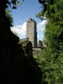
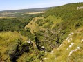
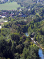
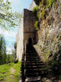
A keep dating back to the year 1000 still stands proudly on its rocky outcrop, with superb cornice walls carved out of the rock, overlooking the wild nature of the Valbois ravine. In just four short kilometres, you will be treated to a series of breathtaking landscapes.

Details

400828
Creation:
Last update:
Last review:
  • Walking
    Activity: Walking
  • ↔
    Distance: 4.08 mi
  • ◔
    Average duration: 2h 35 
  • ▲
    Difficulty: Easy

  • ⚐
    Back to start: Yes
  • ↗
    Ascent: + 794 ft
  • ↘
    Descent: - 787 ft

  • ▲
    Highest point: 1,657 ft
  • ▼
    Lowest point: 1,033 ft

Photos

Description of the walk

Car park at Moulin Grillet, about 1 km from the centre of the village of Cléron: at the fountain, take Rue du Pater and park 150 m past Moulin Grillet

(S/E) Walk up the small tarmac road to the Château du Pater farm, then continue uphill for a further 200 metres to the right to find the start of this short walk, marked by a signpost for Castel Saint-Denis. Walk up this sunken path. You will soon reach a stony track which you follow to the right. Three hundred metres after this stony track becomes straight, look out for a nature trail on the right that descends the hillside (a small post with a dragonfly on it, I think).

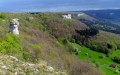
(1) Follow this superb mule track downwards, with views of the ledges and the bottom of the Ravin de Valbois gorge. Walk alongside a dry stone wall. The path becomes a narrow track winding through the grass and joins, at the bottom of the hillside, a wider path, continuing the ascent to the left.

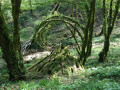
(2) This path enters the woods, soon blocked by a log barrier which you can easily cross via a small step. Soon, you’ll come to a fork at the foot of a post bearing a bird (the black woodpecker); take the path on the left through lovely green undergrowth, dotted in mid-spring with the white spots of wild garlic flowers. You’ll arrive at a charming little rocky cirque. At the foot of the rock, head right.

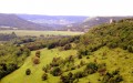
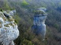
(3) Immediately after the rocks, there is a fork; continue climbing to the left via a small staircase carved into the rock. You will cross some barbed wire via a zigzag path and head right. You’ll reach a lovely stony path; take it to the left. 200 metres further on, look out for a sign on the left and the path leading you to the edge of the cliffs (take care) and a magnificent viewpoint over Castel Saint-Denis, the Rocher de Colonne and the Cléron valley. A lovely clearing, ideal for a picnic break. Leave the viewpoint via the path that runs along the cliffs. Return to the gravel road and follow the signposting. Directly in front of you, on a tree, are some signs. Turn left onto the gravel road. You’ll soon reach a fork (and another viewpoint). Turn right to soon reach the ruins of Castel Saint-Denis

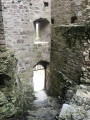
(4) At the castle, there are new views over the entire valley and the Val de Cléron, as well as Mont Poupet. Walk past the Porte aux Ânes and continue to the foot of the keep, which is currently under renovation and therefore off-limits. Then head down the steps on the right. At the foot of the stairs, take a short detour to the left for a view of the keep from below, without going any further than the recently concreted steps.

Return to the foot of the previous staircase and continue straight on along the ramparts. You’ll pass the Porte aux Ânes and head down along the walls, taking the VTT28 route and following the very clear signposting along a lovely path, flanked by beautiful tall trees, creating a magnificent play of light and shade on this hillside. You’ll rejoin the sunken path from the start, which you’ll follow down to return to your car park (start/finish).

Waypoints

  1. S/E : mi 0 - alt. 1,033 ft - Car park at Moulin Caillet. Near the - Loue (rivière)
  2. 1 : mi 1.28 - alt. 1,476 ft - The discovery trail
  3. 2 : mi 1.54 - alt. 1,312 ft - The Valbois Ravine
  4. 3 : mi 1.84 - alt. 1,601 ft - Small rocky cirque
  5. 4 : mi 2.67 - alt. 1,627 ft - Le Castel Saint-Denis - Castel Saint-Denis
  6. S/E : mi 4.08 - alt. 1,033 ft - Car park at Moulin Caillet. Near the - Loue (rivière)

Reviews and comments

4.2 / 5
Based on 10 reviews

Reliability of the description
4.2 / 5
Ease of following the route
4.1 / 5
Route interest
4.3 / 5
User 21241267

Overall rating : 4 / 5

Date of your route : Sep 08, 2025
Reliability of the description : ★★★★☆ Good
Ease of following the route : ★★★★☆ Good
Route interest : ★★★★☆ Good
Very busy route : No

Circuit through a nature reserve. Please note that dogs are not permitted, even on a lead.

Machine-translated

Bigjoss
Bigjoss

Overall rating : 4 / 5

Date of your route : Oct 02, 2023
Reliability of the description : ★★★★☆ Good
Ease of following the route : ★★★★☆ Good
Route interest : ★★★★☆ Good
Very busy route : Yes

Hello,
thank you for this route. We met several small groups, including families. We had an impromptu picnic on the platform under the large trees.

Machine-translated

MariThé
MariThé

Overall rating : 3.3 / 5

Date of your route : Jul 25, 2022
Reliability of the description : ★★★☆☆ Average
Ease of following the route : ★★★☆☆ Average
Route interest : ★★★★☆ Good
Very busy route : Yes

At point 3, we got lost. After the staircase carved into the rock and the passage through a chicane, we turned right as indicated, onto a barely marked path that quickly disappeared into the undergrowth. We followed the edge of a cliff with no path, then abandoned the description (we were clearly not in the right place). We continued on instinct, crossed a pasture, and found a gravel road that took us back to the Château Pater farm. No big deal, we still made it to the castle by climbing a sunken path that leads directly there.
I know you recommend using the smartphone app alongside the paper description, but I don't know how to use it... sorry.
Thank you anyway for your directions and all the walks you make available to us through this site.
Kind regards. Marie

Machine-translated

RBC
RBC

Overall rating : 4.3 / 5

Date of your route : Jun 14, 2022
Reliability of the description : ★★★★★ Very good
Ease of following the route : ★★★★☆ Good
Route interest : ★★★★☆ Good
Very busy route : Yes

A wonderful place for a short hike, with a sunny morning climb, a picnic under the tall trees, and a shaded descent. Very good signage explaining the history of this site, which is currently undergoing restoration. Our group really enjoyed this hike.

Machine-translated

LPV
LPV

Overall rating : 3.7 / 5

Date of your route : Feb 22, 2021
Reliability of the description : ★★★☆☆ Average
Ease of following the route : ★★★★☆ Good
Route interest : ★★★★☆ Good
Very busy route : No

A very pleasant hike, but we couldn't find the "discovery trail that goes down the hillside (a small stake with a dragonfly on it, I think)"; there are only trails that go uphill in that area!
So we ended up doing the route backwards!

Machine-translated

Camille tph
Camille tph

Overall rating : 4 / 5

Date of your route : Oct 11, 2020
Reliability of the description : ★★★★☆ Good
Ease of following the route : ★★★★☆ Good
Route interest : ★★★★☆ Good
Very busy route : Yes

Beautiful hike. At the moment, the road is blocked for construction, so you have to park 1 km from the indicated point and walk along the road to the farm, which is not unpleasant and very quick.
Be careful because at this time of year, between points 1 and 2, there is a herd of cows where you have to pass.

Machine-translated

DidierG25
DidierG25

Overall rating : 4.3 / 5

Date of your route : May 17, 2020
Reliability of the description : ★★★★☆ Good
Ease of following the route : ★★★★☆ Good
Route interest : ★★★★★ Very good
Very busy route : Yes

A beautiful, easy hike above the Scey mirror and in Courbet country. Crossing a pretty little nature reserve. Diverse flora, but with an impressive colony of wild garlic in the undergrowth. The ruins of Castel Saint-Denis, currently undergoing consolidation, are spectacular.

Machine-translated

DAHOME
DAHOME

Overall rating : 4.7 / 5

Date of your route : Jul 29, 2019
Reliability of the description : ★★★★★ Very good
Ease of following the route : ★★★★☆ Good
Route interest : ★★★★★ Very good

very good route for a short walk

Machine-translated

FRANCKM
FRANCKM

Overall rating : 4.7 / 5

Date of your route : Apr 19, 2019
Reliability of the description : ★★★★★ Very good
Ease of following the route : ★★★★★ Very good
Route interest : ★★★★☆ Good

Machine-translated

46497477
46497477

Overall rating : 5 / 5

Date of your route : May 29, 2017
Reliability of the description : ★★★★★ Very good
Ease of following the route : ★★★★★ Very good
Route interest : ★★★★★ Very good

A magnificent route, very well signposted, crossing a nature reserve of great ecological value, where the vegetation, wildlife and low stone walls are very well preserved.
The castle is also of great historical value, with informative signage.

Machine-translated

Other walks in the area

For more walks, use our search engine .

The GPS track and description are the property of this route's author. Please do not copy them without permission.