Country:

 City:
City:


Car park on the D260, 2 km from the Malbrans exit towards Cléron. At the entrance to the Bois des Lavanches, where the road crosses a stony track, take this track on the left. The car park is immediately at the entrance, on a timber-hauling area. No signposting.
(S/E) Continue along this lovely stony track until you reach a crossroads.
(1) Then take the track on the left for a short round trip to the Chapelle du Croc. Return to the track junction.
(1) Carry on straight ahead, towards the Rocher de Colonne, along the path that climbs through the woods. Well-maintained, it winds pleasantly through the forest. You will soon reach the first unsecured viewpoint at the Rocher de Colonne.
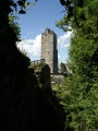
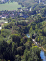
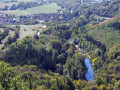
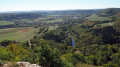
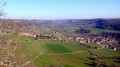
A lovely rock on which to take a break and admire this beautiful view over the head of the Loue valley, dominated by its white cliffs: the Roche du Grand, the Grand Barmaud and, opposite, above Scey-en-Varais, stand the ruins of the keep at Castel Saint-Denis, a solitary sentinel over the Valbois ravine. And if you look up, you’ll spot, a little higher up, the Roche du Soleil and the Roche de Hautepierre.
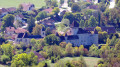
Continue along the path. Soon, on the left, a narrow track leads you to a small promontory offering an unprotected view of Cléron and its castle. You’ll soon come to another sign reading ‘Protected Area’.
(2) Take the narrow path that runs along the edge of the cliff, to the left, to the second unguarded viewpoint, overlooking Cléron and the mountains. Return to the sign.
(2) Carry on straight ahead. After a short descent, leave the path on your right and continue along this lovely, wider track. A little further down, at a fork, turn right to reach a small valley.
(3) Carry on straight ahead, leaving the path leading down to the left. You’ll soon come to a path leading up on your left. Climb to the right towards the nearby field and go round it, keeping to the left-hand edge so as not to ‘trample’ the grass. You’ll come to a small tarmac road; take this to the left to rejoin the departmental road, where you’ll find a hunting lodge and picnic tables for a break.
(4) Cross the main road and continue along the stony track opposite, leaving the path running along the edge to your left to enter the woods after about thirty paces. The track splits into three (forest sign no. 7). Take the forest track on the right, which narrows quickly and becomes more pleasant as it climbs over sharp limestone pavement. At a small stone marker, join a path at right angles. Head left until you reach a nearby junction (forest sign no. 4).
(5) Follow the forest track which runs straight ahead to the right to join a small tarmac road. Turn left for about fifteen steps and then turn right onto the path. At the pasture, walk alongside the barbed-wire fence. The path curves slightly to the right, becomes stony and soon reaches the car park. (S/E)
 Visorando Member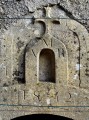

 Average