Country:
 City:




Parking is available in the car park on the opposite side of the road to the church (the Protestant church in Beaussais) or, failing that, in front of it, right next to the junction between the D737 and the D10.
(S/E) From the car park, head to the junction where the D10 meets the D737. Great care is required when crossing this busy junction. Take the D10 uphill straight ahead.
Pass the two farm tracks on your right. Similarly, as you round a right-hand bend, pass the road leading to Gratteloup on your left, followed by the entrance to a property.
The gradient of the D10 becomes steeper and climbs up onto the plateau over a few hundred metres. Near the top of the hill, pass a farm track on your left.
(1) At the top of the hill, an open space with a recycling point appears on the left-hand side. Turn left onto the private farm track, then turn right onto the tree-lined track leading towards the fields.
Further on, the track takes a right-angled bend to the left. Continue until you approach some houses, where the track becomes a road, sloping gently downwards.
Pass two streets on your left which serve the houses, then pass the road coming from Gratteloup on your left. The road bends to the right and immediately reaches a four-way junction.
Turn right onto the road leading uphill. Towards the top of the hill, pass the road on the right leading to the hamlet of La Touche and immediately follow the road on the right.
The road curves to the right and is now flat as it reaches the Mellois plateau. A little further on, pass the road leading to a farm on the right.
(2) The road joins the D108 coming from the hamlet of La Barrellerie. Head left and, about a hundred metres further on, turn right onto the farm track, which is a wide, gently ascending lane.
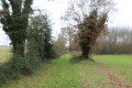
Further on, turn right, ignoring the dead-end track that continues straight ahead. The farm track on the right, still rising gently, quickly turns into a tree-lined avenue and continues on level ground before joining the D10 road.
(3) Turn left onto the road. Pass the first farm track on your right leading to Le Breuil, then a second one just as the D10 bends to the left. In the bend, pass the road leading to Le Quaireux on your right. A little further on, the road rises slightly and is flanked on the left by a small wood.
Further on, pass a farm track on your left which splits at the edge of the woodland (private track through the woodland). Shortly afterwards, pass a turn-off on the right leading to a pond near Le Grand Pré.
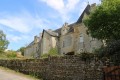
Immediately afterwards, ignore the road on the left leading to the Château de la Boulaye, a noble residence dating from the late Middle Ages (15th century). Fairly well-preserved, it is still surrounded by a moat. Continue along the road to the next crossroads.
(4) Turn left onto the road towards La Jaunetière. This road climbs gently towards the hamlet, which comes into view after a right-hand bend.
Before entering the hamlet, turn left onto the farm track at an acute angle just after the concrete electricity pole.
This turns right and then runs alongside the Bois de Beaussais on your left, with fields on your right.
Much further on, leave the track running along the edge of the Bois des Gâts on your right and continue straight ahead onto the one that enters the woods.
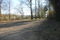
The path through the woods, which has deep ruts that may hold puddles in wet weather, leads out onto the D108 road.
(5) Cross straight ahead and continue along the forest track at the edge of the woods (on your left)
(6) At the next junction of four forest tracks, turn left onto the track that runs along the edge of the Bois du Chêne à Caïn. The track curves to the left before reaching, a little further on, a junction of five forest tracks.
(7) Take the path furthest to the right, which is a tree-lined lane running along the edge of the Bois des Défrichis. Further on, this path turns left, still running along the edge of the woodland.
(8) At the next junction of forest tracks, take the one on the left which runs alongside the Bois de l’Érable on your right. Further on, keep to the right as a forest track (dead end) joins from the left.
Carry on towards the hamlet of l’Érable, which you’ll leave on your left, until you reach the D737 road.
Cross it straight ahead to take the track towards the hamlet of La Fontaine. Please take great care when crossing this busy road, as the crossing is near a crest on the right-hand side, where visibility is reduced for motorists.
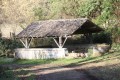
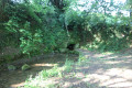
(9) Take the opportunity to look to your right, a few dozen metres away, at a wash house situated right next to the River Lambon.
Next, continue straight ahead (or to the left as you approach from the arrival path) along the uphill farm track, which levels out fairly quickly.
This crosses a road leading to La Passe Bernière. Cross straight ahead, leaving the farm track on your left as it joins the D737.
At the junction with the road leading to La Gandissière, carry on straight ahead. Gradually, the farm track moves away from the D737. Pass a turn-off on the left.
(10) The farm track reaches the D10 road, which you cross to continue straight ahead, towards the high-voltage power line. Please note that the D10 road, which links Beaussais and Saint-Maixient, is very busy, particularly with heavy goods vehicles, and requires great caution.
Pass under the high-voltage power line and, shortly afterwards, you’ll reach a junction of four farm tracks.
(11) Turn left onto the path, which slopes gently downwards and is initially somewhat sunken between two hedges. This path joins a road, the Chemin des Goupilles, just before the first houses; continue to the right.
Immediately afterwards, leave a road on your right and take the Rue des Gasses opposite, which soon begins to slope downwards. Pass the Rue du Fer à Cheval on your right twice.
Rue des Gasses joins the busy Route de Saint-Maixent; turn right. Please note there is no pavement for about ten metres.
Pass Impasse du Moulin on your right and carry on straight ahead towards the car park. There is no pavement near the bridge. Pass the road leading to Château de Beaussais on your right.
Head to the car park, which marks the end of this walk (S/E).

 Visorando Member

 Easy