The village of Crottet and its surroundings

A short walk to enjoy with the family on a sunny day. Views over the town of Pont-de-Veyle and the Mâconnais hills.

Details

288620
Creation:
Last update:
Last review:
  • Walking
    Activity: Walking
  • ↔
    Distance: 3.14 mi
  • ◔
    Average duration: 1h 30 
  • ▲
    Difficulty: Easy

  • ⚐
    Back to start: Yes
  • ↗
    Ascent: + 66 ft
  • ↘
    Descent: - 69 ft

  • ▲
    Highest point: 689 ft
  • ▼
    Lowest point: 614 ft
  • ⚐ Country: France
  • ⚐ City: Crottet (01620|01290|01750)
  • ⚑
    Start/End: N 46.276509° / E 4.898043°
  • ❏
    IGN map(s): Ref. 3028OT, 3029SB
  • Hour-by-hour weather

Description of the walk

Car park at the tennis courts, Rue des Dagaillers in Crottet.

(S/E) Turn left until you reach a pedestrian crossing, then turn right onto Chemin des Serves Basses and continue straight on.

(1) Take the first road on the left (Chemin des Creuses) and follow this road to the next junction, at a place called Grange Bagnevais, where you turn left.

(2) After the bend, turn left at a wash house and a small footpath. Follow this path to the end of the car park, then carry on straight ahead – don’t forget to visit the church

(3) Carry straight on along Rue Villa Croteldi. Pass Rue de la Croix Guérin on your right and turn right into Rue du Gros Chêne. Then turn right into Rue du Pré Neuf.

(4) At the junction, turn left towards Route de Bagé (D28). Take care when crossing the road! Continue along Route de la Montée des Abîmes. Pass the Pont de Veyle cemetery.

(5) Turn left onto Route de Saint-Jean. At the first track on the right, take Chemin du Grand Brulaz. This track is tarmac at the start and continues as a stony, earthen track before joining a road, Chemin de la Rollière.

(6) Turn left onto this road and continue to a crossroads. Cross the D28 again – take care when crossing! Walk for about 150 metres to return to your starting point (S/E).

Waypoints

  1. S/E : mi 0 - alt. 676 ft - Car park at the tennis courts
  2. 1 : mi 0.47 - alt. 636 ft - Take the first road on the left
  3. 2 : mi 0.9 - alt. 630 ft - Washing house, short footpath
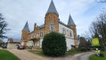
  4. 3 : mi 1.1 - alt. 659 ft - Saint-Paul’s Church
  5. 4 : mi 1.69 - alt. 620 ft - Turn left towards the Route de Bagé
  6. 5 : mi 1.94 - alt. 630 ft - Turn left onto Route de Saint-Jean
  7. 6 : mi 2.69 - alt. 686 ft - On the left, Chemin de la Rollière
  8. S/E : mi 3.14 - alt. 676 ft - Car park at the tennis courts

Notes

Hiking boots recommended
The route is unmarked but very well signposted with street name signs.

Worth a visit

(3) Don’t miss Saint-Paul’s Church in Crottet.

Nearby: Château de l’Aumusse and its 18-hole golf course.
Pont-de-Veyle Castle Park and its bridges over the River Veyle.

Reviews and comments

4.3 / 5
Based on 3 reviews

Reliability of the description
4.7 / 5
Ease of following the route
5 / 5
Route interest
3.3 / 5
Ponthus Marie
Ponthus Marie

Overall rating : 4.3 / 5

Date of your route : Jun 03, 2021
Reliability of the description : ★★★★☆ Good
Ease of following the route : ★★★★★ Very good
Route interest : ★★★★☆ Good
Very busy route : No

It was well signposted, except that we never actually found the wash house and ended up going round in circles a bit at the spot indicated, thinking we must have gone the wrong way somewhere? But when we compared your route map with the one on our phone’s app, they were exactly the same. A bit too much tarmac for our liking!

Machine-translated

droug
droug

Overall rating : 4.3 / 5

Date of your route : Apr 10, 2021
Reliability of the description : ★★★★★ Very good
Ease of following the route : ★★★★★ Very good
Route interest : ★★★☆☆ Average
Very busy route : No

Although the route isn’t exactly a major tourist attraction, it’s good that walks like this exist… to make it easier to systematically explore the 10km lockdown zone around your home!

Machine-translated

Aria
Aria

Overall rating : 4.3 / 5

Date of your route : May 21, 2018
Reliability of the description : ★★★★★ Very good
Ease of following the route : ★★★★★ Very good
Route interest : ★★★☆☆ Average

The walk is as described but isn’t particularly interesting. It’s a village walk that could just as easily be done in any other village.

Machine-translated

Other walks in the area

For more walks, use our search engine .

The GPS track and description are the property of this route's author. Please do not copy them without permission.