Route des Trois Châteaux à Saint-André-d’Huriat

The Three Castles Circular Route in Saint-André-d’Huriat.

Details

n°20780937
Creation:
Last update:
Last review:
  • Walking
    Activity: Walking
  • ↔
    Distance: 7.44 mi
  • ◔
    Average duration: 3h 30 
  • ▲
    Difficulty: Average

  • ⚐
    Back to start: Yes
  • ↗
    Ascent: + 102 ft
  • ↘
    Descent: - 98 ft

  • ▲
    Highest point: 709 ft
  • ▼
    Lowest point: 633 ft

Description of the walk

Starting point: Saint-André-d’Huriat Football Stadium car park.

(S/E) Head west along the Chemin du Stade (opposite the car park). After about 150 m, take thefirst path on the right. At thefirst junction, turn left.

(1) Join a small road (the Chemin des Platières) and follow it to the right.

(2) At La Maladière, turn right onto the road.

(3) At the next junction, take a track on the right. At the end, turn left and pass the Balmondière site (a former fortified house with a dovecote). Turn left again to leave the site, then left once more to return to the original junction.

(3) Follow the road to the right. At the T-junction, turn left into Impasse du Grand Coland, passing a large house on your left.

(4) At the T-junction, turn left onto the country lane known as Impasse du Petit Coland. Pass a house on your right and go under a high-voltage power line.

(5) You’ll come out onto Route du Bois Costa; follow it to the left and pass the old Ferme du Bois Costa.

(6) About 150 m further on, take thefirst track on the left. Pass under the high-voltage power line again. You’ll come out onto a road; follow it to the left for about 50 metres.

(2) At the junction, turn sharply right onto a road you took on the way there.

(1) Stay on the road as it bends to the right. Ignore another road on the left and pass through the hamlet of Les Platières. Cross a small road and continue straight ahead.

(7) At the next junction, turn left onto Chemin de Chaponneau. Go straight on, ignoring the side roads. Go round the village hall and then the town hall on the left.

(8) After the town hall, turn right and, at the junction immediately ahead, take thesecond right onto the Chemin du Grand Chapeland. At the fork in the road at the hamlet of La Garenne, turn left. Then ignore all the turnings on the right.

(9) After the hamlet of Chapeland, turn left onto a dirt track, the Impasse des Mures. You’ll rejoin the tarmac road at the hamlet of Les Mures and continue straight on. At the T-junction, turn right.

(10) At the next junction, turn left onto Chemin de La Mare. Ignore a turn-off on the right, turn left and you’ll come to a T-junction.

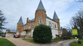
(11) Turn left and walk past Bourdonnel Castle. Continue to the D96 road (cross). Turn left onto the road. On your right, you’ll pass the private grounds of Falconnière Castle. Follow this road to a crossroads in the village.

(12) Turn right onto Route du Village and walk past the church. Take the first cul-de-sac on the left. At the end, turn right onto Chemin du Stade to reach the car park (S/E).

Waypoints

  1. S/E : mi 0 - alt. 636 ft - Football stadium car park
  2. 1 : mi 0.46 - alt. 699 ft - Path x Road
  3. 2 : mi 0.63 - alt. 696 ft - La Maladière
  4. 3 : mi 0.8 - alt. 689 ft - Junction with the Balmondière circular loop
  5. 4 : mi 1.82 - alt. 682 ft - Grand Coland
  6. 5 : mi 2.37 - alt. 692 ft - Route du Bois Costa
  7. 6 : mi 2.7 - alt. 696 ft - Start of the path
  8. 7 : mi 3.78 - alt. 676 ft - Junction
  9. 8 : mi 4.14 - alt. 669 ft - Town hall and village hall
  10. 9 : mi 5.1 - alt. 709 ft - Junction
  11. 10 : mi 5.83 - alt. 650 ft - junction
  12. 11 : mi 6.16 - alt. 696 ft - Château de Bourdonnel
  13. 12 : mi 7.03 - alt. 682 ft - Top of the village - Église Saint-André (Saint-André-d'Huiriat)
  14. S/E : mi 7.44 - alt. 636 ft - Football stadium car park

Reviews and comments

3.1 / 5
Based on 5 reviews

Reliability of the description
3.8 / 5
Ease of following the route
3.4 / 5
Route interest
2 / 5
Clapisson
Clapisson

Overall rating : 3 / 5

Date of your route : Jul 16, 2024
Reliability of the description : ★★★★☆ Good
Ease of following the route : ★★★★☆ Good
Route interest : ★☆☆☆☆ Very disappointing
Very busy route : No

Lots of tarmac. The few footpaths are lined with brambles and nettles. The only point of interest is the Balmondière dovecote.

Machine-translated

dudu01
dudu01

Overall rating : 3 / 5

Date of your route : Aug 31, 2023
Reliability of the description : ★★★★☆ Good
Ease of following the route : ★★★☆☆ Average
Route interest : ★★☆☆☆ Disappointing
Very busy route : No

far too much tar

Machine-translated

TotoB
TotoB

Overall rating : 2 / 5

Date of your route : Jul 31, 2023
Reliability of the description : ★★☆☆☆ Disappointing
Ease of following the route : ★★★☆☆ Average
Route interest : ★☆☆☆☆ Very disappointing
Very busy route : No

A flat walk with nothing to it other than the act of walking.
Thank goodness for the map, as the text is useless.
Furthermore, the first ‘chateau’ is on private property and the path indicated in point 3 is impassable.
In short, one to forget.

Machine-translated

PaulineT
PaulineT

Overall rating : 3 / 5

Date of your route : Jul 27, 2023
Reliability of the description : ★★★★☆ Good
Ease of following the route : ★★★☆☆ Average
Route interest : ★★☆☆☆ Disappointing
Very busy route : No

The châteaux are actually country estates, and not particularly beautiful, especially the one on the southern circular loop. Furthermore, some sections aren’t really paths at all; they’re difficult to navigate due to brambles and stinging nettles.

Machine-translated

gerardpierre
gerardpierre

Overall rating : 4.3 / 5

Date of your route : Jan 20, 2023
Reliability of the description : ★★★★★ Very good
Ease of following the route : ★★★★☆ Good
Route interest : ★★★★☆ Good
Very busy route : No

A flat route with no difficulties whatsoever. At point 4, there are no signs for the Petit Coland cul-de-sac, so it’s best to follow the directions on the map and turn left.
A pleasant route, perhaps with a little too much tarmac, but in the Dombes there aren’t many dirt tracks.

Machine-translated

Other walks in the area

For more walks, use our search engine .

The GPS track and description are the property of this route's author. Please do not copy them without permission.