Via Cahuzères

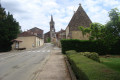
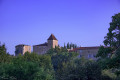
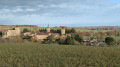
Nestled between the Douze and Auzoue valleys, the village of Lupiac, perched on a hill, is crossed by the Chemin de César, an ancient Roman road also known as the Ténarèze.

Details

291894
Creation:
Last update:
Last review:
  • Walking
    Activity: Walking
  • ↔
    Distance: 8.91 mi
  • ◔
    Average duration: 4h 35 
  • ▲
    Difficulty: Moderate

  • ⚐
    Back to start: Yes
  • ↗
    Ascent: + 568 ft
  • ↘
    Descent: - 577 ft

  • ▲
    Highest point: 814 ft
  • ▼
    Lowest point: 531 ft
  • ⚐ Country: France
  • ⚐ City: Lupiac (32290)
  • ⚑
    Start/End: N 43.682046° / E 0.183164°
  • ❏
    IGN map(s): Ref. 1743SB
  • Hour-by-hour weather

Description of the walk

Starting point: Place du Foirail in Lupiac.

(S/E) Take the D37 (Route de Vic Fezensac) heading north-east. Pass the school and the sports facilities.

(1) Further on, after a small pond, turn left onto a tarmac local road. Pass the Château de la Plagne on your left, then a farm on your right.

(2) Before you reach the hamlet of Pitre, take the path on the right and continue along this white-stone path to Larochelle.

(3) Go round the house on the right, then continue along the footpath which extends from the track. Shortly afterwards, the footpath turns left. Further on, ignore two footpaths branching off to the right before coming out onto a road at Mazous.

(4) Take this road to the left. At the three-way junction, turn right. At the next three-way junction, head right towards the hamlet of Cahuzères.

(5) Turn onto the first road on the right and walk past the chapel. The road turns into a track and then a footpath. Continue in the same direction along this descending path.

(6) At the bottom of the valley, the path veers to the left. The path climbs and soon becomes a track, which you follow westwards until you reach a local road.

(7) Turn left and continue along the road for 1.2 km until you reach a junction at a place called Brana.

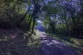
(8) Take the shaded sunken path opposite, heading towards the Bois de Clarac. The path descends, then turns right and then left to reach the Ruisseau de Clarac.

(9) Cross the stream and carry on straight ahead. Turn onto the first path on the right. Shortly afterwards, at the three-way junction, turn right. Further on, turn left onto another path that leads uphill. Ignore a path branching off to the left and continue to a junction of forest tracks.

(10) Ignore the first path on the left, which heads back the way you came, and continue along the second path on the left, which heads south. Leave the woods to reach a group of houses, La Jaulin, where you’ll come to a local road.

(11) Continue along this road, ignoring a path on the left and then one on the right.

(12) Further on, as the road curves to the left, take the path that goes straight ahead to end up opposite the Chapelle Saint-Jacques (Musée d’Artagnan).

(13) Turn left onto the Grande Rue to cross the village and join the D37. Take this road to the left to quickly reach the starting point of this route (S/E).

Waypoints

  1. S/E : mi 0 - alt. 797 ft - Place du Foirail, Lupiac
  2. 1 : mi 0.5 - alt. 758 ft - Turn left after the pond
  3. 2 : mi 1.09 - alt. 745 ft - Path on the right before Pitre
  4. 3 : mi 2.08 - alt. 627 ft - Larochelle. Continue along the path
  5. 4 : mi 2.79 - alt. 738 ft - Turn left onto the road to Mazous
  6. 5 : mi 3.81 - alt. 745 ft - Turn right towards the chapel
  7. 6 : mi 4.55 - alt. 600 ft - Head back up from the bottom of the valley to the left
  8. 7 : mi 5.38 - alt. 745 ft - Turn left onto the road
  9. 8 : mi 5.95 - alt. 758 ft - Go straight on along the path that leads downhill
  10. 9 : mi 6.38 - alt. 587 ft - View of Lupiac’s bell tower
  11. 10 : mi 7.07 - alt. 682 ft - Second path on the left
  12. 11 : mi 7.57 - alt. 748 ft - Straight on to Jaulin
  13. 12 : mi 8.47 - alt. 804 ft - Straight ahead on the path
  14. 13 : mi 8.72 - alt. 801 ft - St Jacques Chapel - Musée d'Artagnan
  15. S/E : mi 8.91 - alt. 797 ft - Place du Foirail, Lupiac

Notes

Also suitable for mountain biking and horse riding.

Worth a visit

A fortified village, Lupiac belonged until 1792 to the de Batz family, known for the most famous of the Gascons: d’Artagnan.

Reviews and comments

4.4 / 5
Based on 3 reviews

Reliability of the description
4.7 / 5
Ease of following the route
4.3 / 5
Route interest
4.3 / 5
pastrouver
pastrouver

Overall rating : 5 / 5

Date of your route : Aug 09, 2023
Reliability of the description : ★★★★★ Very good
Ease of following the route : ★★★★★ Very good
Route interest : ★★★★★ Very good
Very busy route : No

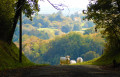
3.5 hours. A superb walk. A varied route taking in shaded paths and sections with views of the Gers countryside and the Pyrenees. A few tarmac roads, but very few vehicles.

Machine-translated

DOB65
DOB65

Overall rating : 4.7 / 5

Date of your route : Oct 05, 2020
Reliability of the description : ★★★★★ Very good
Ease of following the route : ★★★★☆ Good
Route interest : ★★★★★ Very good
Very busy route : Yes

A lovely route, well signposted, with varied scenery.
I highly recommend it.
Kind regards

Machine-translated

Moulis
Moulis

Overall rating : 3.7 / 5

Date of your route : Jul 05, 2020
Reliability of the description : ★★★★☆ Good
Ease of following the route : ★★★★☆ Good
Route interest : ★★★☆☆ Average
Very busy route : No

In fact, my wife and I shortened the route by heading straight from point 2 to point 8, which makes for a 9-kilometre circular route that we wanted to complete in the morning so that we could spend the afternoon visiting the village and the d’Artagnan Museum. The route isn’t particularly interesting in terms of flora, and 80 per cent of it is on roads. There were plenty of herds of cows, and lovely views of the hillsides and the Pyrenees.

Machine-translated

Other walks in the area

For more walks, use our search engine .

The GPS track and description are the property of this route's author. Please do not copy them without permission.