The Bois de Lala in Valanjou

Go for a walk around Valanjou, where you’ll discover the Moulin de Gué Robert and the Bois de Lala.

Details

3538201
Creation:
Last update:
Last review:
  • Walking
    Activity: Walking
  • ↔
    Distance: 6.82 mi
  • ◔
    Average duration: 3h 15 
  • ▲
    Difficulty: Moderate

  • ⚐
    Back to start: Yes
  • ↗
    Ascent: + 98 ft
  • ↘
    Descent: - 102 ft

  • ▲
    Highest point: 308 ft
  • ▼
    Lowest point: 203 ft
  • ⚐ Country: France
  • ⚐ City: Valanjou (49670)
  • ⚑
    Start/End: N 47.21327° / W 0.595875°
  • ❏
    IGN map(s): Ref. 1523SB
  • Hour-by-hour weather

Photos

Description of the walk

Set off from Château de Gonnord and follow the green signposts.

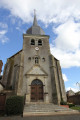
(S/E) Walk past the church on your left, cross the D54 and then head down towards Rue Abbé Gruget. Walk alongside the grounds of the Maison de Retraite des Fontaines care home.

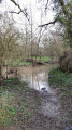
(1) Cross the Ruisseau de Javoineau and, as you emerge from the woodland, head towards the D24, which you cross. Turn left, then take Rue du Gué to the right of the wayside cross. Follow this road for 1 km.

(2) Cross the Ruisseau du Boisneau, then head up to the Moulin du Gué Robert. Turn left, cross the courtyard and continue along a tarmac path. At the end, turn right towards Grand Jaugé.

(3) At the junction, turn right. Continue for almost 2.5 km through the bocage. Turn right at the wind turbine, ignore the path on the right, carry on straight ahead, then turn right until you reach the D84.

(4) Cross the D84, carry on walking along this path through the fields, pass La Grande Chaize and head right, then left.

(5) You’ll come out onto a road; follow it to the right. Take thefirst path on the left.

(6) Cross the D54 and continue along the path opposite. Carry on straight ahead (south-west) and ignore all the side paths. You will then reach La Maison Neuve.

(7) Turn right towards the Bois de Lala. At the junction, go straight on and follow the Bois de Lala. Pass La Normandière and continue to the D54.

(8) Turn left onto the D54, then carry on straight for 1 km.

(9) Once in the village, turn left into Rue Joachim Du Bellay, then right and left again when you see Gonnord Castle. Follow the metal railing down to the bank of the pond, then walk round it to return to the starting point (S/E).

Waypoints

  1. S/E : mi 0 - alt. 230 ft - Gonnord Castle
  2. 1 : mi 0.27 - alt. 213 ft - Javoineau Stream
  3. 2 : mi 0.87 - alt. 203 ft - Boisneau Stream
  4. 3 : mi 1.52 - alt. 279 ft - Grand Jaugé
  5. 4 : mi 2.59 - alt. 266 ft - D84 road
  6. 5 : mi 3.32 - alt. 272 ft - T-junction
  7. 6 : mi 3.96 - alt. 308 ft - D54 Road
  8. 7 : mi 4.62 - alt. 305 ft - La Maison Neuve
  9. 8 : mi 5.81 - alt. 246 ft - Junction – D54
  10. 9 : mi 6.45 - alt. 226 ft - Rue Joachim du Bellay
  11. S/E : mi 6.82 - alt. 230 ft - Gonnord Castle

Worth a visit

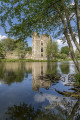
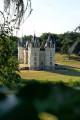
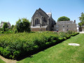
Gonnord Castle: This fortified castle, whose origins date back to the 10th century, suffered several
instances of destruction during the Middle Ages. King Charles IX visited it in 1565 and Henry IV stayed there on several occasions. Set alight during the Revolution, it was sold as national property before its stones were used for other buildings. The façade was listed as a Historic Monument in 1926.
Now owned by the local council, it houses a ‘boule de fort’ court and a performance hall.

Deer of La Fardellière: Head into the heart of nature to discover stags, does and their fawns. With the help of the farm’s little discovery booklet, young and old alike can explore the almost fantastical world of deer. Open all year round by booking, you can enjoy farm-style meals, themed days or evenings (e.g. the deer rutting season).

Reviews and comments

4.1 / 5
Based on 4 reviews

Reliability of the description
4.5 / 5
Ease of following the route
4.5 / 5
Route interest
3.3 / 5
manuuher
manuuher

Overall rating : 3.7 / 5

Date of your route : Mar 02, 2025
Reliability of the description : ★★★★☆ Good
Ease of following the route : ★★★★☆ Good
Route interest : ★★★☆☆ Average
Very busy route : No

I agree with the previous comments; only Gonnord Castle at the start (or finish) is worth a visit.
Don’t expect to see the other château in the Bois de Lala. I tried to get there by cutting through the woods, but the path didn’t look very clear and it might be on private property.
Before reaching the village to finish the walk, you have to follow the D54 for about 1 km, I’d say, which is very busy and has no dedicated footpath. It’s borderline dangerous.

Machine-translated

MARTDomi
MARTDomi

Overall rating : 4 / 5

Date of your route : Aug 11, 2024
Reliability of the description : ★★★★☆ Good
Ease of following the route : ★★★★☆ Good
Route interest : ★★★★☆ Good
Very busy route : No

A lovely circular shape.
The first part is interesting, featuring Gonnor Castle, the narrow streets and passageways leading out of the village, and the mill.
The second part is an easy, scenic walk along small roads and lovely paths.

Machine-translated

Philippe et Marinette

Overall rating : 3.7 / 5

Date of your route : Sep 03, 2021
Reliability of the description : ★★★★★ Very good
Ease of following the route : ★★★★★ Very good
Route interest : ★☆☆☆☆ Very disappointing
Very busy route : No

A “tiring” walk… An uninteresting and unattractive start. Welcome to the land of maize fields, hydroponic crops and wind turbines. It feels a bit more like a proper “hike” on the section from La Grande Chaize to La Normandière (a lovely little sunken lane). A tedious return journey along the D74 to Gonnord (tarmac and traffic). Gonnord Castle is worth a visit, but it’s not worth putting yourself through these 10.97 km just to see it. If there’s nothing to show for it, why mark out a walking route?

Machine-translated

DanGab49
DanGab49

Overall rating : 5 / 5

Date of your route : Aug 18, 2021
Reliability of the description : ★★★★★ Very good
Ease of following the route : ★★★★★ Very good
Route interest : ★★★★★ Very good
Very busy route : No

An interesting walk, taking you past an old mill which the owner keeps in good condition.

Machine-translated

Other walks in the area

For more walks, use our search engine .

The GPS track and description are the property of this route's author. Please do not copy them without permission.