The Bois d’Ophain and the Bois du Foriest

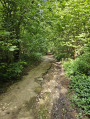
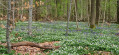
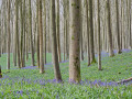
This walk, starting from Village No. 1, Reine Fabiola, begins by crossing the pretty Bois d’Ophain (which, apart from the path taken, is private) and then takes a short detour via the Querton farm before entering the Bois du Foriest. Unfortunately, the route cannot avoid a number of roads and concrete paths, particularly in its second half, but this circular route through the two woods is nonetheless pleasant and varied.

Details

101262842
Creation:
Last update:
Last review:
  • Walking
    Activity: Walking
  • ↔
    Distance: 3.70 mi
  • ◔
    Average duration: 2h 05 
  • ▲
    Difficulty: Easy

  • ⚐
    Back to start: Yes
  • ↗
    Ascent: + 308 ft
  • ↘
    Descent: - 302 ft

  • ▲
    Highest point: 433 ft
  • ▼
    Lowest point: 256 ft

Photos

Description of the walk

Car park:
- On Avenue des Champs Clairs. For GPS directions: Ophain, 16 Avenue des Champs Clairs.
- Alternatively: the car park at Foriest Cemetery (9).

Starting point: Follow the avenue southwards and take the first right onto Chemin du Bois d’Ophain.

To follow the route: see the detailed map or use the Visorando app.

Waypoints

  1. S/E : mi 0 - alt. 390 ft - Avenue des Champs Clairs
  2. 1 : mi 0.39 - alt. 344 ft - Junction – Chemin du Bois d’Ophain
  3. 2 : mi 0.62 - alt. 276 ft - T-junction – Bruyère de Noucelles path
  4. 3 : mi 0.82 - alt. 322 ft - T-junction – Rue du Bois
  5. 4 : mi 1.03 - alt. 322 ft - Junction – Querton Farm
  6. 5 : mi 1.27 - alt. 266 ft - Querton Trail – Chemin Jean Lanneau
  7. 6 : mi 1.86 - alt. 417 ft - Where the two circular loops meet
  8. 7 : mi 2.21 - alt. 344 ft - Junction – Chemin du Blanc Caillou
  9. 8 : mi 2.62 - alt. 318 ft - T-junction
  10. 9 : mi 3.3 - alt. 420 ft - Cemetery car park – Chemin des Voiturons
  11. S/E : mi 3.7 - alt. 390 ft - Avenue des Champs Clairs

Notes

A walk with no particular difficulties, on a relatively flat route.
A mix of footpaths, tracks and concrete roads.
Walking poles aren’t essential but are useful for comfort if, like the author of this walk, you’re no longer 20…

Other walks in the area

For more walks, use our search engine .

The GPS track and description are the property of this route's author. Please do not copy them without permission.