Country:
 City:
City:



Parking is available on Place d’Ophain, opposite Sainte-Aldegonde Church. This is a stop for TEC buses 65 and 66 coming from Braine-l’Alleud station.
(S/E) With your back to the church, cross Rue des Combattants (watch out for heavy traffic) and turn left, then immediately right onto Rue Courte, which leads to the rear of the houses. At the end of the car park, by the fence of the meadow, take the tarmac path leading off to the left.
(1) Cross Rue du Cimetière and continue straight on, taking Rue de l’École opposite. At the end, turn left to rejoin Rue des Combattants. The street changes its name to Rue de Dinant. Cross it and follow the pavement opposite on your right until you reach the first road on the left – a cobbled road called Rue du Gazon.
(2) Take this road and continue until you reach Rue des Belles Pierres after a short climb.
(3) Turn right and cross over the ring road.
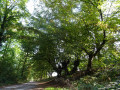
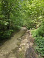
(4) At the first junction after the bridge, turn right into Rue du Bossu. It runs downhill parallel to the ring road before forming a circular route to the left. After a house on the right-hand side of the street, just as the road starts to climb and becomes Chemin de la Chapelle, a dirt track flanked by a footpath branches off straight ahead. Watch your head, especially if you’re on a bike, as you pass under a branch forming an arch and a canopy over the path.
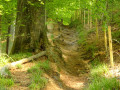
(5) At the junction, turn left (see alternative route in the Practical Information section). Join the tarmac road and head down Rue de Griponwez to the right. At the bottom of the descent, you’ll find a small chapel next to the Hain, which you cross. Pass the Faut-Bien farm on your left. The path becomes a dirt track and climbs, a sunken path through the woodland. Follow it, ignoring all the side paths branching off to the right or left.
(6) At the first proper crossroads, turn right onto Chemin Bertinchamps. Follow it until you reach an old farm converted into a function venue. Shortly afterwards, you’ll see the Bois du Drape on your left.
(7) Enter the woods via the second entrance. About ten metres further on, on your left, there is a shelter where you can eat or rest. Follow the path as it climbs gently along the edge of the woods beneath the trees and join Rue de Bois-Seigneur-Isaac.
(8) Cross the road (be careful, as traffic can be heavy and vehicles travel fast!) and follow the road to the right along the central reservation for about 250 metres. Turn left onto Rue Castor, a cobbled street.
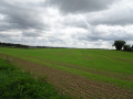
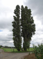
(9) Further on, turn left again onto the tarmac-surfaced Rue Baty du Cerisier. You’ll reach the plateau and pass by a stud farm, Les Pouplis.
The path returns to its natural state.
(10) Turn right onto the first country lane, the Chemin de Haut-Ittre, and follow it straight on until you reach a wooded area after passing over the ring road. This will take you to Rue du Hautmont.
(11) About 100 m further on, turn right onto Chemin n°22, a farm track just before a house. Follow this track downhill; it leads onto Rue du Cimetière. Pass the school and then the cemetery, and rejoin the original route.
(1) Turn left and follow it in the opposite direction as far as Place d’Ophain (S/E).


 Visorando Member
 Easy
Easy 
 Very difficult