The Baigura circular walk, starting from Hélette

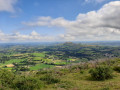
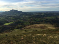
Baigura is one of the most beautiful viewpoints in the Basque Country. The 360° panorama offers views of:
- to the east and south, the Pyrenees mountain range, the Pic du Midi d’Ossau, the Pic d’Anie, the Pic d’Orrhy and the peaks of Labourd; - to the west, Navarre, Autza and Iparla;
- to the north, the beaches of the Basque Coast and the Landes.

Details

3438564
Creation:
Last update:
Last review:
  • Walking
    Activity: Walking
  • ↔
    Distance: 8.62 mi
  • ◔
    Average duration: 6h 15 
  • ▲
    Difficulty: Difficult

  • ⚐
    Back to start: Yes
  • ↗
    Ascent: + 2,608 ft
  • ↘
    Descent: - 2,605 ft

  • ▲
    Highest point: 2,913 ft
  • ▼
    Lowest point: 830 ft

Description of the walk

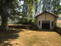
To reach the starting car park, located at the hamlet of Uxarreta on the D22: from Louhossoa via the D119, take the D22 towards Hasparren; after 500 m, the car park is on the right, marked by plane trees and picnic tables.

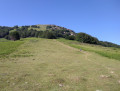
(S/E) Head northwards along the D22. Turn left onto the small road opposite the Route d’Hélette. At the ‘Zone Pastorale’ sign on the left, follow the grassy path which climbs gently until you reach a fork.

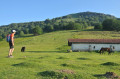
(1) Take the path on the left until you reach a ruin. Then head due south; at the T-junction, leave the wide track on your left and take the grassy path on the right. Very soon, turn off to the south and rejoin a track. Continue to the right along this track. You will then come to a junction with several paths. Turn left and continue uphill to reach a grassy plateau with a picnic table and panoramic information boards.

(2) Follow the wide path to the left, continuing uphill. Take a hairpin bend and reach the ridge. Carry on to reach the Erregelu transmission masts. Continue a little further and you’ll soon reach the junction with the track suitable for vehicles.

(3) Take the track straight ahead to reach the summit of Baigurra and its antennas.

(4) Return to the previous junction.

(3) Turn left and begin the descent along the path that cuts across the track. Join the track at a hairpin bend and follow it to reach a path junction at the edge of the woodland.

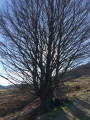
(5) Leave the track here and turn right onto the undulating path through the ferns. Climb slightly to reach a beech forest. Cross this woodland and emerge at a clearing at the junction with the Discovery Trail.

(6) Turn right onto this path and follow it until you reach the picnic area on the grassy plateau that you passed on the way out.

(2) Follow the same route as on the way there to return to the car park at Uxarreta (S/E).

Waypoints

  1. S/E : mi 0 - alt. 873 ft - Car park at Uxarreta
  2. 1 : mi 0.49 - alt. 896 ft - Junction in pastoral area
  3. 2 : mi 1.96 - alt. 1,972 ft - Developed rest area
  4. 3 : mi 3.45 - alt. 2,795 ft - Track junction - Erregelu
  5. 4 : mi 3.68 - alt. 2,913 ft - Mont Baïgura
  6. 5 : mi 5.26 - alt. 1,621 ft - Path junction
  7. 6 : mi 5.74 - alt. 1,732 ft - Nature trail. Near the source of the - Joyeuse (rivère)
  8. S/E : mi 8.62 - alt. 876 ft - Car park at Uxarreta

Notes

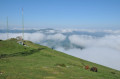
Fog is common in this area. This walk has an IBP rating of 77.

Worth a visit

(6) This is a nature trail featuring information boards on the flora and fauna of the Baïgurra.

Reviews and comments

4.3 / 5
Based on 3 reviews

Reliability of the description
4.3 / 5
Ease of following the route
4.3 / 5
Route interest
4.3 / 5
xiberotarra
xiberotarra

Overall rating : 4.7 / 5

Date of your route : May 12, 2025
Reliability of the description : ★★★★★ Very good
Ease of following the route : ★★★★★ Very good
Route interest : ★★★★☆ Good
Very busy route : No

I did this on Monday in lovely sunshine in the morning. The climb wasn’t too strenuous – probably the easiest of all the trails leading up to Baigura (Leisure Centre, Ossès, etc.). I wasn’t so keen on the section of the descent along the track, but as soon as it rejoins the nature trail, the walk regains all its charm.
For those who are struggling to find the start point, scan the hike if you’ve downloaded the app. With a sat-nav app like Waze, it’ll take you straight to the starting point.

Machine-translated

jd8fttj59
jd8fttj59

Overall rating : 5 / 5

Date of your route : Mar 27, 2023
Reliability of the description : ★★★★★ Very good
Ease of following the route : ★★★★★ Very good
Route interest : ★★★★★ Very good
Very busy route : Yes

Very good

Machine-translated

Peio87
Peio87

Overall rating : 3.3 / 5

Date of your route : Aug 10, 2022
Reliability of the description : ★★★☆☆ Average
Ease of following the route : ★★★☆☆ Average
Route interest : ★★★★☆ Good
Very busy route : Yes

Hello,
Hike completed on 10 August 2022
Two unfortunate inaccuracies in the description.

1/ To find the car park (under the shady plane trees) and the first path: coming from Louhossoa, you must ‘leave’ the Hasparren road on your left and head towards Irissary/St Jean Pied de Port; you’ll find the car park at a bend. Once parked (sign for the Hélette exit).From there, retrace your steps (200 m) to the previous junction to start the walk, heading towards the AKABOTEA farm opposite the D245. On this road (Etxegoieneko Bidea), 500 m further on, you’ll find the first footpath on the left, marked by a sign indicating the entrance to a pastoral area.
2/ Point 1: some punctuation is missing from the text, making it difficult to understand: after the ruin, turn left and join a path which is now signposted (yellow line) (the path comes from the leisure centre). It is only further up that you take the grassy path.

Machine-translated

Other walks in the area

For more walks, use our search engine .

The GPS track and description are the property of this route's author. Please do not copy them without permission.