


Refine your search for walks in Lauze (rivière) - Affluent de l'Ariège
Lauze (rivière) - Affluent de l'Ariège walks


 From Ax-les-Thermes to Orgeix
 Visorando Member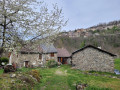
 5.29 mi
 +1,043 ft
 -1,024 ft
 3h 20
3h 20
 Moderate
 Departure from Ax-les-Thermes (Ariège)
This pleasant hike will take you to the charming village of Orgeix, where you can explore its castle on the shores of Lake Campauleil.
Ascou and Sorgeat from Ax-les-Thermes
 5.18 mi
+1,237 ft
-1,220 ft
3h 25
Moderate
Departure from Ax-les-Thermes (Ariège)
5.18 mi
+1,237 ft
-1,220 ft
3h 25
Moderate
Departure from Ax-les-Thermes (Ariège)
Short circular loop passing through Ascou and Sorgeat.
Pic de Brasseil, known as Dent d'Orlu, starting from La Forge
 9.68 mi
+3,665 ft
-3,694 ft
7h 40
9.68 mi
+3,665 ft
-3,694 ft
7h 40
 Difficult
Departure from Ascou (Ariège)
Difficult
Departure from Ascou (Ariège)
Ascent of Pic de Brasseil, known as Dent d'Orlu, starting from La Forge.
The Dent d'Orlu is usually accessed from the Poêle à Frire car park at Jasse de Cabane Longue. It is a half-day hike.
This itinerary suggests using the access track to this car park as an approach walk. This allows for a day's hiking and, what's more, a good warm-up before thefirst climb in the forest, which is quite steep.
Chioula Mountain Hut from Ascou
 10.23 mi
+2,503 ft
-2,490 ft
6h 55
Difficult
Departure from Ascou (Ariège)
10.23 mi
+2,503 ft
-2,490 ft
6h 55
Difficult
Departure from Ascou (Ariège)
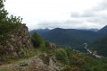
A very pleasant circular walk starting from the village of Ascou. The ascent to the Refuge du Chioula follows theGR®107or the Chemin des Bonshommes. The return journey can be made either by following old markings (a route to be avoided in foggy conditions and requiring a fair sense of direction) or by taking the same route as on the way up.
Walks near Lauze (rivière) - Affluent de l'Ariège
Forges d'Orlu - Refuge d'en Beys via Naguille and La Couillade d'en Beys
 7.48 mi
+4,964 ft
-1,509 ft
7 hrs
7.48 mi
+4,964 ft
-1,509 ft
7 hrs
 Very difficult
Departure from Orlu (Ariège)
Very difficult
Departure from Orlu (Ariège)
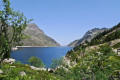
Significant elevation gain over a relatively short distance. Magnificent landscapes in a very wild mountain setting. Numerous ponds along the way. A magnificent view from the Couillade d'en Beys. The effort is rewarded throughout the day.
⚠️ Stay on the marked trails: GRP® Tour de la Montagne d'Ax, as you are on the edge of or within the National Reserve.
Pic de Tarbesou and the Rabassoles Lakes
 7.67 mi
+2,060 ft
-4,078 ft
5h 20
Difficult
Departure from Ascou (Ariège)
7.67 mi
+2,060 ft
-4,078 ft
5h 20
Difficult
Departure from Ascou (Ariège)
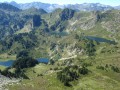
A beautiful hike not far from the Ascou-Pailhères resort. On the agenda are the magnificent Pic de Tarbesou viewpoint (2364m) and the three Rabassoles lakes. To spice things up, the last part requires good navigation skills to find your way.
Refuge d'en Beys - Refuge des Bésines
 5.61 mi
+2,178 ft
-1,759 ft
4h 30
Difficult
Departure from Orlu (Ariège)
5.61 mi
+2,178 ft
-1,759 ft
4h 30
Difficult
Departure from Orlu (Ariège)
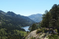
Amendment on 12 September 2022: new route marked on the ground, approved on Saturday 10 September 2022.Third stage of the Tour des Pérics. Day classified as difficult. Short distance but difficult terrain.The climb from the refuge d'en Beys to the passage through the Orlu Reserve (2,400 m) is difficult.The balcony path from (6) to (8) is very beautiful.
⚠️ From (S/E) to (5)you are in the Orlu National Hunting and Wildlife Reserve, where regulations must be observed. See practical information.
Refuge d'en Beys - Orlu via the Étang de Naguille
 9.08 mi
+1,526 ft
-5,217 ft
5h 30
Difficult
Departure from Orlu (Ariège)
9.08 mi
+1,526 ft
-5,217 ft
5h 30
Difficult
Departure from Orlu (Ariège)
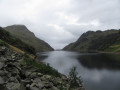
Fourth and final stage of the tour of the Orlu and Montagne d'Ax reserves.I have classified this stage as difficult because of the 1,650 m descent on a steep and sometimes damaged path.The view from the Couillade d'en Beys (3) to the dam (8) is magnificent.The stage begins by heading in the opposite direction to the previous day's route, taking theGR®®107and theGRP®® Tour des Pérics andGRP®® Tour des Montagnes d'Ax. At (2), be careful to turn right, west, onto theGRP®® Tour des Montagnes d'Ax, and continue until you reach the end of the four-day hike.The estimated time is underestimated: the descent is difficult on steep and degraded paths after the Couillade d'en Beys (3).
⚠️ From (S/E) to (10), you are on the edge of or within the Orlu National Hunting and Wildlife Reserve, where regulations must be observed. See practical information.
Refuge d'en-Beys - Barrage des Bouillouses
 10.08 mi
+2,257 ft
-2,136 ft
6h 35
Difficult
Departure from Orlu (Ariège)
10.08 mi
+2,257 ft
-2,136 ft
6h 35
Difficult
Departure from Orlu (Ariège)
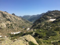
The second stage of this circuit is rocky at first, then more rolling. The whole thing is enchanting.The trail is well marked.
⚠️ From (S/E) to (3), you are in the Orlu National Hunting and Wildlife Reserve, where regulations must be observed. See practical information.
En Beys Refuge - Camporells Refuge
 7.15 mi
+2,605 ft
-1,680 ft
5h 35
Difficult
Departure from Orlu (Ariège)
7.15 mi
+2,605 ft
-1,680 ft
5h 35
Difficult
Departure from Orlu (Ariège)
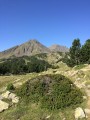
Part of the long itinerary (9 days) around Carlit, travelling from refuge to refuge, based on the Peyrics tour and using various marked trails.
⚠️ You are entering the Orlu National Hunting and Wildlife Reserve, where regulations must be observed. See practical information.
Camporells Refuge - Lac des Bouillouses via Petit Peric
 7.14 mi
+1,503 ft
-2,267 ft
6 hrs
Very difficult
Departure from Formiguères (Pyrénées-Orientales)
7.14 mi
+1,503 ft
-2,267 ft
6 hrs
Very difficult
Departure from Formiguères (Pyrénées-Orientales)
Part of the long itinerary (9 days) around Carlit, hiking from refuge to refuge, based on the Peyrics tour and using various marked trails.
Camporells Refuge - En Beys Refuge
 6.82 mi
+1,562 ft
-2,490 ft
4h 30
Moderate
Departure from Formiguères (Pyrénées-Orientales)
6.82 mi
+1,562 ft
-2,490 ft
4h 30
Moderate
Departure from Formiguères (Pyrénées-Orientales)
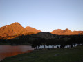
Second stage of the Tour Des Pérics.This stage should only be undertaken in good weather and when there is no fog.Otherwise, you must use the Visorando app or a GPS device to track your route.
⚠️ You are entering the Orlu National Hunting and Wildlife Reserve, where certain regulations must be observed. See practical information.
Vauban Trail from Rouze to Aunat
9.41 mi
+1,414 ft
-1,585 ft
5h 35
Moderate
Departure from Rouze (Ariège)
This section of the Chemin Vauban links Rouze to Aunat, gradually leaving the Donezan behind to reach the Aude Pyrenees. The route, which is generally easy and accessible, alternates between sections through woodland and pleasant paths, notably crossing the border between Ariège and Aude. The section between Campagna-de-Sault and the Col de la Clause is particularly interesting for its heritage and numerous information boards, which provide a better understanding of the areas passed through, especially around the Dournes tunnel.From the Col de la Clause, the route continues mainly downhill through woodland before gradually reaching the village of Aunat.
Mérens – L’Hospitalet-près-l’Andorre via the Bésines refuge
 9.54 mi
+4,160 ft
-3,225 ft
8h 00
Difficult
Departure from Mérens-les-Vals (Ariège)
9.54 mi
+4,160 ft
-3,225 ft
8h 00
Difficult
Departure from Mérens-les-Vals (Ariège)
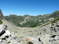
A challenging second stage with a steep gradient on the ascent of the Porteille des Bésines.
This day’s walk follows good, well-signposted paths.
Stopping off at the Refuge des Bésines may be useful for drinking water and, possibly, lunch.
The climb to Les Bésines and the descent towards L’Hospitalet are not very busy (as observed on 2 August 2022).