Lautenbach: from the heritage of the Chapter to the forest trails

Starting from the former Romanesque collegiate church in Lautenbach, in the Florival region, this circular walk will take you to the hamlet of Schweighouse and the Chapel of Saint Gangolphe, a place of pilgrimage and legend. You will then climb through the forest via the Col du Bannstein to the Hochfelsen and the Rochers de l’Engelstein, before descending via unmarked paths and a sunken track.

Details

n°111746063
Creation:
Last update:
Last review:
–
  • Walking
    Activity: Walking
  • ↔
    Distance: 6.93 mi
  • ◔
    Average duration: 4h 15 
  • ▲
    Difficulty: Moderate

  • ⚐
    Back to start: Yes
  • ↗
    Ascent: + 1,178 ft
  • ↘
    Descent: - 1,165 ft

  • ▲
    Highest point: 2,257 ft
  • ▼
    Lowest point: 1,201 ft

Photos

Description of the walk

Park in the car park on Place de l’Église, at the foot of Lautenbach Collegiate Church.

(S/E) Head towards the war memorial and walk past it on the left, past the stone sarcophagi lined up along the side of the church. Turn left onto Rue du Presbytère, which runs behind the church, then turn right onto Rue Principale. Walk past a fountain at the junction with Rue des Pierres, and continue to the pedestrian crossing at Rue Haute.

(1) Cross Rue Principale at the pedestrian crossing, then follow it straight on, keeping to the left-hand side of the road. Continue like this for about 1.2 km; the road becomes Rue du Faubourg, then Rue de la Vallée at the junction with Rue de Colmar, which you should cross at the pedestrian crossing. Carry on for about a hundred metres, slightly downhill.

(2) Leave Rue de la Vallée via the small path that climbs to the left up the grassy embankment. Follow the top of the embankment, then go straight on along a small road overlooking the main road. It passes the historic sign for Albert Syren’s grocery shop and descends back towards the main road. Join the pavement, pass a wayside cross and turn immediately left onto Route de Soultzmatt, towards the church.

(3) Walk past Saint-Michel Church. At the junction with Rue Saint-Michel, by the washhouse, carefully follow Route de Soultzmatt (D40) to the left for about 650 m. Where the road branches off to the left, continue straight on along the footpath, then along the pavement, until you reach Rue de la Chapelle.

(4) Turn right onto Rue de la Chapelle and follow it straight on to the Saint-Gangolphe Chapel, where it ends as a footpath.

Red Ring signposting

(5) Walk past the Saint-Gangolphe Chapel. Just after this, at the signpost, turn left onto the forest track towards the Col du Bannstein. Further on, at the junction, continue straight on towards the pass, then stay on this track until you reach the Col du Bannstein.

(6) At the Col du Bannstein, turn left and carefully cross the D40 to join, on the other side, the forest track towards Hochfelsen. A few dozen metres further on, at the signpost, turn left onto the path towards Hochfelsen and Engelstein.

(7) About a hundred metres further on, at the very inconspicuous junction, turn left: the signpost only becomes visible just as you turn. The path, which is sometimes poorly marked, then veers off to the right several times: keep an eye out for the markings until you reach the rocks of the Hochfelsen.

(8) Walk past the Hochfelsen rocks and continue straight on along the same path, without following the small track that descends to the left towards a wide track further down.

Yellow Cross markings

At the junction with a forest track, follow it a few metres to the left, then turn right back onto the path which takes a sharp right-hand bend towards the Engelstein, eventually winding its way uphill (discreet markings) and leading onto another track. Turn left onto this track, then leave it on the right about ten metres further on and continue climbing.

(9) Pass by the Rochers de l’Engelstein and continue along the signposted path. Cross the first forest track, then join a wide track, which you should follow to the right. Stay on this track, going straight on, until you reach a junction of tracks.

End of signposting

(10) At the junction, stay on the wide track, which climbs a little further until it reaches a hairpin bend.

(11) At the bend, turn left to head downhill. Join the Chemin de Kreuzbach and follow it to the next junction, marked by a signpost.

Green Ring signposting

Leave the track and continue straight on along the ‘Du chemin creux au Langrucken’ path, signposted with the Green Ring symbol, which passes close to some wooden sculptures. It then descends steeply into a more open area, climbs very briefly, then continues its descent for about 350 m, until you reach a spot where the undergrowth thins out a little.

End of signposting

(12) Take the path that branches off sharply to the right – it’s easy to miss. Follow it to a bend in the Chemin de Kreuzbach.

Blue Ring signposting

Head up the Chemin de Kreuzbach to the right until you reach a picnic table.

Green Ring signpost

(13) At the top of the sunken path, follow the signs for Lautenbach centre: just past the picnic table and then a tree, leave the wide track for the narrow path that descends to the left. About a hundred metres further down, where the path seems to continue straight ahead but soon ends, turn left at a small stone marker; the path takes a sharp left, then immediately right. Pass a second marker and continue down to a grassy clearing.

(14) Leave the grassy clearing via the small, well-hidden path that sets off opposite, slightly to the left, and continues downwards, bypassing the hairpin bend. Continue downwards until you reach several mounds, opposite a trench.

(15) Just before the mounds, turn left, making your own way through. Two trenches then come into view: take the one on the left and walk down the middle of it. At the end of the trench, at the three-way junction, continue to the left. You’ll gradually start to hear the road. The path leads to a garden shed.

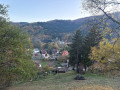
(16) Just past the garden shed and its small benches, turn right to go round this small area. The village comes into view below. The path then overlooks the gardens, just above the rooftops. Walk alongside a low stone wall on your right, then take a wooden footbridge, between the rooftops and the wall, and head down to the Rue Principale.

(1) Cross Rue Principale at the pedestrian crossing, then return to the car park by following the route in reverse (S/E).

Waypoints

  1. S/E : mi 0 - alt. 1,293 ft - Car park - Église Saint-Jean-Baptiste (Lautenbach)
  2. 1 : mi 0.14 - alt. 1,286 ft - Junction of Rue Principale and Rue Haute
  3. 2 : mi 0.89 - alt. 1,240 ft - Leaving Rue de la Vallée
  4. 3 : mi 1.13 - alt. 1,207 ft - Église Saint-Michel de Schweighouse
  5. 4 : mi 1.61 - alt. 1,352 ft - Rue de la Chapelle
  6. 5 : mi 1.85 - alt. 1,325 ft - Chapelle Saint Gangolphe
  7. 6 : mi 2.59 - alt. 1,585 ft - Col du Bannstein
  8. 7 : mi 2.75 - alt. 1,631 ft - Unobtrusive junction
  9. 8 : mi 3.04 - alt. 1,699 ft - Rocks - Hochfelsen
  10. 9 : mi 3.53 - alt. 2,083 ft - Rochers de l'Engelstein
  11. 10 : mi 4.19 - alt. 2,234 ft - Crossroads of trails
  12. 11 : mi 4.39 - alt. 2,244 ft - Hairpin bend
  13. 12 : mi 5.2 - alt. 1,798 ft - Diagonal junction
  14. 13 : mi 6 - alt. 1,900 ft - Top of the sunken lane
  15. 14 : mi 6.3 - alt. 1,703 ft - Grass square
  16. 15 : mi 6.46 - alt. 1,549 ft - Mounds and trenches
  17. 16 : mi 6.63 - alt. 1,394 ft - Garden shed
  18. S/E : mi 6.93 - alt. 1,293 ft - Car park

Notes

Points to note

Between (1) and (2), the road (D429) runs alongside the path without a pavement, right at the edge of the carriageway: there is little traffic, but visibility is reduced in places and cars can sometimes be travelling at speed.

(6) The D40 must be crossed without a pedestrian crossing at the Col du Bannstein.

(15) Sturdy footwear is required for the descent down the gully.

Narrow paths, rocky sections and the descent down the gully mean the circular route is unsuitable for pushchairs.

During the hunting season, driven hunts take place on the hills. On 14 November 2026, gunshots were heard near the Rochers de l’Engelstein (9), with no appropriate warning signs. An orange high-visibility vest is recommended. From (10) to (13), the circular route crosses the Guebwiller State Forest, for which the ONF publishes the hunting days.

Information

(5) In 2026, the chapel will be open, subject to availability, on Sundays and public holidays from 3 pm to 5 pm, from mid-May – the date of the Feast of Saint Gangolphe (thesecond Sunday in May) – until Heritage Days in September.

Make sure you bring plenty of water: there are no drinking water points along the route.

(13) A picnic table provides a place to rest before the final descent.

Shops and restaurants in the centre of Lautenbach.

Access

Lautenbach is situated in the Florival valley, upstream from Guebwiller.

(S/E) Parking is free.

Buses on route 68R042 Linthal–Guebwiller (Fluo Grand Est network) serve Lautenbach: the ‘Lautenbach – Mairie’ stop is about 60 metres from the start point.

For further information, contact the Guebwiller and Florival Tourist Office: tourisme-guebwiller.fr, 03 89 76 10 63.

Worth a visit

(S/E) The former Collegiate Church of Saint-Michel-et-Saint-Gangolphe, now the parish church of Saint-Jean-Baptiste, was rebuilt at the turn of the 11th and 12th centuries for the canons of the Lautenbach Chapter, following the destruction of an earlier church in 1080. Its chancel dates from the 13th century and its western section was rebuilt with two towers in 1862. Listed as a historic monument since 1898, it is notable for its Romanesque porch. Along its wall, stone sarcophagi are lined up near the war memorial.

Between (2) and (4), the information panels on the Old Schweighouse Route recount the history of the hamlet: Albert Syren’s grocery shop, where locals used to do their shopping in the 20th century, and then, at the crossroads by the washhouse, the former hotel and restaurant Au Cheval Blanc. Built in 1890, it hosted weddings, balls and banquets until 1992, and served as an operating theatre for German soldiers wounded during the Second World War.

(3) Saint-Michel Church in Schweighouse was built in 1884. Next to it stands the hamlet’s war memorial, topped by a statue of a warrior in armour.

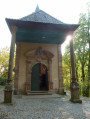
(5) Saint-Gangolphe Chapel, built in 1446, was extended with a side chancel in 1778. Its murals, which depict the saint’s life, are said to be the work of a pupil of Martin Schongauer. Patron saint of springs and protector of marriage, Gangolphe is at the heart of a local legend: whilst stopping in Florival, he is said to have planted his pilgrim’s staff in a meadow, from which a spring immediately gushed forth, and then built a hermitage nearby. A notice also depicts a mural in which his unfaithful wife is burned upon contact with the water. On one wall of the chapel, a walled-up stone arch bears an inscription in Gothic script, and the nearby fountain preserves the remains of a stone basin dating from 1664.

(6) The Col du Bannstein links Florival to the Vallée Noble, near Soultzmatt. Its name means ‘ban stone’, in other words a boundary marker denoting the limit of a municipal territory.

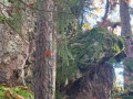
(8) The Hochfelsen, the ‘high rock’, consists of large boulders covered in moss, set amidst the forest.

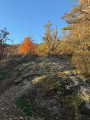
(9) The Rochers de l’Engelstein form an exposed rocky passage amidst the trees. The summit of the Engelstein lies about 250 m to the north-west, off the route.

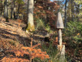
Between (11) and (12), wooden sculptures (a birdbox, mushrooms) stand by the side of the path, which offers an unobstructed view of the Alsace plain further down.

(16) The view looks down over the village and the cemetery chapel, the former parish church of Saint John the Baptist. Built in the 13th century, it was reduced to its chancel in 1838.

Other walks in the area

For more walks, use our search engine .

The GPS track and description are the property of this route's author. Please do not copy them without permission.