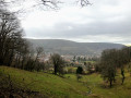
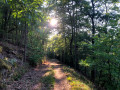
The Cuckoo Trail in Saint-Gangolphe

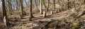
This path, well known to older residents, used to be a pleasant place for a walk before being severely damaged by forestry work. The forestry group, made up of local councillors, took charge of its restoration: over 150 hours of voluntary work, the installation of numerous drainage systems and the delivery of more than 100 tonnes of stone.
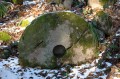
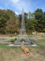
Following a proposal by Julie Ritter, an ONF officer, Rémy Salomon, a professional woodcutter and French woodcarving champion, created several remarkable works of art.
This ‘cuckoo trail’ now enriches the local heritage, for the enjoyment and well-being of all.

Details

n°45561595
Creation:
Last update:
Last review:
  • Walking
    Activity: Walking
  • ↔
    Distance: 0.91 mi
  • ◔
    Average duration: 0h 35 
  • ▲
    Difficulty: Easy

  • ⚐
    Back to start: Yes
  • ↗
    Ascent: + 151 ft
  • ↘
    Descent: - 151 ft

  • ▲
    Highest point: 1,447 ft
  • ▼
    Lowest point: 1,296 ft

Description of the walk

Parking on Rue de la Chapelle, near the Saint-Gangolphe Chapel.

(S/E) “From the chapel, take a moment to read the two signs: ‘Route des légendes’ and
‘Lautenbach-Schweighouse: Past and Present’.'' Take the path on the left, heading towards the Col du Bannstein, until you reach the first junction.

(1) Take the first path on the right, then turn right towards ‘Chemin du coucou’. Take a moment to admire Mr Salomon’s sculptures and sit on one of his benches to take in the view. Continue to the next gate.

(2) There, head straight ahead and follow the path which joins the forest track at the two ponds, keeping to the right at all times.

(3) Then, turn right towards the chapel, at the ponds (S/E).

Waypoints

  1. S/E : mi 0 - alt. 1,332 ft - Chapelle Saint Gangolphe
  2. 1 : mi 0.23 - alt. 1,394 ft - Crossroads
  3. 2 : mi 0.48 - alt. 1,437 ft - Barrier
  4. 3 : mi 0.76 - alt. 1,296 ft - Ponds
  5. S/E : mi 0.91 - alt. 1,332 ft - Chapelle Saint Gangolphe

Notes

A second starting point is available at Rue Saint-Gangolphe: take Rue Saint-Gangolphe and continue straight on until you reach the edge of the forest.
To reach Rue Saint-Gangolphe from the chapel, follow the signs for Col du Bannstein to return to the starting junction at the end of Rue Saint-Gangolphe.

At (2), you can turn right and head straight to the chapel.

Worth a visit

Reviews and comments

5 / 5
Based on 1 review

Reliability of the description
5 / 5
Ease of following the route
5 / 5
Route interest
5 / 5
Azimut71
Azimut71

Overall rating : 5 / 5

Date of your route : Sep 04, 2024
Reliability of the description : ★★★★★ Very good
Ease of following the route : ★★★★★ Very good
Route interest : ★★★★★ Very good
Very busy route : No

There isn’t much space to park.
The forest tracks are very pleasant.

Machine-translated

Other walks in the area

For more walks, use our search engine .

The GPS track and description are the property of this route's author. Please do not copy them without permission.