


Refine your search for walks in Lac des Dix
Lac des Dix walks


 Cabane des Dix – Prafleuri Hut
 Visorando Member
 7.23 mi
 +1,919 ft
 -2,756 ft
 5h 00
 Difficult
 Departure from Hérémence (Valais)
This fifth stage will take you from the Cabane des Dix to the Cabane de Prafleuri. The route begins with a steep descent to Lac des Dix. This lake is held back by the Grande Dixence dam, the highest in the world. The route then follows the lake’s shore to the junction leading to the private Ecoulaies hut and on to the Col des Roux. At the pass, the descent leads quickly to the Prafleuri Hut.
Walks near Lac des Dix
Prafleuri Hut – Louvie Hut
6.89 mi
+2,343 ft
-3,714 ft
5h 10
Difficult
Departure from Hérémence (Valais)
This sixth stage will take you from the Prafleuri Hut to the Louvie Hut. The route begins with the ascent to the Col de Prafleuri. The descent takes you down scree before you begin another climb up to the Col de Louvie (some sections require you to use your hands). The Col de Louvie is the perfect spot to take a break and enjoy the panoramic views of the Combins. A long descent will take you to the Louvie Hut, situated at the far end of the lake.
Cabane de Prafleuri - Cabane des Dix
 6.98 mi
+2,710 ft
-1,870 ft
5h 35
Difficult
Departure from Hérémence (Valais)
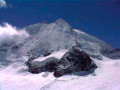
This seventh stage takes place in high mountains and, depending on the season, may involve crossing snowfields.From the Prafleuri hut, head towards the Col des Roux, then descend to Lac des Dix. Walk along the lake to the south-eastern end, where you will find signs for the Cabane des Dix. The path follows the glacier moraine and then goes around Tête Noire to reach the Cabane des Dix. Views of Mont Blanc de Cheilon, La Ruinette and Pigne d'Arolla.
Prafleuri hut - La Sage lodge
 12.28 mi
+4,327 ft
-7,536 ft
10 hrs
 Very difficult
Departure from Hérémence (Valais)
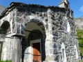
Today's stage is unusual: it starts with a descent before a long climb, a second descent and a chairlift transfer, followed by a flat walk and a bus ride to the lodge.
Cabane des Dix - Arolla
 6.72 mi
+974 ft
-3,934 ft
3h 55
Difficult
Departure from Hérémence (Valais)
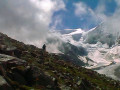
This eighth stage takes place in high mountains and, depending on the season, may involve crossing snowfields. From the Cabane des Dix, return to the Pas de Chèvres / Col de Riedmaten junction. Return to the Pas de Chèvres after a long passage through scree and large boulders. Ladders provide access to the Pas des Chèvres. The descent to Arolla follows a good path. Views of Mont Collon and Pigne d'Arolla.Pas de Chèvres or Col de Riedmaten? See the "Practical information" section.
Mauvoisin – Brunet Hut
8.46 mi
+4,094 ft
-3,219 ft
7h 25
Very difficult
Departure from Bagnes (Valais)
This eighth stage will take you from Mauvoisin to the Brunet Hut. This challenging route begins with a fairly steep climb up to the Col des Otanes. At the pass, you’ll be rewarded with an exceptional view of the Corbassière Glacier and the Grand Combin massif. The route continues with a steep descent towards the Panossière Hut, which is the perfect spot for a break. The route continues downhill, passing over the 200-metre-long Corbassière Footbridge, which overlooks the Corbassière torrent from a height of 70 metres. The landscape changes and becomes greener as you approach the Brunet Hut.
Arolla – Prarayer Mountain Hut
10.60 mi
+3,701 ft
-3,727 ft
8h 05
Difficult
Departure from Evolène (Valais)
This is the longest stage of the route but presents no difficulties other than its length and the elevation gain. The section across the glacier can be avoided by taking the moraines, which allow you to climb more directly to the right (see the route map).
Arolla - La Sage
 6.76 mi
+1,644 ft
-2,762 ft
4h 30
 Moderate
Departure from Evolène (Valais)
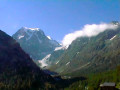
This ninth stage is more relaxing than the previous ones. Many hikers skip this section by taking a bus transfer from Arolla to La Sage or Villa. Although short and easy, this stage really has its place in the route. The trail passes by Lac Bleu and crosses the beautiful hamlet of La Gouille, typical of the Val d'Hérens, then the villages of Les Haudères and La Sage. From La Gouille to Les Haudères, the trail follows the "La Borgne d'Arolla" torrent. In the centre of Les Haudères, a sign indicates the path that climbs up to the village of La Sage.
Louvie Hut - Prafleuri Hut
 6.32 mi
+3,501 ft
-2,103 ft
8 hrs
Very difficult
Departure from Bagnes (Valais)
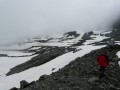
The second stage of the route involves crossing two passes, the Louvie and the Prafleuri, both of which were snow-covered.
Arolla – Cabane des Dix
6.72 mi
+4,108 ft
-1,119 ft
6h 40
Very difficult
Departure from Evolène (Valais)
This fourth stage will take you from the village of Arolla to the Cabane des Dix. The route begins with an ascent through a forest up to the Tsijiores de Nouves mountain pasture. The climb to the Remointse mountain pasture follows a winding path. The Tsijiore Nouve glacier and the Pigne d’Arolla seem very close by. The climb continues to the Col de Riedmatten (the famous pass used by the Patrouille des Glaciers). At the pass, the start of the descent is very steep but secured by chains. The route continues, skirting a lake formed by the meltwater from the Cheilon Glacier. At the Cabane des Dix/Pas du Chat junction, a final climb leads to the Cabane des Dix. To choose between thePas de Chèvres and the Col de Riedmaten, see the ‘Practical Information’ section.
Louvie Hut - Prafleuri Hut
 7.26 mi
+4,019 ft
-2,654 ft
6h 50
Difficult
Departure from Bagnes (Valais)
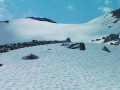
This sixth stage takes place in the high mountains and, depending on the season, may involve crossing snowfields.From Lake Louvie, climb up to Col Termin and rejoin the balcony path that comes from the Montfort Hut. Continue to Col de Louvie (possibility of snowfields). After descending Col de Louvie, the path passes at the foot of the Grand Désert Glacier. The trail then crosses scree; look out for the red and white markings and follow the signs for Prafleuri. Climb Col de Prafleuri. Descend to Torrent de Prafleuri (small bridge); on the left, a trail leads to the Prafleuri Hut.