


Refine your search for walks in Lac de la Clarée
Lac de la Clarée walks


 Lakes of the upper Clarée Valley via Les Rochilles
 Visorando Member
 8.35 mi
 +1,467 ft
 -1,470 ft
 5h 05
5h 05
 Moderate
 Departure from Névache (Hautes-Alpes)
This is an easy route that allows you to see the three most accessible lakes in the upper Clarée Valley. If the weather is fine, you won't be able to resist the temptation to cool off in the many pools created by the torrent, and the surroundings are majestic.
To the Haute Clarée peat bogs from the Laval chalets
 6.87 mi
+1,368 ft
-1,368 ft
4h 20
Moderate
Departure from Névache (Hautes-Alpes)
6.87 mi
+1,368 ft
-1,368 ft
4h 20
Moderate
Departure from Névache (Hautes-Alpes)
This easy hike will take us from the Chalets de Laval to the sources of the Clarée and their peat bogs, a real ecological treasure in their mountain setting, and incidentally to the small lake where this pretty river, often celebrated by hikers, has its source.
Walks near Lac de la Clarée
Refuge des Drayeres – Valmeinier 1,800
 10.62 mi
+2,500 ft
-3,848 ft
7h 05
10.62 mi
+2,500 ft
-3,848 ft
7h 05
 Difficult
Departure from Névache (Hautes-Alpes)
Difficult
Departure from Névache (Hautes-Alpes)
The final stage of this route runs from the Refuge des Drayeres in the Clarée Valley to the resort of Valmeinier. You will pass the Deuil des Rochilles before emerging onto three magnificent high-altitude lakes: Lac de la Clarée, Lac Rond and Lac du Grand Ban. Next comes the ascent of the Col des Plagnettes, followed by the descent with the rocky ridge of the Grande Paré to your left and the Aiguille Noire to your right, then the ascent of the Pas des Griffes, before descending back to Valmeinier, the end point of this 5-day route.
Refuge des Drayères – Pont de l’Alpe
 9.08 mi
+2,014 ft
-3,563 ft
5h 55
Moderate
Departure from Névache (Hautes-Alpes)
9.08 mi
+2,014 ft
-3,563 ft
5h 55
Moderate
Departure from Névache (Hautes-Alpes)
3rd and final stage. Starting from the Refuge des Drayères, head up to the source of the Clarée and return to Pont de l’Alpe via the Col de la Ponsonnière. A tour of the Massif des Cerces taking in numerous lakes, each more beautiful than the last: in turn, the Clarée, Rond, Grand Ban, Cerces, Ponsonnière and, finally, the Grand Lac.
Lac des Cerces - Lacs de la Madeleine via Pointe des Cerces
 7.84 mi
+3,963 ft
-3,261 ft
8 hrs
7.84 mi
+3,963 ft
-3,261 ft
8 hrs
 Very difficult
Departure from Valloire (Savoie)
Very difficult
Departure from Valloire (Savoie)
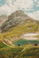
Day 2 in the Clarée Valley: ascent of Pointe des Cerces (unmarked mountain route), passage to Lac and Source de la Clarée and climb to the second bivouac at Lacs de la Madeleine (off-trail on the final section).
As with the other parts of this circular, this route is intended for experienced hikers who are accustomed to high mountains.
Lacs de la Madeleine - Lac Lavoir via Mont Thabor
 6.38 mi
+2,283 ft
-3,448 ft
7 hrs
Very difficult
Departure from Névache (Hautes-Alpes)
6.38 mi
+2,283 ft
-3,448 ft
7 hrs
Very difficult
Departure from Névache (Hautes-Alpes)
Third day of the circular with ascent of Mont Thabor (highest point of the route) via the oldGR® trail along the Roche du Chardonnet ridge and the Valmeinier Glacier, which presents certain difficulties compared to the newGR® route.
As with the other days of the circular, this route is intended for very experienced hikers who are accustomed to high mountains.
The Chemin de Ronde between Laval and Biaune
 7.22 mi
+1,680 ft
-2,484 ft
4h 45
Moderate
Departure from Névache (Hautes-Alpes)
7.22 mi
+1,680 ft
-2,484 ft
4h 45
Moderate
Departure from Névache (Hautes-Alpes)
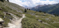
Supported by theGRP® Tour du Mont Thabor, this trail overlooks the upper Clarée Valley and offers magnificent views of this famous valley throughout the route.
Laval Refuge – Lac Blanc
 5.65 mi
+3,192 ft
-1,243 ft
5h 25
Difficult
Departure from Névache (Hautes-Alpes)
5.65 mi
+3,192 ft
-1,243 ft
5h 25
Difficult
Departure from Névache (Hautes-Alpes)
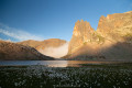
The first day offers the chance to explore the lakes of the Haute Clarée and camp at the foot of the Thabor amidst spectacular scenery.
Laval car park - Lac des Cerces
 7.23 mi
+3,537 ft
-2,254 ft
7 hrs
Very difficult
Departure from Névache (Hautes-Alpes)
7.23 mi
+3,537 ft
-2,254 ft
7 hrs
Very difficult
Departure from Névache (Hautes-Alpes)
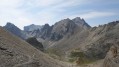
First day of a 4-day circular starting from the Laval car park in the Upper Clarée Valley. As with the other parts of this circular, this route is intended for experienced hikers who are accustomed to high mountains.
Chalet de Laval - Alpe du Lauzet
8.12 mi
+2,785 ft
-3,793 ft
6h 10
Difficult
Departure from Névache (Hautes-Alpes)
A traverse of the Cerces massif via one of its highest passes (Béraudes) and some very beautiful lakes.And a chance to see much of the previous day’s descent route, as well as the many lakes on the other side.In early summer, the route can be made difficult by the presence of snow in the Lac des Béraudes cirque or a snow cornice on the Col des Béraudes (speaking from experience).
Refuge de Terre Rouge - Le Prec
 8.76 mi
+2,165 ft
-3,848 ft
5h 55
Difficult
Departure from Valmeinier (Savoie)
8.76 mi
+2,165 ft
-3,848 ft
5h 55
Difficult
Departure from Valmeinier (Savoie)
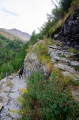
This is the last stage of this three-day route, with one last beautiful climb. A final alpine pass, a few lakes, and the return via the Fenêtre du Prec to round off this lovely Tour du Thabor.
 Association / Club / Walk leader