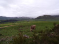
Lake Guéry

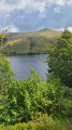
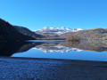
This volcanic lake is the highest in Auvergne. Situated 8 km from Mont-Dore and surrounded by mountain pastures, you may come across flocks of sheep. Do not approach them as they are guarded by Patou dogs.

Details

n°94130489
Creation:
Last update:
Last review:
–
  • Walking
    Activity: Walking
  • ↔
    Distance: 3.96 mi
  • ◔
    Average duration: 2h 15 
  • ▲
    Difficulty: Easy

  • ⚐
    Back to start: Yes
  • ↗
    Ascent: + 486 ft
  • ↘
    Descent: - 486 ft

  • ▲
    Highest point: 4,370 ft
  • ▼
    Lowest point: 4,088 ft

Description of the walk

Start from the car park at Col de Guéry.

(S/E) Leave the car park and turn left to head up to the pass. Then turn right.

(1) Turn left to reach the lake. Keep to the right and continue along the path.

(2) After the bend, turn left and then keep to the left as you walk alongside the lake.

(3) Turn right at the junction, then take the second right before the Guéry farm.

(4) At the Fork in the road, turn right and carry on straight ahead.

(5) At the junction after the stream, turn right. At the end, first turn right then left, then, at the end again, turn right.

(6) At the bend, turn left, then at the T-junction, turn right and keep to the left.

(7) At the Fork in the road, first turn right then left, then carry on straight ahead. At the end, turn right and head for the car park (S/E).

Waypoints

  1. S/E : mi 0 - alt. 4,147 ft - Car park at the - Col de Guéry
  2. 1 : mi 0.07 - alt. 4,154 ft - Col de Guéry
  3. 2 : mi 0.49 - alt. 4,131 ft - Junction after the bend - Lac de Guéry
  4. 3 : mi 1.23 - alt. 4,094 ft - Crossroads - Lac de Guéry
  5. 4 : mi 1.79 - alt. 4,255 ft - Fork
  6. 5 : mi 2.73 - alt. 4,360 ft - Crossroads after the stream
  7. 6 : mi 3.15 - alt. 4,301 ft - Bend
  8. 7 : mi 3.36 - alt. 4,229 ft - Fork
  9. S/E : mi 3.96 - alt. 4,147 ft - Car park at - Col de Guéry

Notes

No water source

Worth a visit

Waterfall

Other walks in the area

For more walks, use our search engine .

The GPS track and description are the property of this route's author. Please do not copy them without permission.