Country:

 City:


To start the walk, head to Champagne-en-Valromey. There are several parking spaces near the village church on Place Brillat Savarin, as well as on Place Raymond Juillet.
Follow the ‘VL’ stickers
(S/E) In front of the church, follow the Grande Rue for a few hundred metres, passing the village chemist’s and then the post office.
(1) Take the first road leading down to the right onto Chemin du Pré Monsieur. There is a signpost at the junction. Pass the La Virgule brewery (highly regarded local producers – a must for enthusiasts) and carry on straight ahead.
(2) After crossing a small stream, keep right at the junction sign, then let the Route du Glanon carry on to the right 50 metres further on, whilst you follow the path straight ahead.
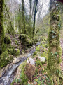
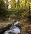
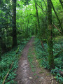
(3) Follow the path as it enters the Bois Guichard and head down it to the next junction, where you should continue down to the right. Some sections may be slippery and the slope quite steep. Follow the path running alongside the Arvière.
(4) When you reach the road, take the road on the left towards Vaux-Morets.
(5) Turn right at the ferry crossing and follow the road downhill, passing Les Ruchers de l’Arvière (a local honey producer).
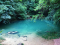
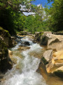
(7) Take a short detour to the left to the Source du Groin, an impressive emerald-coloured resurgence when the water level is high (may be dry in summer).
(6) Then head back the way you came.
(7) Then keep left twice.
(8) Turn right twice in the hamlet of Chongnes, following the yellow markings to the oven, then on to the fountain and the Chapelle de l’Adoue.
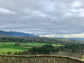
The panoramic view from this vantage point opens up to the south. From this distinctive spot, which inspired the writer Paul Claudel, continue along the path that climbs to the left of the chapel (to find out all about the history of this magical place, book a guided tour of Vieu-en-Valromey organised by the Bugey Sud Grand Colombier Tourist Office).
(9) At the top of this short, steep hill, take the road on the right, then the path that continues along it to Vieu.
(10) In front of Vieu church, turn right up Rue de l’Église. At this point, try to imagine that a Roman aqueduct runs beneath your feet for several hundred metres towards the site of the Fontaine de l’Adoue (not open to visitors).
(11) At the next junction, take the D30b on the left to reach Place Brillat Savarin (S/E) via the main street of Champagne-en-Valromey, which you should follow to the right. Do pop into the Espace Aguascalientes art gallery. La Barque Café, situated next to the church, offers a (always warm!) welcome at the end of the walk for a drink or a bite to eat.
 Tourist office
 Difficult

 Visorando Member
 Moderate