From La Bourbellière to the Sérémond viewpoint

This is a shorter alternative to the Belvédère de Sérémont snowshoe walk, which starts from Thézillieu and often follows thePR® trail marked in yellow and red, though not always.
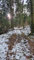
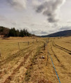
The walk is easy and pleasant in hot weather. It starts at La Bourbellière after Thézillieu; there is little tarmac, and it follows forest tracks and paths that are often shaded.
The panoramic view from the belvedere is well worth a visit.

Details

40241619
Creation:
Last update:
Last review:
  • Walking
    Activity: Walking
  • ↔
    Distance: 4.19 mi
  • ◔
    Average duration: 2h 25 
  • ▲
    Difficulty: Easy

  • ⚐
    Back to start: Yes
  • ↗
    Ascent: + 581 ft
  • ↘
    Descent: - 571 ft

  • ▲
    Highest point: 3,343 ft
  • ▼
    Lowest point: 3,018 ft

Description of the walk

Pass through Thézillieu, continue along the Route de la Bourbellière, then park at the start of the forest road before La Bourbellière, opposite the sign for the Sérémond viewpoint.

(S/E) Take the small tarmac road and head towards La Bourbellière.

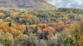
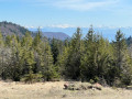
(1) Take the path on the right marked in yellow and red. Follow it to the junction with the forest track. Opposite the ‘Belvédère de Sérémond’ sign, take the path leading to the viewpoint. Enjoy the beautiful panoramic view of the mountains and villages below.

(2) Retrace your steps, then take the forest track on the right and continue to its end.

(3) Turn left onto the path that follows on from it. Follow a relatively flat section to reach another path junction.

(4) Take the left-hand path and begin a gentle climb. You’ll come to a wider track and then an X-shaped four-way junction.

(5) Turn left, continue uphill and, at the following junctions, always stay on the path on the right. At the top of the hill, you’ll reach the junction (marked by a sign for La Bourbellière).

(6) Turn right downhill and reach the edge of the woods. Turn left to return to the initial junction you passed on the way there.

(1) Turn slightly to the right and follow the route back in the opposite direction to return to the car park on the forest road (S/E).

Waypoints

  1. S/E : mi 0 - alt. 3,087 ft - Forest road car park
  2. 1 : mi 0.14 - alt. 3,143 ft - Crossroads at the end of the circular loop
  3. 2 : mi 1.32 - alt. 3,176 ft - Sérémond viewpoint
  4. 3 : mi 1.9 - alt. 3,064 ft - End of track
  5. 4 : mi 2.56 - alt. 3,048 ft - Crossroads on the ascent
  6. 5 : mi 2.92 - alt. 3,117 ft - X-shaped junction
  7. 6 : mi 3.68 - alt. 3,333 ft - Crossroads towards La Bourbellière
  8. S/E : mi 4.19 - alt. 3,097 ft - Forest road car park

Always be cautious and plan ahead when you're outdoors. Visorando and the author of this route cannot be held responsible for any accidents occurring on this route.

The GR® and PR® markings are the intellectual property of the Fédération Française de Randonnée Pédestre.

Reviews and comments

3.7 / 5
Based on 5 reviews

Reliability of the description
3.6 / 5
Ease of following the route
3.8 / 5
Route interest
3.6 / 5
EMPTDM72
EMPTDM72

Overall rating : 4 / 5

Date of your route : Jun 09, 2026
Reliability of the description : ★★★★☆ Good
Ease of following the route : ★★★★☆ Good
Route interest : ★★★★☆ Good
Very busy route : No

It was a very pleasant walk with plenty of sections through the forest, which gave us the chance to spot some wildlife

Machine-translated

ANDRE Daniel
ANDRE Daniel

Overall rating : 2.7 / 5

Date of your route : May 07, 2026
Reliability of the description : ★★☆☆☆ Disappointing
Ease of following the route : ★★★☆☆ Average
Route interest : ★★★☆☆ Average
Very busy route : No

Hike completed on Thursday 7 May 2026
After the Sérémond viewpoint, the trail markings are virtually non-existent.
Between points 5 and 6, the trail leads onto a path cluttered with dead trees and reaches the boundary of private land.
The section between points 4 and 6 takes you through a landscape ravaged by logging.
What’s more, you might think I’m being critical, but once again, Météo France got its forecast completely wrong.
At 80, you start to get a bit fussy...
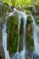
Fortunately, we had previously revisited the Clairefontaine waterfall, which was still magnificent after three days of rain.
There’s often joy to be found in hiking; believe me, I’m convinced of it!
Daniel

Machine-translated

andomir
andomir

Overall rating : 3.7 / 5

Date of your route : Apr 29, 2026
Reliability of the description : ★★★★☆ Good
Ease of following the route : ★★★★☆ Good
Route interest : ★★★☆☆ Average
Very busy route : No

A leisurely walk through the woods. Stunning views from the Seremond viewpoint.
Use of a GPS is recommended

Machine-translated

Thomas73
Thomas73

Overall rating : 4 / 5

Date of your route : Nov 11, 2024
Reliability of the description : ★★★★☆ Good
Ease of following the route : ★★★★☆ Good
Route interest : ★★★★☆ Good
Very busy route : No

An easy and pleasant route through the forest with a lovely view from the lookout point, despite the thick clouds in the valley.

On the way back, the paths are less clearly marked and the forest is very cluttered following the storms and the foresters’ work.

Machine-translated

Eve Lyne01800
Eve Lyne01800

Overall rating : 4 / 5

Date of your route : Aug 18, 2024
Reliability of the description : ★★★★☆ Good
Ease of following the route : ★★★★☆ Good
Route interest : ★★★★☆ Good
Very busy route : No

A lovely, well-shaded walk with a beautiful view

Machine-translated

Other walks in the area

For more walks, use our search engine .

The GPS track and description are the property of this route's author. Please do not copy them without permission.