Country:

 City:


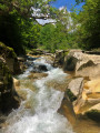
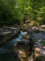
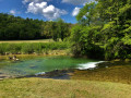
There are plenty of parking spaces available on Rue du Stade in Artemare, near the Salle Confluence and the boules court, which is where the walk starts.
(S/E) Set off along Rue du Stade towards the hamlet of Cerveyrieu.
(1) After the bridge crossing the Groin at this point, turn left onto Rue du Vaugrais (no entry for cars), continue along this narrow road for about 50 metres and turn left again to cross the bridge over the Séran.
(2) Turn left twice in succession after the bridge. Hiking signposts indicate the correct direction.
(3) At the information board for the Fierloz Interpretive Trail about bats, continue left until you reach the road.
(4) At the road, turn left and follow the road carefully for 150 metres, crossing the Séran again.
(5) Take the first right after the bridge and continue straight on along the path named after the Séran, a tributary of the Rhône.
(6) At Pra Rui, turn right and continue to follow the Séran as far as Marlieu and the underpass beneath the railway line. Continue along the Séran to the next road.
(7) Turn left and follow this quiet road for nearly 2 km towards Talissieu.
(8) Cross the D904 and carry on straight ahead to the pretty village of Talissieu, passing an unusual wash house by the small bridge.
(9) Turn left onto Rue du Joli Bugey (you couldn’t make it up). Turn right at the first junction towards Rue de Bâcon and head up to the left of the cross towards the village church.
(10) Turn right at the junction before the ferry, and continue uphill along Rue du Vieux Bac.
(11) Leave the road by taking the Chemin des Chèvres on the right.
(12) At the signpost marking the hiking trail junction, turn right and continue uphill along this steep path.
(13) When you rejoin the GR® de Pays Balcon du Valromey, follow it to the left, pass the viewpoint and follow the GRP® to Charaillin, keeping straight on.
(14) In Charaillin, turn right and follow the yellow and red GRP® markings towards Vieu.
(15) Leave the Route de la Lavanche by heading down towards the Golet de la Messe. Continue along this road downhill to the departmental road, passing a junction and the church on your right.
(16) Turn right onto the D105 and follow it for 250 metres.
(17) Take the first left at the cross and follow this road for 250 metres. Pass the road leading to the Ferme de la Blada on your right.
(18) Take the small road on the right as it climbs, following the signs on a hiking signpost. Continue along this section of the Balcon du Valromey. At the junction in a sharp right-hand bend, continue to the left, before staying on the path on the right until you reach the road.
(19) Turn left and follow the D69 downhill to a small track (also signposted for mountain bikes), which takes you off the road; take this track. Then follow it to the right until you reach the road.
(20) Head briefly back up the D69 to the right until you reach the sign for Vaux Morets and Source du Groin. Follow these directions to the left until you reach Vaux Morets. Carry on straight ahead at the ferry crossing until you reach Source du Groin.
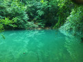
(21) A short detour of about a hundred metres takes you to the spring, an impressive resurgence and a Sensitive Natural Area in the Ain department. Then return to the junction and turn left, then left again.
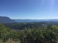
(22) In the hamlet of Chongnes, take the first steep road on your right and turn right again towards the Fontaine de l’Adoue. You can enjoy an unobstructed view to the south from here. Continue along the path to the left of the chapel.
(23) At the top of the steep path above the chapel, turn right and carry on to Vieu, following the GR® de Pays signposts.
(24) In front of the church in Vieu (an ancient Roman vicus), turn left then right, following the signs for Thurignin. At the end of Rue des Seez, turn left and follow the road for 50 metres, then turn right and leave the road at the first junction.
(25) When you rejoin a tarmac road, turn right. Turn left after 30 metres to follow another road downhill. Follow the road to the next junction. A signpost marked ‘Gare de Vieu’ indicates that you should continue straight ahead along a dirt track to the Gorges de Thurignin. On this dirt track, turn left at the first junction.
(26) At the gorges, stay on the same bank and follow the Séran downstream along a path that is sometimes damp.
(27) At La Chaponnière, a hiking sign indicates that you should turn right and follow the signs for the Cerveyrieu waterfall. At the ‘Give Way’ sign, cross the road and continue straight on along the path that starts opposite.
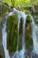
(28) When you reach the road again, take a short detour by turning right, crossing the bridge and walking to the viewpoint above the Cerveyrieu Waterfall. Back at this junction, carry on straight ahead along the road, uphill, until you reach the ‘Stop’ sign. Turn right towards the hamlet of Chassin. Walk through Chassin until you see a sign on the right for ‘Le Chemin du Golet au Loup’.
(29) Walk down the Chemin du Golet au Loup to Cerveyrieu, following the main path. At the bottom of Rue des Charrieres, turn left and follow this road to the car park (S/E).
 Visorando Member
 Moderate

 Tourist office
 Easy