The Venice of Beauce

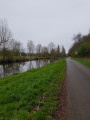
Bonneval invites you to take a stroll to discover its medieval town and its moats. Extend your walk with a trip on an electric boat through the ‘Little Venice of Beauce’, where you’ll discover numerous wash houses and waterways.

Details

23909079
Creation:
Last update:
Last review:
  • Walking
    Activity: Walking
  • ↔
    Distance: 1.43 mi
  • ◔
    Average duration: 0h 40 
  • ▲
    Difficulty: Easy

  • ⚐
    Back to start: Yes
  • ↗
    Ascent: + 10 ft
  • ↘
    Descent: - 10 ft

  • ▲
    Highest point: 410 ft
  • ▼
    Lowest point: 394 ft
  • ⚐ Country: France
  • ⚐ City: Bonneval (28800)
  • ⚑
    Start/End: N 48.181747° / E 1.385223°
  • ❏
    IGN map(s): Ref. 2018SB
  • Hour-by-hour weather

Description of the walk

Parking is available on Place Saint-Roch (except on Mondays, market day), with a second car park on Rue de la Résistance.
Follow the yellow signposts.

(S/E) From Place Saint-Roch, turn left onto Rue Saint-Roch towards the town hall. Walk past Notre-Dame Church and continue along Rue Hérisson. Ignore Rue d’Enfer and carry on to the next junction.

(1) Turn left into Rue Billault until you reach the bridge, then turn right onto Rue des Fossés Hérisson.
Follow the River Loir and walk past Saint-Florentin Abbey. Carry straight on along Rue des Fossés Saint-Jacques, passing the façade of the Maison du Cheval Blanc (a 13th-century residence). Continue to the Stop sign and Rue de la Résistance.

(2) At the ‘Stop’ sign, turn left, follow Rue de la Résistance and pass the former coaching inn with its 15th-century façade and mullioned windows. Cross the River Loir and turn right onto Rue du Verglas, which passes under the railway line and continues along the banks of the River Loir to the Moulin du Pont.

(3) Turn right into Rue du Pont de Boisville and walk past the 13th-century Porte de Boisville. Turn right into Rue Saint-Michel until you reach the 13th-century Porte Saint-Roch, then head to the car park (S/E).

Waypoints

  1. S/E : mi 0 - alt. 404 ft - Place Saint-Roch
  2. 1 : mi 0.15 - alt. 400 ft - Crossroads – Rue Billaul
  3. 2 : mi 0.65 - alt. 404 ft - Stop – Rue de la Résistance
  4. 3 : mi 1.03 - alt. 410 ft - Moulin du Pont - Loir (rivière)
  5. S/E : mi 1.43 - alt. 404 ft - Place Saint-Roch

Notes

Worth a visit

- Things to do:
Bonneval Canoe and Kayak Club.
Bonneval Harbour Master’s Office.
L’Océanide Aquatic Centre.

Local produce:
Megret Farm.
Gamm Vert Bonneval.
Les Vergers de Beauce.

Reviews and comments

4.5 / 5
Based on 2 reviews

Reliability of the description
4.5 / 5
Ease of following the route
4.5 / 5
Route interest
4.5 / 5
User 26326286

Overall rating : 5 / 5

Date of your route : Aug 19, 2026
Reliability of the description : ★★★★★ Very good
Ease of following the route : ★★★★★ Very good
Route interest : ★★★★★ Very good
Very busy route : No

A very easy route to follow

Machine-translated

Bienvenuebrigitte
Bienvenuebrigitte

Overall rating : 4 / 5

Date of your route : Jan 29, 2024
Reliability of the description : ★★★★☆ Good
Ease of following the route : ★★★★☆ Good
Route interest : ★★★★☆ Good
Very busy route : No

A really interesting route for exploring this village

Machine-translated

Other walks in the area

For more walks, use our search engine .

The GPS track and description are the property of this route's author. Please do not copy them without permission.