Route du Mont Rainfer to La Malfiance

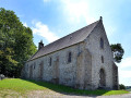
This very hilly route on the outskirts of Coutances will take you through all the different levels and landscapes of the valley through which the Malfiance river flows. In addition to the local architecture, which combines the grey schist of Nicorps, Cambernon diorite (used for doors and windows) and earth and stone, the route takes you past some beautiful buildings (manor houses, dovecotes, vicarages and churches) characteristic of the Coutances region.

Details

n°15918070
Creation:
Last update:
Last review:
  • Walking
    Activity: Walking
  • ↔
    Distance: 9.42 mi
  • ◔
    Average duration: 5h 00 
  • ▲
    Difficulty: Moderate

  • ⚐
    Back to start: Yes
  • ↗
    Ascent: + 728 ft
  • ↘
    Descent: - 735 ft

  • ▲
    Highest point: 358 ft
  • ▼
    Lowest point: 56 ft

Photos

Description of the walk

Parking at the car park in the centre of Saussey.
Yellow signposting

(S/E) From the car park, head towards the Manoir along the street of the same name.

(1) At the bend, look out for the return path on the right and continue along the street until you reach the junction with the D7. Cross this road carefully to find a footpath opposite. After 100 metres, turn first right and then left along this path.

(2) At this junction, turn left, then right, and finally take the second left to come out onto a road. Then turn right.

(3) At the next junction, turn left. Ignore the first junction and carry on straight ahead until you reach a small road at La Herrerie.

(4) Turn sharply right to join the D27 on the other side. On this road, turn right, then take the first street on the left, Rue de Brotherlandes, to reach the village of Nicorps, passing by the inn of the same name. Pass the Town Hall and the Village Hall, and continue along this road until you reach the Hôtel Danlos.

(5) Take the path on the right. Ignore two turnings on the right, then keep to the right towards the Petit Château. Continue to the right along the small road.

(6) Carefully cross the D27 towards La Coliberdière, and follow the Route du Mont Rainfer. Walk past La Siennerie and let the access road to La Benserie branch off to the left.

(7) Turn left onto a footpath.

(8) At the end of the path, turn right towards La Brouèze, then La Muette des Prés and finally L’Hullerie. Then turn right at a 90° angle onto a small road which quickly becomes a path. Stay on this path until it ends. Then turn left onto the small road towards Le Claquet. Cross the D7 to reach Rue du Manoir.

(9) Turn left and follow the La Planche stream

(10) Cross the D73 (Route de Hyenville). Then turn left before La Motterie

(11) Turn right onto the footpath and continue towards La Butte, which you’ll reach after first turning right then left.

(12) At the D235, turn right towards La Véronnerie. Cross the D73 again, then stay on this road until the next junction with the D299.

(13) Turn left. Very soon, take a path on the right to rejoin the road you left earlier. Turn right towards Bretteville, then turn left onto the Chemin du Mont. Continue to La Coleterie, then keep to the right to return to La Gauderie.

Turn left and return to the starting point of this walk (S/E).

Waypoints

  1. S/E : mi 0 - alt. 154 ft - Car park in the centre of Saussey
  2. 1 : mi 0.2 - alt. 108 ft - Junction with the Mont Rainfer circular loop
  3. 2 : mi 0.71 - alt. 253 ft - At the junction, turn left
  4. 3 : mi 1.37 - alt. 302 ft - Crossroads; turn left
  5. 4 : mi 1.9 - alt. 308 ft - La Herrerie, on the right
  6. 5 : mi 2.61 - alt. 272 ft - The Hôtel Danlos
  7. 6 : mi 3.42 - alt. 338 ft - D27
  8. 7 : mi 4.06 - alt. 315 ft - Path on the left
  9. 8 : mi 4.49 - alt. 128 ft - La Brouèze
  10. 9 : mi 5.79 - alt. 102 ft - Junction
  11. 10 : mi 6.31 - alt. 72 ft - D 73
  12. 11 : mi 6.78 - alt. 213 ft - Marker 66, on the right
  13. 12 : mi 7.4 - alt. 141 ft - D235
  14. 13 : mi 8.06 - alt. 79 ft - D299, turn left
  15. S/E : mi 9.42 - alt. 154 ft - Car park in the centre of Saussey

Notes

Difficulty: at the hamlet of Le Claquet towards the village of Saussey, rutted ground; at the hamlet of La Planche, wearing wellies is recommended.

L’Auberge de Brothelande bar and restaurant in Nicorps.
Water point in the cemetery.
Picnic tables and a communal area in Saussey.

Worth a visit

Point of interest
From L’Hullerie, a lovely view of the manor house (17th century) and the Plessis park.
The moors of Mont Rainfer form a plateau with poor, damp soil; they are home to a biodiversity (flora and fauna) typical of such environments.

Saussey Manor Museum
This 17th-century manor house, accessed via a covered approach and gardens featuring roses and boxwood, houses exceptional collections of antique glassware dating from the 1st to the 4th centuries, French glassware from the 16th to the 19th centuries, and glassware from Venice, the Netherlands, Saxony, Silesia, Bohemia, England, Spain and elsewhere. In addition to these some 3,500 pieces, the museum also displays a collection of 17th- and 18th-century French and Italian nativity scenes, made from Nevers drawn glass, ivory, bone, wax and paper.

La Planche
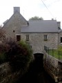
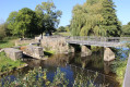
This neighbourhood has the dual distinction of being crossed by the Ruisseau de la Planche, with fords, and of boasting a number of beautiful old houses. It is just a stone’s throw from the former vicarage and the community hall.

The Grand Beaucoudray dovecote
Situated very close to La Malfiance, this sandstone dovecote, with a circumference of 28.5 metres and likely dating from the second half of the 16th century, is the last remaining vestige of a former manor house. With 1,200 nesting boxes, it can be estimated that the estate to which it belonged covered nearly 600 hectares and was home to around 4,000 birds.

Reviews and comments

4.7 / 5
Based on 1 review

Reliability of the description
5 / 5
Ease of following the route
5 / 5
Route interest
4 / 5
Natacha91
Natacha91

Overall rating : 4.7 / 5

Date of your route : Oct 19, 2026
Reliability of the description : ★★★★★ Very good
Ease of following the route : ★★★★★ Very good
Route interest : ★★★★☆ Good
Very busy route : No

As described. Thank you

Machine-translated

Other walks in the area

For more walks, use our search engine .

The GPS track and description are the property of this route's author. Please do not copy them without permission.