The Roguenette Valley

This trail, starting from Oisème, a village nestled along the Roguenette, invites you to discover the painters and writers of the 18th century: the Goncourt brothers, Ingres, Courbet, and Corot, who created a fresco in Gasville Church and in Saint-Julien Chapel in Chartres.

Details

23024973
Creation:
Last update:
Last review:
  • Walking
    Activity: Walking
  • ↔
    Distance: 4.37 mi
  • ◔
    Average duration: 2h 10 
  • ▲
    Difficulty: Easy

  • ⚐
    Back to start: Yes
  • ↗
    Ascent: + 135 ft
  • ↘
    Descent: - 144 ft

  • ▲
    Highest point: 482 ft
  • ▼
    Lowest point: 384 ft

Description of the walk

Parking available at the village hall.

(S/E) From the community hall, head towards the village via Rue de la Chesnaie (at No. 12, a house painted by Soutine). Pass the crossroads and take the first path on the left (be careful, it’s a narrow path between the gardens at the top of the street). You’ll reach a much wider dirt track.
Turn right and head towards the water tower.

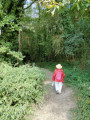
(1) Then turn left onto a wooded path, then head down a narrow track to the D134-11 (Grande Rue); turn right, then left onto Rue de la Mairie. Walk past the town hall and the schools, and cross a footbridge.

(2) Turn right onto the path running alongside the Roguenette. View of the pond and herons; view of Goulet Castle through the vegetation. Join a road on the left.
You can take a 20-metre detour along the Chemin du Goulet to see the Château du Goulet (private property; home to Camille Marcille (1816–1875), a wealthy patron of the arts and heir to a collection of 18th-century paintings).

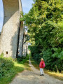
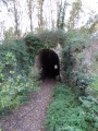
(3) Turn right onto Rue du Biloir. At the end, take the second left onto Rue de la Madeleine, then turn right onto Rue du Bois des Caves until you reach the viaduct (built in 1907: 260 metres long, with 18 arches, intended to link Chartres to Paris via Palaiseau by train).

(4) Follow a path on the right which leads onto the Route de Saint-Prest; follow this to the left for 200 m.

(5) Head up into the forest on the right along a path. On the plateau, turn left and head back down to a road junction on the Route de Saint-Prest; take this to the right for 200 m.

(6) Take a track on the right (pumping station). Continue along a path that runs through a small valley. At the end of the clearing, turn left and head towards a junction.

(7) Pass a small stream on your left. The path climbs slightly and reaches a plateau.
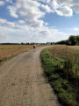
Turn right, then walk along the plateau (the old gatekeeper’s cottage can be seen in the distance on the right).

(8) Cross the railway line and continue along the track until you reach the road which leads, to the left, back to the starting point (S/E).


Waypoints

  1. S/E : mi 0 - alt. 472 ft - Oisème multi-purpose hall
  2. 1 : mi 0.55 - alt. 472 ft - Water tower
  3. 2 : mi 0.89 - alt. 397 ft - Roguenette (rivière) - Affluent de l'Eure
  4. 3 : mi 1.09 - alt. 417 ft - Rue du Biloir
  5. 4 : mi 1.5 - alt. 410 ft - Viaduct
  6. 5 : mi 1.78 - alt. 407 ft - Forest path
  7. 6 : mi 2.74 - alt. 387 ft - Pumping station
  8. 7 : mi 3.26 - alt. 413 ft - Stream
  9. 8 : mi 4.01 - alt. 479 ft - Former gatekeeper’s cottage
  10. S/E : mi 4.37 - alt. 469 ft - Oisème multi-purpose hall

Worth a visit

Things to do:
- introductory flight – Chartres Flying Club
- Chartres Gliding Centre

Reviews and comments

3.9 / 5
Based on 6 reviews

Reliability of the description
3.8 / 5
Ease of following the route
4.2 / 5
Route interest
3.8 / 5
Marco Pagotto
Marco Pagotto

Overall rating : 4.3 / 5

Date of your route : May 28, 2026
Reliability of the description : ★★★★☆ Good
Ease of following the route : ★★★★☆ Good
Route interest : ★★★★★ Very good
Very busy route : No

The La Roguenette Valley is an ideal hike during a heatwave as it’s very refreshing if you walk the route in the opposite direction.
I’d advise setting off early in the morning. Some of the paths are overgrown with grass, so make sure you wear long trousers and sturdy shoes.

Machine-translated

EH
EH

Overall rating : 3.7 / 5

Date of your route : Jan 14, 2025
Reliability of the description : ★★★☆☆ Average
Ease of following the route : ★★★★☆ Good
Route interest : ★★★★☆ Good
Very busy route : No

Soutine’s house is not the starting point, and you’ll need to retrace your steps to find the first path. However, as the first part of the route is impassable, you can continue straight on past Soutine’s house and take the first left to reach point 2. This gives you a view of the old town with its pretty houses.
Make sure you wear good walking shoes: due to heavy rain in the second section through the woods, some areas are flooded and very muddy.

Machine-translated

eclo5326
eclo5326

Overall rating : 3.7 / 5

Date of your route : May 20, 2024
Reliability of the description : ★★★★☆ Good
Ease of following the route : ★★★★☆ Good
Route interest : ★★★☆☆ Average
Very busy route : No

Hello
Following a landslide, there are signs almost at the start of the route. It’s essential to follow them. You’ll rejoin the actual route a little further on.
However, near the end, you pass by land occupied by travellers (who no longer travel), and they have very aggressive dogs – fortunately, they’re small dogs. And of course, nobody takes any interest in what they’re up to.
It must be their alarm system 🤔
I wouldn’t recommend this route with children.
Only the sound of your footsteps prevents you from being bitten.
In my opinion, there’s no hope of sorting this out.

Machine-translated

LL04
LL04

Overall rating : 2.7 / 5

Date of your route : Aug 05, 2023
Reliability of the description : ★★★☆☆ Average
Ease of following the route : ★★★☆☆ Average
Route interest : ★★☆☆☆ Disappointing
Very busy route : Yes

Hello, the start of the route isn’t very well signposted.
To be honest, we’re not really following the Roguenette route.

Machine-translated

Chartraine
Chartraine

Overall rating : 4.7 / 5

Date of your route : Aug 28, 2023
Reliability of the description : ★★★★☆ Good
Ease of following the route : ★★★★★ Very good
Route interest : ★★★★★ Very good
Very busy route : No

A really lovely walk, most of which takes place under the trees, deep in the forest – perfect for summer. Surprisingly, the streams hadn’t even run dry, even though it was late August and we were in the middle of a drought.
Only the final section on the plateau at the edge of the forest is out in the open.
There are a few hundred metres to walk along a quiet road.
There’s a bit of an uphill climb on stony paths that can be slippery, so make sure you wear proper walking boots.
Please note that Soutine’s house is off the route described; you’ll need to retrace your steps for about a hundred metres after seeing it to take the small path between the houses
Follow the yellow markings; there’s no risk of getting lost.

Machine-translated

bibi28
bibi28

Overall rating : 4.7 / 5

Date of your route : May 18, 2023
Reliability of the description : ★★★★★ Very good
Ease of following the route : ★★★★★ Very good
Route interest : ★★★★☆ Good
Very busy route : No

Please note that the house painted by Soutine is not on the path; if you go to see it, you’ll need to turn back afterwards to start the path between the two houses.

Machine-translated

Other walks in the area

For more walks, use our search engine .

The GPS track and description are the property of this route's author. Please do not copy them without permission.