Rabuchon Forest via Village Colson

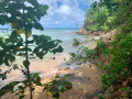
A walk best enjoyed in dry weather if possible. A picnic area with plenty of huts where families and children gather. The stream will provide a refreshing dip if needed.

Details

46876990
Creation:
Last update:
Last review:
  • Walking
    Activity: Walking
  • ↔
    Distance: 4.66 mi
  • ◔
    Average duration: 3h 35 
  • ▲
    Difficulty: Moderate

  • ⚐
    Back to start: Yes
  • ↗
    Ascent: + 1,634 ft
  • ↘
    Descent: - 1,611 ft

  • ▲
    Highest point: 2,169 ft
  • ▼
    Lowest point: 873 ft

Description of the walk

Head to Village Colson via the N3 to the hamlet of Les Nuages. Access is via the agricultural integration farm. Park in the spaces available at the side of the road.

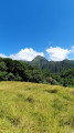
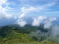
(S/E) Take the path along the hillside, heading east. As you climb to the top of the meadow, there’s a stunning view of the Pitons du Carbet.

(1) The track continues through the undergrowth along a fairly steep path. Ropes are in place to make the climb easier. Once at the top, the path descends to rejoin the Bouliki circular trail.

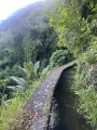
(2) Turn left to head back down. The descent can be slippery, with steps in places. You’ll reach the Rivière Blanche.

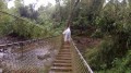
(3) Cross a rope bridge over the river. Just after this, you can relax at a picnic area with several huts. Once you’ve rested by the river, the return journey takes you downstream along the road for about 500 metres, with a ford just past the picnic area.

(4) Continue south-east along the local track, passing a ravine.

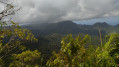
(5) About twenty metres further on, turn right and head up through the meadow before reaching the forest and the clay steps. Climb all the way to the top of the path to find a hunters’ hut and a view of the three islets and Montagne Vauclin.

(6) Continue along the path, which is now less steep, until you reach the junction from the outward journey.

(2) Turn left and head back down: watch out for slippery patches – the ropes are very useful.

(1) Once at the bottom, cross the shaded meadow and make your way back to the car park (S/E).

Waypoints

  1. S/E : mi 0 - alt. 1,926 ft - Les Nuages
  2. 1 : mi 0.16 - alt. 2,060 ft - View of the Pitons du Carbet
  3. 2 : mi 0.55 - alt. 1,998 ft - Circular Bouliki junction
  4. 3 : mi 1.39 - alt. 1,004 ft - Rope bridge
  5. 4 : mi 1.73 - alt. 951 ft - Junction with the local road
  6. 5 : mi 2.25 - alt. 873 ft - Junction on the right
  7. 6 : mi 3.2 - alt. 1,795 ft - Hunting lodge, viewpoint
  8. S/E : mi 4.66 - alt. 1,926 ft - Les Nuages

Worth a visit

The picnic area can be reached via the Saint-Joseph road.

Reviews and comments

5 / 5
Based on 2 reviews

Reliability of the description
5 / 5
Ease of following the route
5 / 5
Route interest
5 / 5
User 25840724

Overall rating : 5 / 5

Date of your route : Feb 02, 2026
Reliability of the description : ★★★★★ Very good
Ease of following the route : ★★★★★ Very good
Route interest : ★★★★★ Very good
Very busy route : No

The Rabuchon forest is exceptionally beautiful and diverse, with the most "heart-warming" river and picnic area. The start is quite difficult but perfectly maintained. Not to be missed.

Machine-translated

Magali N
Magali N

Overall rating : 5 / 5

Date of your route : Aug 12, 2024
Reliability of the description : ★★★★★ Very good
Ease of following the route : ★★★★★ Very good
Route interest : ★★★★★ Very good
Very busy route : No

It’s a really lovely route that we did on 8 August 2024, going in the opposite direction to the recommended route – so towards the end you get a 360° view stretching from the Anses d’Arlet all the way to Fort-de-France. A few precautions, however: don’t attempt it in unsettled weather or if it’s rained the day before – as the path is very steep at the start, it’s very slippery even going uphill, so I can’t imagine how slippery it must be on the way down! Also watch out for cows towards the end of the route. The picnic area by the car park is very popular, but you’re sure to find a quiet spot to wade into the river up to your shoulders.
A must-do if you’re feeling fit.

Machine-translated

Other walks in the area

For more walks, use our search engine .

The GPS track and description are the property of this route's author. Please do not copy them without permission.