Pointe Banane and Bois Pothau

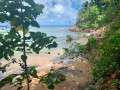
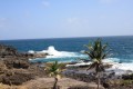
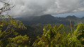
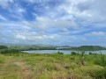
A beautiful walk offering a comprehensive view of Martinique’s various coastal environments and biotopes. It passes through the dry forest (as opposed to the more humid tropical forest), the coastline, and the various mangrove swamps. The walk extends beyond the simple Pointe Banane circular route to the sugarcane fields, offering an exceptional view. You’ll find trees such as the kapok tree and the red gum tree, as well as a few historical features, such as the two lime kilns. Locally, you can discover a typical fisherman’s hut, made of corrugated iron and wood. The route includes two beaches – one pebbly, the other sandy with turquoise waters – as well as interesting viewpoints over the Galion bays, culminating in a breathtaking 300° panoramic view of the entire bay.

Details

n°60573746
Creation:
Last update:
Last review:
  • Walking
    Activity: Walking
  • ↔
    Distance: 4.33 mi
  • ◔
    Average duration: 2h 25 
  • ▲
    Difficulty: Easy

  • ⚐
    Back to start: Yes
  • ↗
    Ascent: + 456 ft
  • ↘
    Descent: - 440 ft

  • ▲
    Highest point: 246 ft
  • ▼
    Lowest point: 0 ft

Photos

Description of the walk

Start from Pointe Savane, in a residential area with no parking facilities: park at the side of the road.

(S/E) Take the path signposted with a sign showing the route for the Pointe Banane circular path. Expect a path with stones and roots. You’ll come to a junction.

(1) Turn right, following theGR® coastal path, marked in red and white.

(2) Let the coastal path branch off to the left, and turn right to follow the Pointe Banane circular path, passing the first mangrove.

(3) Turn right to start the circular loop. There’s a small viewpoint along the way.

(4) Head down towards the mangrove on the left (before that, you can go down to the pebble beach overlooking Cayol Bay).

(5) At the end of the path, on the right, is the first lime kiln. Then head off to the left, skirting the beach, and you’ll reach Pointe Banane beach (which has two picnic tables).

(6) Why not enjoy a quick dip in the turquoise waters? Continue along the coast to the left, passing the mangrove swamp and its mangrove trees twice. You’ll reach the junction of the Pointe Banane circular loop.

(3) Follow the route back in the opposite direction to the way you came, until you reach the next junction, where you’ll rejoin theGR® (Nord Atlantique Côtier).

(2) Follow it to the right, towards Trinité.

(7) At the next junction, stay on the coastalGR®, heading towards Trinité. About fifty metres further on, watch out for a misleading sign: to follow the path to Trinité, turn left. (However, if you veer slightly to the right, you’ll find the second lime kiln.) As you walk up alongside the mangrove on your right, you’ll come across an abandoned fisherman’s hut – a 150-metre round trip, very rustic… Retrace your steps to rejoin the path running alongside the mangrove. You’ll emerge into a field of sugar cane, after a brief stop at a viewpoint overlooking the bay.

(8) Turn right and follow the farm track up through the plantations. Walk almost to the edge of the woodland, then take the path on the right which continues uphill.

(9) At the top of the sugarcane field: a panoramic view of the bay. Head off to the right again to walk alongside the woodland.
Almost at the end of the field, look for the small path leading back up into the woodland on your left (not easy to spot). You’ll come back to the junction you passed on the way out.

(1) Follow the route back in the opposite direction to return to the car park (S/E).

Waypoints

  1. S/E : mi 0 - alt. 151 ft - Residential area
  2. 1 : mi 0.49 - alt. 240 ft - Crossroads at the end of the circular loop
  3. 2 : mi 1.04 - alt. 3 ft - Towards Point Banane
  4. 3 : mi 1.15 - alt. 7 ft - Pointe Banane circular junction
  5. 4 : mi 1.65 - alt. 36 ft - Gravel beach
  6. 5 : mi 1.81 - alt. 3 ft - Lime Kiln
  7. 6 : mi 1.91 - alt. 0 ft - Pointe Banane Beach
  8. 7 : mi 2.93 - alt. 16 ft - Crossroads towards Trinité
  9. 8 : mi 3.32 - alt. 7 ft - Sugar cane fields
  10. 9 : mi 3.53 - alt. 164 ft - 300° panoramic view over Galion Bay
  11. S/E : mi 4.33 - alt. 151 ft - Residential area

Notes

No particular difficulties and no steep gradients, but do wear sturdy footwear as the path is covered in roots, mud and stones; not recommended for running.

Always be cautious and plan ahead when you're outdoors. Visorando and the author of this route cannot be held responsible for any accidents occurring on this route.

The GR® and PR® markings are the intellectual property of the Fédération Française de Randonnée Pédestre.

Reviews and comments

3.8 / 5
Based on 2 reviews

Reliability of the description
4 / 5
Ease of following the route
4 / 5
Route interest
3.5 / 5
Vince Cho
Vince Cho

Overall rating : 4 / 5

Date of your route : Apr 19, 2025
Reliability of the description : ★★★★☆ Good
Ease of following the route : ★★★★☆ Good
Route interest : ★★★★☆ Good
Very busy route : Yes

A lovely route, alternating between woodland, mangrove swamp and sugarcane fields. Suitable in dry weather, though the mangrove swamp remains a little damp; watch out for roots and stones in the woodland – you’ll need sure-footedness.
There are a few sections where you can smell sargassum between points 3 and 4.
As you leave the mangrove at point 8, head straight up into the sugarcane field and do not follow the GR, which heads off to the right towards La Trinité.

Machine-translated

Oleron1
Oleron1

Overall rating : 3.7 / 5

Date of your route : Nov 28, 2024
Reliability of the description : ★★★★☆ Good
Ease of following the route : ★★★★☆ Good
Route interest : ★★★☆☆ Average
Very busy route : No

A very muddy route. Allow 1.5 times the stated duration. The route is mostly shaded, often through mangrove woodland, with your feet in the mud.

Machine-translated

Other walks in the area

For more walks, use our search engine .

The GPS track and description are the property of this route's author. Please do not copy them without permission.