The Tour du Faudé from Orbey

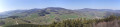
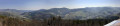
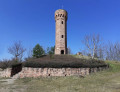
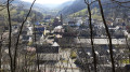
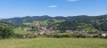
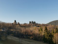
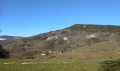
A lovely forest walk with a magnificent viewpoint from which to admire the Pays Welsche. From the top of the tower, you’ll enjoy a 360° panorama. The viewing platform is equipped with picnic tables, making it the perfect spot for a lunch break.

Details

20375697
Creation:
Last update:
Last review:
  • Walking
    Activity: Walking
  • ↔
    Distance: 5.50 mi
  • ◔
    Average duration: 3h 30 
  • ▲
    Difficulty: Moderate

  • ⚐
    Back to start: Yes
  • ↗
    Ascent: + 1,142 ft
  • ↘
    Descent: - 1,145 ft

  • ▲
    Highest point: 2,536 ft
  • ▼
    Lowest point: 1,532 ft

Photos

Description of the walk

The start of this walk is at the car park on Rue Charles de Gaulle, near the “Au Bois le Sire” hotel.

(S/E) From the car park, cross the Weisbach and turn left into Rue du Faudé (signposted for Lac Blanc and Munster). On the right-hand pavement, after about 150 m, look out for a path running parallel to the road, identifiable by a flight of steps and access for people with reduced mobility.

Signposting: Red Ring and Blue Ring

(1) Take this path, which runs alongside a wall and leads to a dead end. Continue to the first junction and turn right onto Rue du Faudé. (Sign: ‘No entry except for residents’ and Red Ring). Follow this small road, which quickly becomes a path. After a few bends, you’ll come to a fork.

Signposting: Blue Ring

(2) Turn right and head towards a bend in the road. Follow it on the left for a few metres until you reach a Fork in the road near a stadium. See Practical Information.

Markings: Red Ring

(3) Take the track on the right and follow the sign for Lapoutroie. Continue along this forest track until you reach the hamlet of Le Bâa. After passing the houses, stay on the Le Bâa track for a further 150 metres or so. Look out for the start of a path on the left.

Unmarked

(4) Turn left onto the ascending path. Continue until you reach another junction. Keep heading west along a path that descends towards a small farm after a bend to the north. Walk for about 80 m past this building to join a path on the left.

Signposting: Blue Disc

(5) Turn southwards into a fairly steep meadow, follow a hedge to emerge behind the “Les Alisiers” hotel. Follow the road, keeping a southerly course. At the end of the road, head for a ruined building. See Practical Information

(6) Head due south, skirting the ruined shed on your right; you’ll soon come out onto the Grand Faudé spiral track. Follow this track to the Roche du Chat Noir (a viewpoint, but also home to some antennas). Turn back and, at the Fork in the road, take the right-hand branch. Carry on to another junction and turn right (towards Tour du Faudé, Red Ring and Blue Ring). After 80 metres, look out for a direct path on the left.

Markings: Red Ring and Red Triangle.

(7) Turn left onto the direct path. Cut across two loops of the spiral track, reaching the Tour du Faudé, which comes into view as you climb.

Signposting: Red Ring.

(8) Enjoy the panoramic view from the top of the tower. Make the most of the viewing platform, equipped with picnic tables, for a well-deserved break. Begin the descent on the western side via a fairly steep path. Cross the spiral track twice. Walk to the edge of the woodland just before the Petit Faudé car park. Turn left, following the sign for Roche du Chat Noir (Blue Disc). Return almost to the Fork in the Road at Roche du Chat Noir.

Signposting: Red Triangle and Blue Disc.

(9) About 40 m before the Fork in the road, look out for a path signposted ‘Orbey’. Descend to a sports ground, go round it along a small road to reach a crossroads near some small bungalows. Take the ‘Orbey Centre’ path (Blue Disc), then leave it at the first junction. Take the path on the left, which leads back towards the hairpin bends used on the ascent.

(2) Return to the car park by following the route in reverse (S/E).

Waypoints

  1. S/E : mi 0 - alt. 1,535 ft - Car park on Rue Charles de Gaulle. Cross the - Weiss (rivière)
  2. 1 : mi 0.12 - alt. 1,572 ft - Stairs – Ramp for disabled access
  3. 2 : mi 0.43 - alt. 1,703 ft - Crossroads of the circular loop
  4. 3 : mi 0.63 - alt. 1,768 ft - Fork in the road
  5. 4 : mi 2 - alt. 1,621 ft - Junction with the uphill path
  6. 5 : mi 2.47 - alt. 1,739 ft - Turn left
  7. 6 : mi 2.81 - alt. 2,047 ft - Ruined building
  8. 7 : mi 3.81 - alt. 2,536 ft - Tour du Faudé
  9. 8 : mi 4.36 - alt. 2,182 ft - Junction
  10. 9 : mi 4.77 - alt. 1,844 ft - Junction
  11. S/E : mi 5.5 - alt. 1,535 ft - Car park on Rue Charles de Gaulle

Notes

Stadiums: there are two stadiums; do not confuse them. At point (3) you will pass close to the first stadium. Between (8) and (9) you will go round another stadium.

(6) A brief explanation for this point: When you reach the end of the small tarmac road, you will find a house on your right. The IGN map shows a path on the right turning at a 90° angle, but this cannot be found; the area appears to be abandoned and overgrown. However, if you keep heading south, a path emerges, passing close to a ruined shed (on your right), and does indeed lead to the track.

? Sturdy walking shoes.

See the Club Vosgien’s signposting

Worth a visit

- Orbey.
- La Roche du Chat Noir: a viewpoint, but also some antennae.
- La Tour du Faudé – see its history.
- Lapoutroie.

Reviews and comments

4 / 5
Based on 4 reviews

Reliability of the description
4.3 / 5
Ease of following the route
4 / 5
Route interest
3.8 / 5
User 13747977

Overall rating : 4.3 / 5

Date of your route : May 15, 2026
Reliability of the description : ★★★★★ Very good
Ease of following the route : ★★★★☆ Good
Route interest : ★★★★☆ Good
Very busy route : No

A lovely walk and a chance to explore nature in Alsace. Easy enough even for those new to hiking.

Machine-translated

danielle67440
danielle67440

Overall rating : 3.7 / 5

Date of your route : Jun 17, 2024
Reliability of the description : ★★★★☆ Good
Ease of following the route : ★★★★☆ Good
Route interest : ★★★☆☆ Average
Very busy route : Yes

You need to be careful, as the signposting on the descent from Faudey to Orbey is rather confusing (signs that cross and criss-cross one another).

Machine-translated

odnar6
odnar6

Overall rating : 3.3 / 5

Date of your route : Jul 27, 2022
Reliability of the description : ★★★☆☆ Average
Ease of following the route : ★★★☆☆ Average
Route interest : ★★★★☆ Good
Very busy route : No

A lovely walk with some beautiful views and a few shaded sections. The picnic stop at the tower is very well laid out. Pay attention to the signposting and make sure you follow the GPS coordinates carefully.

Machine-translated

henrigole
henrigole

Good evening,
I assume you’re referring to the forest track between the points (4) and (5).
I don’t recall seeing any signs indicating private property.
I’m happy to add to the description that this is a forest track and, in principle, if you follow the GPS track, you should reach point (5) without any problems.

Machine-translated

grandin
grandin ★

MIFLO

Do you mean that the suggested route crosses private land where entry is prohibited, or that only walkers who cannot find the right path end up straying onto private land?

Machine-translated

MIFLO
MIFLO

I am the trail manager at the Club Vosgien
Following your publication of the walk, walkers have got lost in the unmarked section of your route
Please state that this is a forest track and not a marked trail to follow through the woods
The owners of the private land you cross have complained to me

Machine-translated

dancom
dancom

Overall rating : 4.7 / 5

Date of your route : Apr 16, 2022
Reliability of the description : ★★★★★ Very good
Ease of following the route : ★★★★★ Very good
Route interest : ★★★★☆ Good
Very busy route : No

A very pleasant and fairly easy walk.
A lovely view from the tower.

Machine-translated

Other walks in the area

For more walks, use our search engine .

The GPS track and description are the property of this route's author. Please do not copy them without permission.