The Pierre du Loup and the Pierre Tremblante

A pleasant short walk starting from Orbey, with lovely views over the valley and Orbey, and other points of interest along the way.

Details

44929128
Creation:
Last update:
Last review:
  • Walking
    Activity: Walking
  • ↔
    Distance: 5.30 mi
  • ◔
    Average duration: 3h 40 
  • ▲
    Difficulty: Moderate

  • ⚐
    Back to start: Yes
  • ↗
    Ascent: + 1,424 ft
  • ↘
    Descent: - 1,424 ft

  • ▲
    Highest point: 2,917 ft
  • ▼
    Lowest point: 1,581 ft

Photos

Description of the walk

Parking is available near the church in Orbey.

(S/E) Opposite the church, turn right down a narrow lane which climbs steeply and passes in front of a large, light-coloured building. A sign indicates a ‘Blue Saltire’ trail. Turn left onto the path and follow it to the first junction.

(1) A sign points to the Pierre du Loup. There are several junctions on this climb. Follow the signposts for the Pierre du Loup very carefully. Before you reach it, first pass through the hamlet of Pierre du Loup, then, on leaving the hamlet, turn left into the woods, continuing to follow the signposts for the Pierre du Loup and the Blue Rectangle and White Rectangle markings. Shortly afterwards, you will reach the Pierre du Loup.

(2) Continue along the path until you reach a crossroads in the woods. Join the Blue Rectangle markings ofthe GR®531towards La Pierre Tremblante. Follow the Blue Rectangle markings, first through the woods, then along a forest track leading to meadows, and finally to a major crossroads

(3) Turn left onto the path which climbs through the woods (still marked with Blue Rectangles) and leads to the Pierre Tremblante.

(4) The path then begins a gentle descent and reaches a junction with forest tracks (elevation 879). Ignore these, leave theGR®531and turn right onto a path that descends through the woods, marked with Blue Rectangles and White Rectangles. Further down, cross the first track and continue straight on until you reach the next track (elevation 741).

(5) Turn right and follow the Yellow Ring markings for 350 m. At the Fork in the road, take the path leading down to the left. It gradually turns northwards to reach the hamlet of La Mossure.

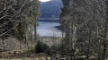
(6) Follow the track leaving La Mossure heading north, which leads to a Y-junction (small tarmac roads). Take the road uphill to the right. After a superb view of the valley to the left, at the edge of a woodland, a path marked with a Blue Rectangle – theGR®531– crosses the road. Take this path downhill to the left. It leads to the hamlet of La Grande Vallée.

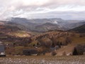
(7) Continue down the slope along a sunken path with lovely views of Orbey. This path leads to Orbey, but to return to the starting point without going along the road, it is best to head back up to the right along the small path marked with a Blue Saltire, which joins a Blue and White Rectangle signpost. Follow it to the left until you reach the descent towards Rue de l’Église. Turn right and return to the starting point (S/E).

Waypoints

  1. S/E : mi 0 - alt. 1,581 ft - Orbey Church
  2. 1 : mi 0.17 - alt. 1,765 ft - Junction
  3. 2 : mi 0.6 - alt. 2,211 ft - Pierre du Loiup
  4. 3 : mi 1.36 - alt. 2,474 ft - Junction
  5. 4 : mi 1.92 - alt. 2,894 ft - Pierre Tremblante
  6. 5 : mi 2.6 - alt. 2,415 ft - Yellow Ring
  7. 6 : mi 3.36 - alt. 2,175 ft - La Mossure
  8. 7 : mi 4.42 - alt. 1,965 ft - The Grande Vallée
  9. S/E : mi 5.3 - alt. 1,581 ft - Orbey Church

Notes

Worth a visit

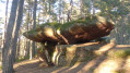
The Pierre Tremblante is composed of sandstone eroded by the combined effects of rain, sun, frost and wind.
It is said that this stone was used by our ancestors as a place of worship. In the Middle Ages, it also served as a ‘judgement stone’, signifying God’s judgement. The accused had to make the stone move. If they succeeded, God would prove their innocence. You can have a go to find out whether the executioner will come for you!
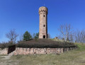
Along the way, the numerous holes and remains of fortifications and shelters serve as a reminder of the Battle of the Linge, which claimed many lives between February and October 1915.

Always be cautious and plan ahead when you're outdoors. Visorando and the author of this route cannot be held responsible for any accidents occurring on this route.

The GR® and PR® markings are the intellectual property of the Fédération Française de Randonnée Pédestre.

Reviews and comments

4.3 / 5
Based on 2 reviews

Reliability of the description
3.5 / 5
Ease of following the route
4.5 / 5
Route interest
5 / 5
GeneM
GeneM

Overall rating : 4.3 / 5

Date of your route : May 24, 2024
Reliability of the description : ★★★☆☆ Average
Ease of following the route : ★★★★★ Very good
Route interest : ★★★★★ Very good
Very busy route : No

The route was walked in the rain, so it was a bit slippery in places. It’s quite a steep climb for the first half of the route. The signposting seems to have been changed after the ridge

Machine-translated

François VERNIER
François VERNIER

Overall rating : 4.3 / 5

Date of your route : Apr 29, 2024
Reliability of the description : ★★★★☆ Good
Ease of following the route : ★★★★☆ Good
Route interest : ★★★★★ Very good
Very busy route : No

A lovely walk – the Pierres du Loup and Tremblante are magnificent landmarks.
A few minor details about the route:
point 1 isn’t quite in the right place – you need to carry on for just over 100 metres to find the path to the Pierre du Loup.
To reach point 6, after the last big bend, you need to spot a gap in the edge of the woodland to cross a meadow and rejoin the Chemin de la Moussure.

Machine-translated

Other walks in the area

For more walks, use our search engine .

The GPS track and description are the property of this route's author. Please do not copy them without permission.