La Pointe de Courpain via the Croix de Micy nature trail.

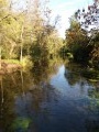
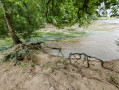
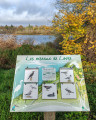
An integral part of the Saint-Mesmin National Nature Reserve, the alluvial forest through which our route passes has reclaimed its place from the former meadows, which were certainly cultivated but, as the name suggests, the harvests were barely enough to make a living! The biodiversity here is evident and even highlighted by the humorous information boards along the nature trail, which cover everything from large trees to shrubs, not forgetting the grasses – sometimes unloved – that attract insects, nor the animals emblematic of the Loire. As you make your way to the confluence of the Loiret and the Loire, the appeal of nature takes on different forms depending on the season, and the Croix de Micy serves as a reminder of the importance and influence of the abbey founded by Clovis, which no longer stands today.

Details

n°111999272
Creation:
Last update:
Last review:
–
  • Walking
    Activity: Walking
  • ↔
    Distance: 5.25 mi
  • ◔
    Average duration: 2h 25 
  • ▲
    Difficulty: Easy

  • ⚐
    Back to start: Yes
  • ↗
    Ascent: + 23 ft
  • ↘
    Descent: - 23 ft

  • ▲
    Highest point: 315 ft
  • ▼
    Lowest point: 279 ft

Photos

Description of the walk

Park in the car park at Pointe de Courpain, Rue des Hautes Levées.

(S/E) With your back to the street – and therefore to the car park entrance – leave the car park and turn right, facing the Loire. You are now on the Croix de Micy nature trail.

(1) Turn off to the right, as indicated by the bird’s beak on the small sign, and follow the narrow path through unspoilt countryside.

(2) Leave the return path for the circular loop on your right and carry straight on down towards the Loire.

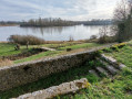
(3) Continue along the path to the right, ignoring the bird’s beak which would suggest turning left. The Croix de Micy nature trail runs alongside the Loire and, weather permitting, offers views of the horses from the Écuries de Micy grazing in their pastures.

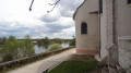
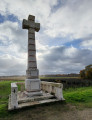
(4) Between two horse pastures, take the path on the right that climbs up to Rue des Hautes Levées, at a place called Montauban. Once on the tarmac road, turn right, preferably keeping to the left-hand side of the road, as this is safer. Walk past the Croix de Micy, a monument commemorating the former glory of the now-vanished Micy Abbey.

(5) Carry on straight ahead, ignoring Rue Claude Joliot on the left, which leads to the Carmelite convent at Micy. Take care not to miss the path on the right which takes you straight back to the outbound route.

(2) Turn right again, onto a section you have already walked, and arrive at the banks of the Loire.

(3) This time, take the path along the banks of the Loire, which you’ll find on the left, following the bird’s beak on the sign that you chose not to follow earlier. This section of the nature trail leads back to the car park.

(1) Leave the car park on your left and continue along the banks of the Loire until you reach a spot directly beneath several power lines.

(6) The path then turns left and, leaving the canopy behind, takes you across a lawn which you should respect by staying on the path until you reach the forest again.

(7) Look out for the Loiret River below on your left; in June, it may be covered with rafts of white-flowered water buttercups or, failing that, their foliage. Continue to the end of the walk, the confluence of the Loiret and the Loire – a fragile yet utterly charming spot.

(8) The return journey follows the same route as before. But don’t forget to turn right, then left twice, to get back to the car park (S/E).

Waypoints

  1. S/E : mi 0 - alt. 302 ft - Pointe de Courpain car park
  2. 1 : mi 0.05 - alt. 302 ft - Start of the Croix de Micy nature trail
  3. 2 : mi 0.24 - alt. 308 ft - Junction with the Montauban circular loop
  4. 3 : mi 0.28 - alt. 295 ft - Junction on the nature trail - La Loire
  5. 4 : mi 0.93 - alt. 292 ft - Walk back up towards Rue des Hautes Levées - Chapelle Saint-Mesmin
  6. 5 : mi 1.44 - alt. 312 ft - Return via the right-hand route on the outward journey
  7. 6 : mi 3.23 - alt. 295 ft - Between alluvial forest and grassland
  8. 7 : mi 3.46 - alt. 299 ft - View of the Loiret - Loiret (rivière)
  9. 8 : mi 3.59 - alt. 279 ft - Confluence of the Loiret and the Loire - Loiret (rivière)
  10. S/E : mi 5.25 - alt. 302 ft - Pointe de Courpain car park

Notes

Sturdy walking shoes are recommended, as the ground can sometimes be slippery, depending on the weather.

Worth a visit

- The Croix de Micy nature trail:

https://www.loiret-nature-environnement.org/system/files/inline-files/Le_sentier_pe%CC%81dagogique_de_la_Croix_de_Micy_DH4-1.pdf

- La Croix de Micy, with a view of the church at La Chapelle Saint-Mesmin and the Dragon de Béraire cave on the opposite bank of the Loire.

- The confluence of the Loiret and the Loire.

Other walks in the area

For more walks, use our search engine .

The GPS track and description are the property of this route's author. Please do not copy them without permission.