La Planche des Belles-Filles from Plancher-les-Mines

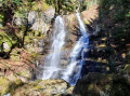
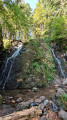
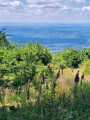
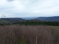
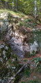
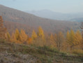
This walk, the main highlight of which is the legendary Planche des Belles Filles, takes you mainly through the beautiful forests of the Vosges, whilst offering some stunning panoramic views. On the way back, you’ll pass by a typical lake and, above all, the extraordinary Cascade de la Goutte des Saules, which is in fact a series of cascades and waterfalls stretching over a total vertical drop of more than 100 metres.

Details

n°53218180
Creation:
Last update:
–
Last review:
  • Walking
    Activity: Walking
  • ↔
    Distance: 12.87 mi
  • ◔
    Average duration: 8h 25 
  • ▲
    Difficulty: Difficult

  • ⚐
    Back to start: Yes
  • ↗
    Ascent: + 2,894 ft
  • ↘
    Descent: - 2,890 ft

  • ▲
    Highest point: 3,766 ft
  • ▼
    Lowest point: 1,611 ft

Photos

Description of the walk

Park at Place de l’Hôtel de Ville in Plancher-les-Mines

Markings: Yellow Rectangle for theGR®532

(S/E) With your back to the town hall, cross the square and take the street opposite. Continue straight ahead. At the footbridge, cross over and then turn right onto Rue des Martenots until you reach No. 16.

(1) Immediately afterwards, turn left onto the narrow path between two fences and follow the path as it climbs. Cross a road and continue straight ahead on the tarmac. When the road bends left at the last house on the right, continue straight ahead. Pass a valley trough and, shortly afterwards, at the Fork in the road, take the right-hand path for about 250 m.

(2) Just before reaching a forest track, take a sharp left-hand bend. Continue uphill; the final section is a little steep, leading to the Col d’Auxelles.

Green Rectangle markings forthe GR®533

(3) Turn left onto the ridge path. The path then continues along the eastern flank and, after a zigzag, reaches a pass (elevation 1083).

(4) Do not take the path leading up to the ridge but continue straight ahead to join the Tour de France route. Turn right. Reach the summit.

Unmarked

(5) Avoid the path that descends into the meadow (ski run), but head east to find the pleasant path that descends along the ridge beneath the trees. You’ll briefly follow the Green Rectangle markings again at the mountain hut.
Carry on to the car parks and restaurant, then continue past them for about a hundred metres until you reach the crossroads of paths.

Red Disc markings

(6) Turn right towards the Étang des Belles Filles.

Green Triangle markings

(7) Walk round the lake along the downstream embankment, cross the stream and turn left onto the path that climbs.
Reach a pass, head back down the opposite side and come to a lovely forest track.

Green Rectangle signpost

(8) Take it on the right and follow it for about 2 km. You’ll come to a junction with another forest track that joins sharply from the left.

No markings

(9) Take this forest track to the left for about 700 m. After a bend to the left, you’ll reach a bend to the right in a valley.

“Caution: the following section is unmarked and very little used: intended for experienced walkers wearing suitable footwear. No particular difficulties apart from a few fallen trees, which are easy to walk round or over.”

(10) Just before the bottom of the valley, look out for a track (an old, little-used logging track) that leaves the main track and heads off to the right. The start may be a little tricky as, during the rainy season, some of the water from the valley may flow along this old track.
However, the track is fairly easy to follow as it heads generally south-west, descending at a steady gradient.
After just over a kilometre, this track turns right, then after 150 metres meets another track, which is signposted.

Yellow Ring markings

(11) Take this path on the left. After a hairpin bend to the right, you’ll reach a car park with a picnic area on the banks of the Rahin.

Unmarked

(12) Cross the bridge and take the correct forest track on the left, which climbs gently. Walk uphill for about 1.5 km in a south-westerly direction. After a right-hand bend, and before a hairpin bend to the left at the bottom of a valley, you’ll reach a signposted path.

Markings: Yellow Ring

(13) Take this path on the left, which leads closer to the torrent and the waterfalls.
Please note: there are many side paths leading to the best viewpoints of the waterfalls and cascades – make sure you return to the main path to continue the descent!
Carry on until you reach the valley and a junction of well-maintained paths near a small cottage.

(14) Turn right until you reach the Fork in the road.

(15) Carry on to the right along this path, avoiding the branches that head uphill to the left and those to the right that cross the Rahin. This path, which more or less follows the right bank of the Rahin, becomes a road after about 1.5 km.
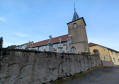
Carry on, keeping to the right bank, until you reach the village (with the church tower in sight) and come back to the car park (S/E).

Waypoints

  1. S/E : mi 0 - alt. 1,631 ft - Place de l’Hôtel de Ville - Rahin (rivière)
  2. 1 : mi 0.19 - alt. 1,624 ft - Narrow path
  3. 2 : mi 0.97 - alt. 2,087 ft - Elevation marker 636
  4. 3 : mi 1.57 - alt. 2,723 ft - Col d'Auxelles (827m)
  5. 4 : mi 3.04 - alt. 3,527 ft - Unnamed pass, elevation 1083
  6. 5 : mi 3.47 - alt. 3,763 ft - Summit of the - Planche des Belles Filles
  7. 6 : mi 4.33 - alt. 3,281 ft - Crossroads
  8. 7 : mi 4.88 - alt. 3,018 ft - Étang des Belles Filles
  9. 8 : mi 5.76 - alt. 3,392 ft - Unnamed pass, elevation 1037
  10. 9 : mi 6.99 - alt. 3,084 ft - Junction of forest tracks at elevation 943
  11. 10 : mi 8.03 - alt. 2,913 ft - Start of the trail
  12. 11 : mi 8.88 - alt. 2,283 ft - Crossroads at elevation 698
  13. 12 : mi 9.23 - alt. 2,060 ft - Bridge over the Rahin - Rahin (rivière)
  14. 13 : mi 10.15 - alt. 2,359 ft - Yellow Ring Trail
  15. 14 : mi 10.64 - alt. 1,900 ft - Former Mérique shelter
  16. 15 : mi 10.77 - alt. 1,890 ft - Forest House
  17. S/E : mi 12.87 - alt. 1,631 ft - Place de l’Hôtel de Ville

Notes

Understanding the Club Vosgien’s signposting.

Please note: the section between points (10) and (11) is unmarked and very little used. These are old forestry tracks, still clearly visible, but they require caution and very good footwear.
A good IGN map and/or GPS tracking are strongly recommended.

There is a bakery (sandwiches, drinks, etc.) 100 metres south of the Place de l’Hôtel de Ville (S).
At the car park at the foot of the Planche des Belles Filles ski slopes (near (6)).
- Bar-restaurant, but open only at weekends, except in July and August when it is open every day.
- Drinking water fountain near the first-aid post (opposite the bar).
- Several picnic tables all along the ski run.
- In the event of bad weather, shelter is available at the Refuge de la Haute Planche past the (5) (roughly halfway up the ski run).

This route passes through a protected area, which may be subject to special regulations:

Always be cautious and plan ahead when you're outdoors. Visorando and the author of this route cannot be held responsible for any accidents occurring on this route.

The GR® and PR® markings are the intellectual property of the Fédération Française de Randonnée Pédestre.

Reviews and comments

3.7 / 5
Based on 2 reviews

Reliability of the description
4 / 5
Ease of following the route
3.5 / 5
Route interest
3.5 / 5
Claude L2.
Claude L2.

Your comment surprises me. Yes, sections 10 to 11 are a bit rough going: I chose them, however, to avoid overly long stretches on well-maintained but somewhat boring roads and forest tracks.
I also recognise that sections 12 to 13 aren’t fantastic, but they’re very easy and can be covered quickly. Their appeal and necessity lie in reaching the top of the Goutte des Saules waterfalls, which is one of the main highlights of the walk: I’m surprised you find this section ‘uninteresting’. There are a few long stretches, it’s true, but they’re often necessary...

Machine-translated

n.suchaux
n.suchaux

Overall rating : 2.7 / 5

Date of your route : Aug 23, 2024
Reliability of the description : ★★★☆☆ Average
Ease of following the route : ★★☆☆☆ Disappointing
Route interest : ★★★☆☆ Average
Very busy route : No

The climb up to the ‘Planche des Belles Filles’ is magnificent, even if the ascent is quite challenging.

To be honest, the second part of the walk after passing the ‘Planche des Belles Filles’ is rather uninteresting; what’s more, a section of it (markers 11 to 15, if I remember correctly) follows an abandoned path with numerous obstacles (fallen trees) and is shaded by uninteresting woodland.

Machine-translated

Claude L2.
Claude L2.

I have been made fully aware of certain restrictions within the Ballons Comtois nature reserve.
However, judging by the map accompanying Decree 11RAA17_04_PrefHAUTE-SAONE.pdf (available online), I believe that the section connecting the points (9), (10) and (11) lies on the edge of the protected area, and is therefore, in principle, accessible for hiking...
Should this be confirmed with the ONF?

Machine-translated

Pierrot DAVID
Pierrot DAVID

Overall rating : 4.7 / 5

Date of your route : Jul 15, 2024
Reliability of the description : ★★★★★ Very good
Ease of following the route : ★★★★★ Very good
Route interest : ★★★★☆ Good
Very busy route : No

A lovely, well-shaded route. Please note that the unmarked section is off-limits from December to July.

Machine-translated

Other walks in the area

For more walks, use our search engine .

The GPS track and description are the property of this route's author. Please do not copy them without permission.