


 Country:
 City:
City:


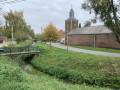
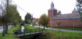
Car park at the start of the Petit-Hallet Trail at 1350 Orp-le-Petit, alongside the stream, opposite Rue de la Grande Ferme.
Alternative car park: the football pitch car park, 200 m towards Petit-Hallet.
(S/E) Leave the Sentier de Petit-Hallet, cross Rue Joseph Jadot and turn opposite onto Rue de la Grande Ferme, which follows the Ruisseau Henri Fontaine. Cross the first bridge and continue along the stream via Rue de Biamont. After 200 m, turn left onto Rue de la Distillerie, then go straight on at the roundabout onto Rue Henri Grenier. Go under the bridge and turn right onto Rue du Paradis.
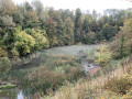
(1) After about 150 m, turn left into the old quarry, which is now a nature reserve (sign, gate). Once in the clearing, take the steps furthest to the left and climb up to the top of the quarry. Follow the path to the right (a few steps along the way) through the undergrowth.
(2) Just as the path is about to emerge from the thicket, take the flight of steps on the right and descend to the bottom of the quarry, then climb back up the other side. Above the steps, turn right and follow the slope for 100 m before leaving the nature reserve on the left to join a tarmac road. Follow this road down to the bottom and turn left onto Rue de la Sucrerie (N279). Follow this road to the end. At the junction, keep left twice to turn onto Rue Sainte-Adèle.
(3) At number 45 Rue Sainte-Adèle, take the path on the right, then immediately afterwards, the track that branches off to the right behind a row of trees and runs alongside a meadow and then a field, leading to Rue du Pirchat, which you follow to the left for 200 metres.
(4) As the road takes a right-angle bend to the right, go straight on along the dirt track, between the row of yews and the houses. At the junction, take the tarmac farm track on the right. At the junction with the N279, continue straight on along Chavée aux Lapins. Follow it to the end to reach Avenue Émile Vandervelde.
(5) Turn left onto this avenue and follow it for about thirty metres, then turn right towards Place de Maret. After the stream, turn right onto Avenue Henri Pirard, cross Rue Léon Jacquemin and continue straight ahead.
(6) At the end of the street, turn right onto Rue du Chemin de Fer and take the footpath that continues from this street as it curves to the left. This footpath runs alongside the Petite Gette and leads to the end of the circular Rue Henri Collin.
(7) Walk up this street to the end, continue along Rue Virgile Orvart for about fifty metres, then turn into Rue Capitaine Lefèvre opposite. This street continues as a footpath (ignore the path branching off to the left) which, further on, runs alongside the Petite Gette once again.
(8) Pass under the old railway bridge (Ravel) and continue along the stream. The path emerges onto Rue de Fontigny near a chapel.
(9) Turn right onto this street, which further on becomes Rue du Château Rose.
(10) 300 m further on, at the junction with Rue Joseph Jadot (a triangular crossroads below the castle), carry on for about forty metres and turn left onto the farm track leading up towards the plateau. Once at the top, the track runs alongside the motocross track before crossing fields and meadows at a good distance from the wooded edge at the top of the slope. After 1 km, it joins the tarmacked Rue Joseph Triffaux, which leads to the village of Petit-Hallet. Walk down this road for about 100 metres and pass the first houses.
(11) Then turn sharply right onto Rue Sous les Monts. Follow it to the end. This road continues as a footpath (GR®579) winding between the meadows and the foot of the wooded slope of the valley, before soon running alongside the Henri-Fontaine stream. Follow it to the end, crossing the Orp-Jauche motocross track at the end of this section. This will take you back to the car park (S/E).


 Visorando Member
 Moderate

 Difficult
