The Nivelle from Chantaco to the sea wall

A walk along the right bank of the Nivelle, offering views of its alluvial plains and the chance to admire the bay of Saint-Jean-de-Luz.

Details

n°48428734
Creation:
Last update:
Last review:
  • Walking
    Activity: Walking
  • ↔
    Distance: 5.41 mi
  • ◔
    Average duration: 2h 30 
  • ▲
    Difficulty: Easy

  • ⚐
    Back to start: Yes
  • ↗
    Ascent: + 16 ft
  • ↘
    Descent: - 16 ft

  • ▲
    Highest point: 30 ft
  • ▼
    Lowest point: 3 ft

Photos

Description of the walk

The starting point is in the car park of the Chantaco Gymnasium.

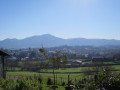
(S/E) Head south to find, behind the gymnasium, a viewing platform overlooking the alluvial plains of the Nivelle.

(1) Head north again, skirting the gymnasium.

(S/E) Carry on straight ahead and join the shared footpath and cycle path.

(2) Follow the cycle path around the Nivelle circular loop, taking care not to obstruct this path, which is very busy with cyclists who are not always fitted with bells. Pass under the motorway bridge.

(3) Leave the cycle path and take the footpath along the banks of the Nivelle – known as the Promenade Alfred de Pose – until you reach the fishermen’s boat launch.

(4) Go round the jetty and continue along the Promenade until you reach the railway line. Go round the car park and finish on Avenue Pierre Larramendi.

(5) Take the footpath along Avenue Pierre Larramendi.
Walk along the Saint-Jean-de-Luz quay to the end, passing the Grillerie du Port.

(6) Turn left, heading west, leaving the famous Place Louis XIV behind you, then take the first street on the right.
Walk past the superb Maison de l’Infante and head up Rue de l’Infante.

(7) At the end of the street, head up onto the sea wall and turn right onto the Promenade Jacques Thibaud. Walk to the Pergola.

(8) Walk round the residence (in 2024, the gallery overlooking the beach is undergoing renovation and a detour via the rear of the building is necessary).
Walk past the terrace of the Grand-Hôtel and arrive at the Digue aux Chevaux.

(9) Turn round and follow the same route in the opposite direction back to the car park (S/E).

Waypoints

  1. S/E : mi 0 - alt. 13 ft - Chantaco Gymnasium car park
  2. 1 : mi 0.09 - alt. 7 ft - Alluvial plain viewing platform - Nivelle (fleuve)
  3. 2 : mi 0.25 - alt. 13 ft - Cycle path
  4. 3 : mi 0.92 - alt. 13 ft - Riverbank footpath - Nivelle (fleuve)
  5. 4 : mi 1.46 - alt. 10 ft - Boat launch
  6. 5 : mi 1.95 - alt. 7 ft - Tunnel under the railway line
  7. 6 : mi 2.18 - alt. 10 ft - Harbour area
  8. 7 : mi 2.26 - alt. 26 ft - Saint-Jean-de-Luz sea wall
  9. 8 : mi 2.52 - alt. 30 ft - Building - La Pergola
  10. 9 : mi 2.71 - alt. 23 ft - The turning point
  11. S/E : mi 5.41 - alt. 13 ft - Chantaco Gymnasium car park

Notes

There are plenty of drinking fountains along the way and, of course, depending on the season, plenty of places to eat.

Worth a visit

Information boards detailing the history of Saint-Jean-de-Luz are situated at various points along the sea wall.

Reviews and comments

5 / 5
Based on 1 review

Reliability of the description
5 / 5
Ease of following the route
5 / 5
Route interest
5 / 5
Boumo
Boumo
• Edited:

Overall rating : 5 / 5

Date of your route : May 29, 2024
Reliability of the description : ★★★★★ Very good
Ease of following the route : ★★★★★ Very good
Route interest : ★★★★★ Very good
Very busy route : Yes

A very pretty and pleasant route from the motorway bridge to the sea wall, where it is very popular with local residents. The section from the sports centre to the motorway bridge is unpleasant, as it runs alongside the (very busy) road and requires constant vigilance to watch out for cyclists.

Machine-translated

Other walks in the area

For more walks, use our search engine .

The GPS track and description are the property of this route's author. Please do not copy them without permission.